|
|
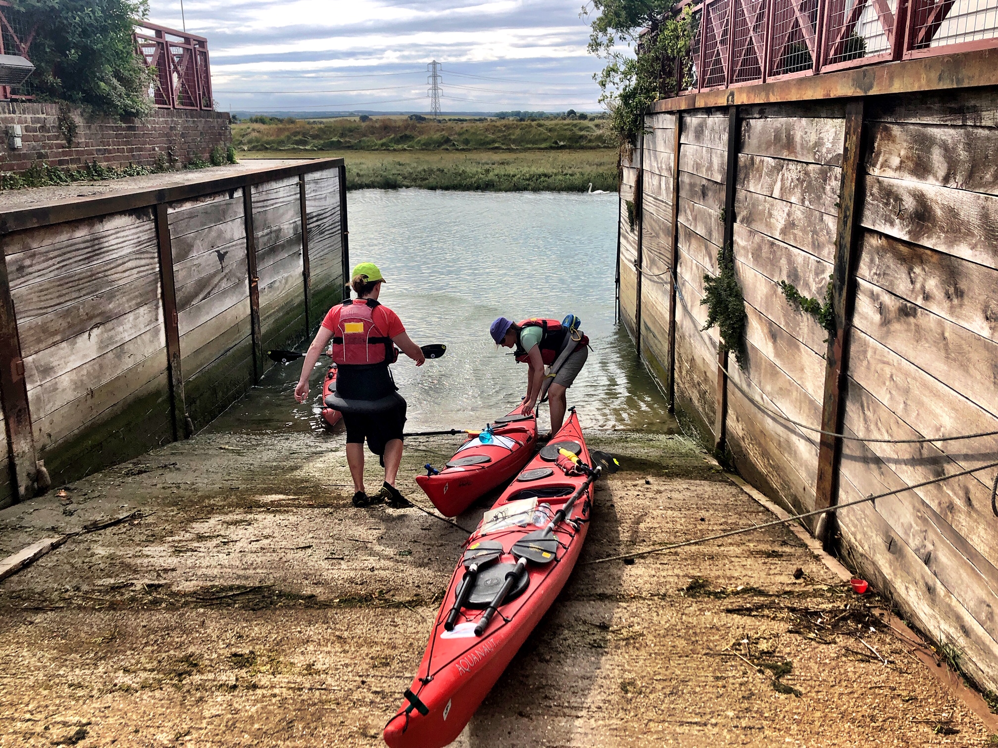
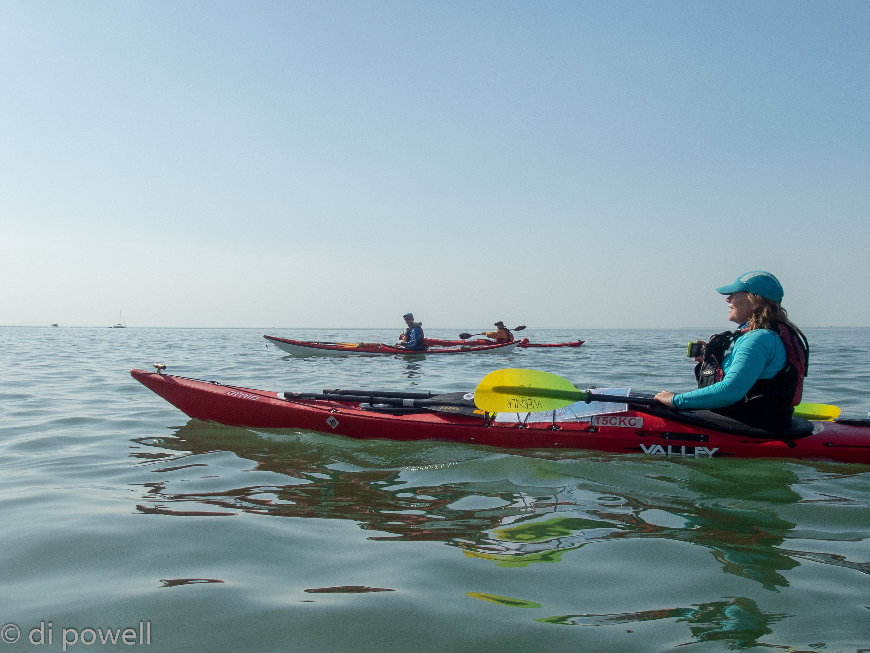
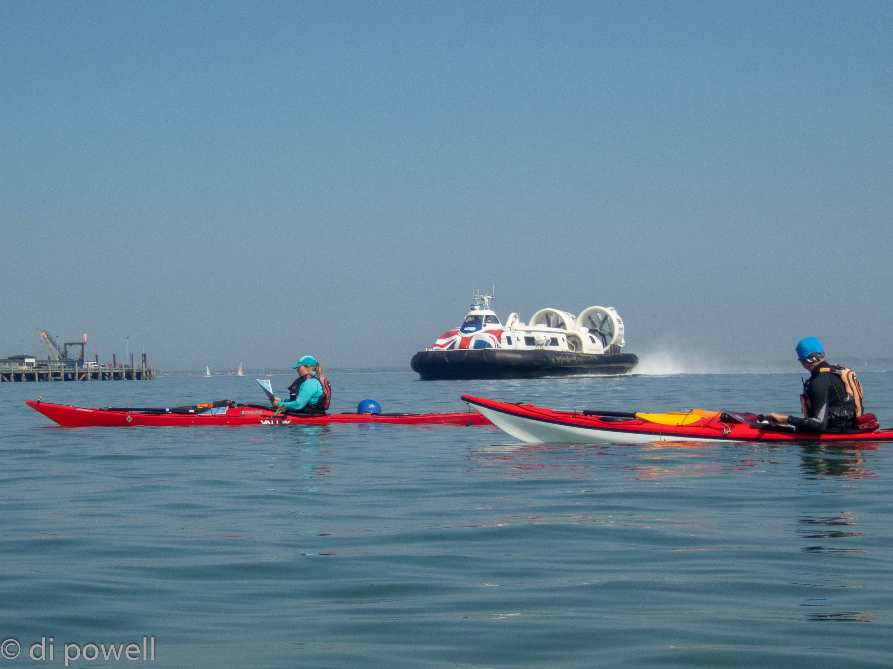
On Saturday morning we drove down to Shoreham-by-Sea nibbling on bacon rolls and arrived at 9am – possibly one of the quickest trips to the coast.
The meeting location was marked by a lighthouse on Shoreham Harbour. Tudor, Olwen and Cathy were already at the (free) car park unloading their boats having got owner of the coffee van on the beach to unlock the 2m height barrier to let them in.
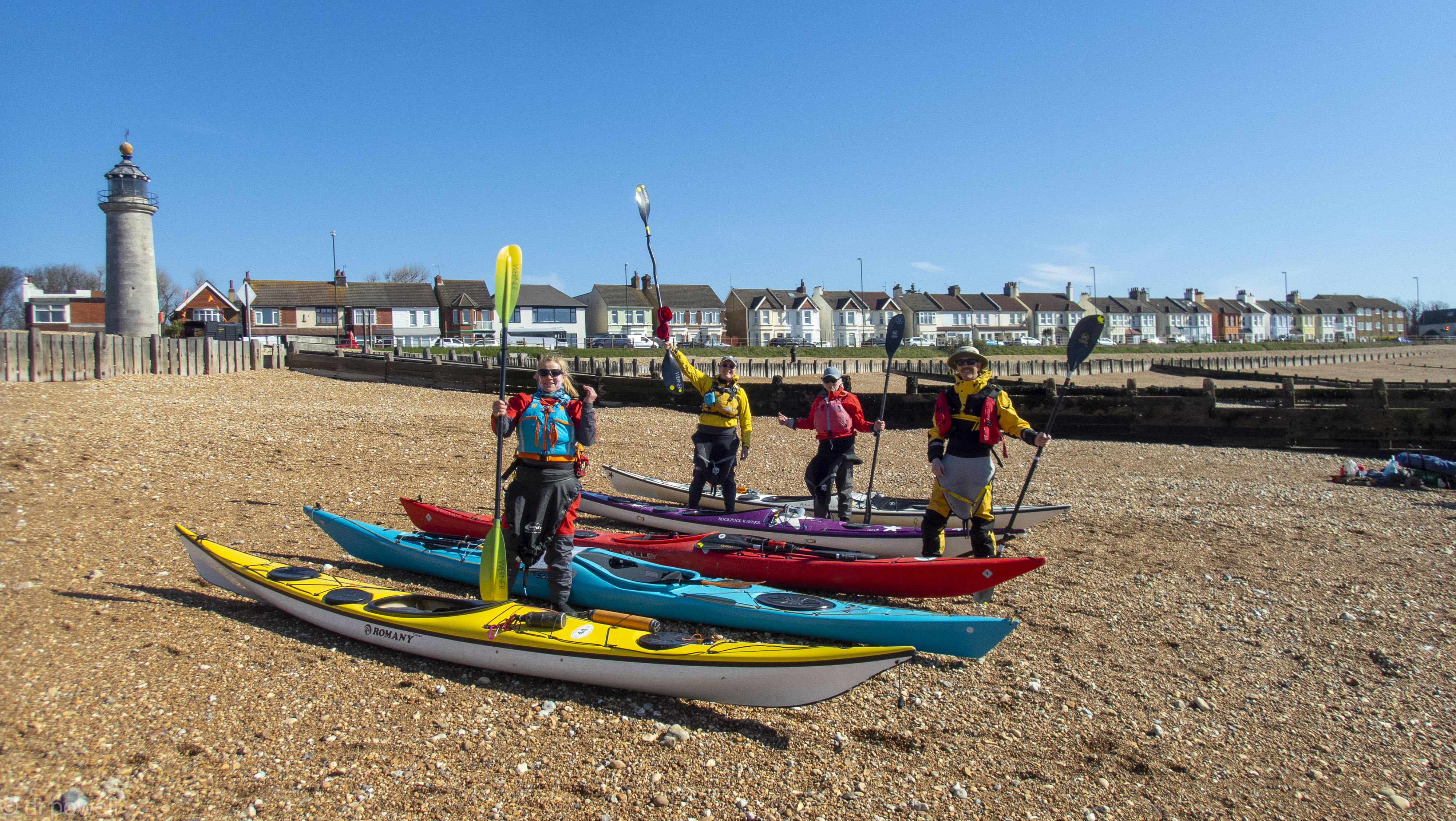
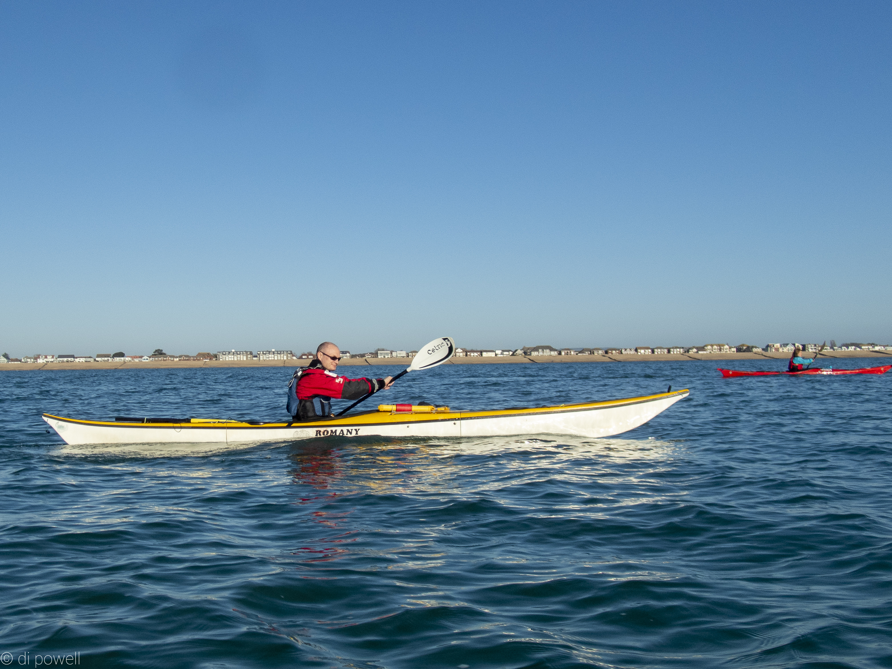
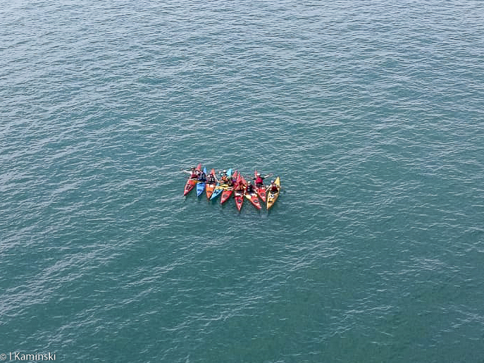
After getting changed and moving the boats down to the water, we had a safety briefing covering the rules of the harbour that the harbourmaster had kindly sent to us (at the same time as confirming no launch fees would be due). Launching at 10:10 am we follow the right-hand arm of the harbour wall out to the sea. Once out of the harbour the wind picked up to force three. We paddle for 40 minutes south looking for a southerly cardinal marker. We arrive at a buoy at 10:50 am but it is not a cardinal marker. We get quite confused, but on checking the GPS see that it is actually where we are meant to be to turn Eastwards.
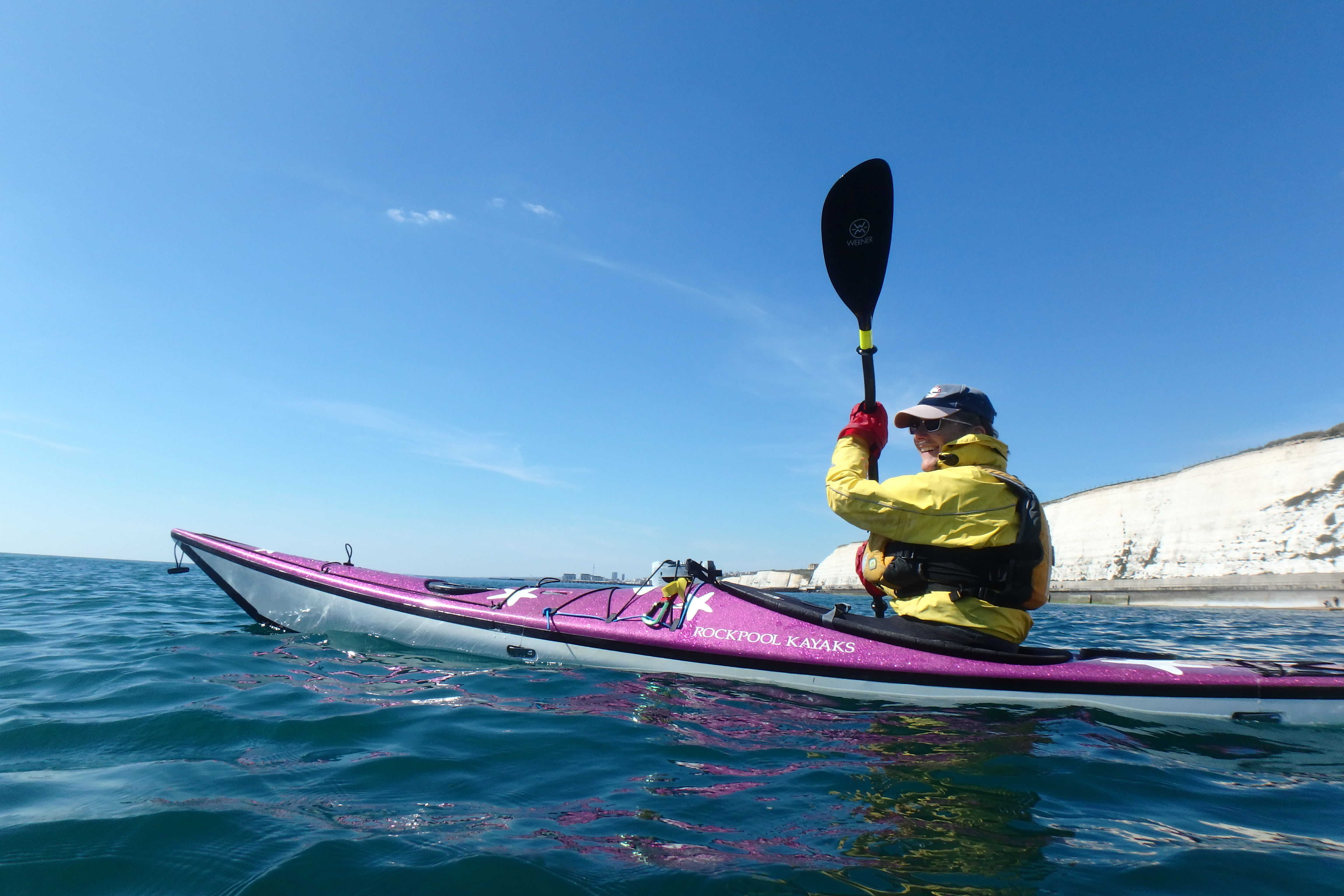
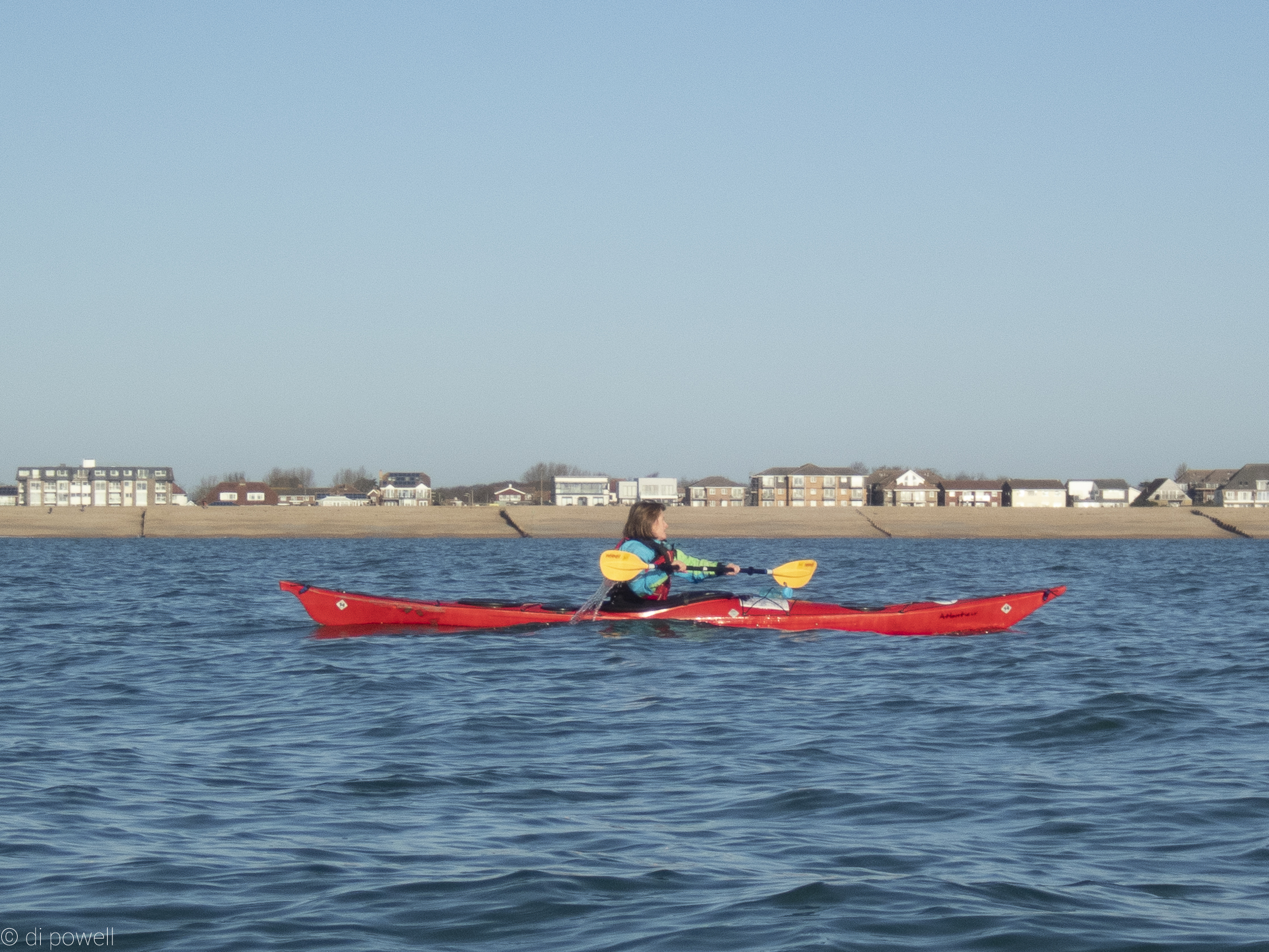
The planned route was to follow three more yellow buoys spaced about 1.5nm apart, but somewhat disappointingly, none exist. As we approach Brighton Marina a sailing regatta was underway but luckily moves away before we arrive. We head towards Beacon Mill, Rottingdean – a Grade II listed windmill from 1802, now restored as a seamark on top of the hill above Rottingdean. Arriving at the beach at 1 pm.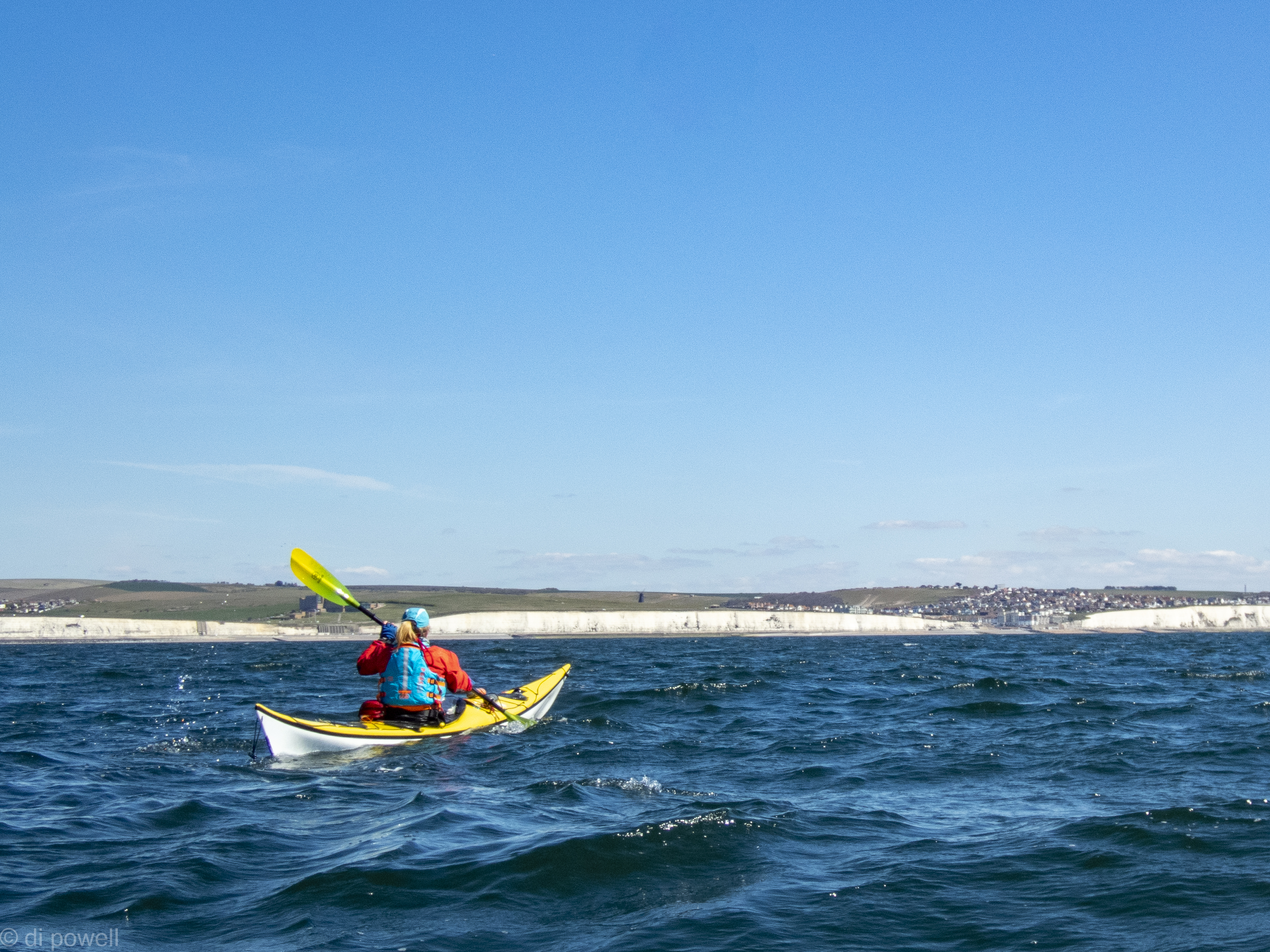
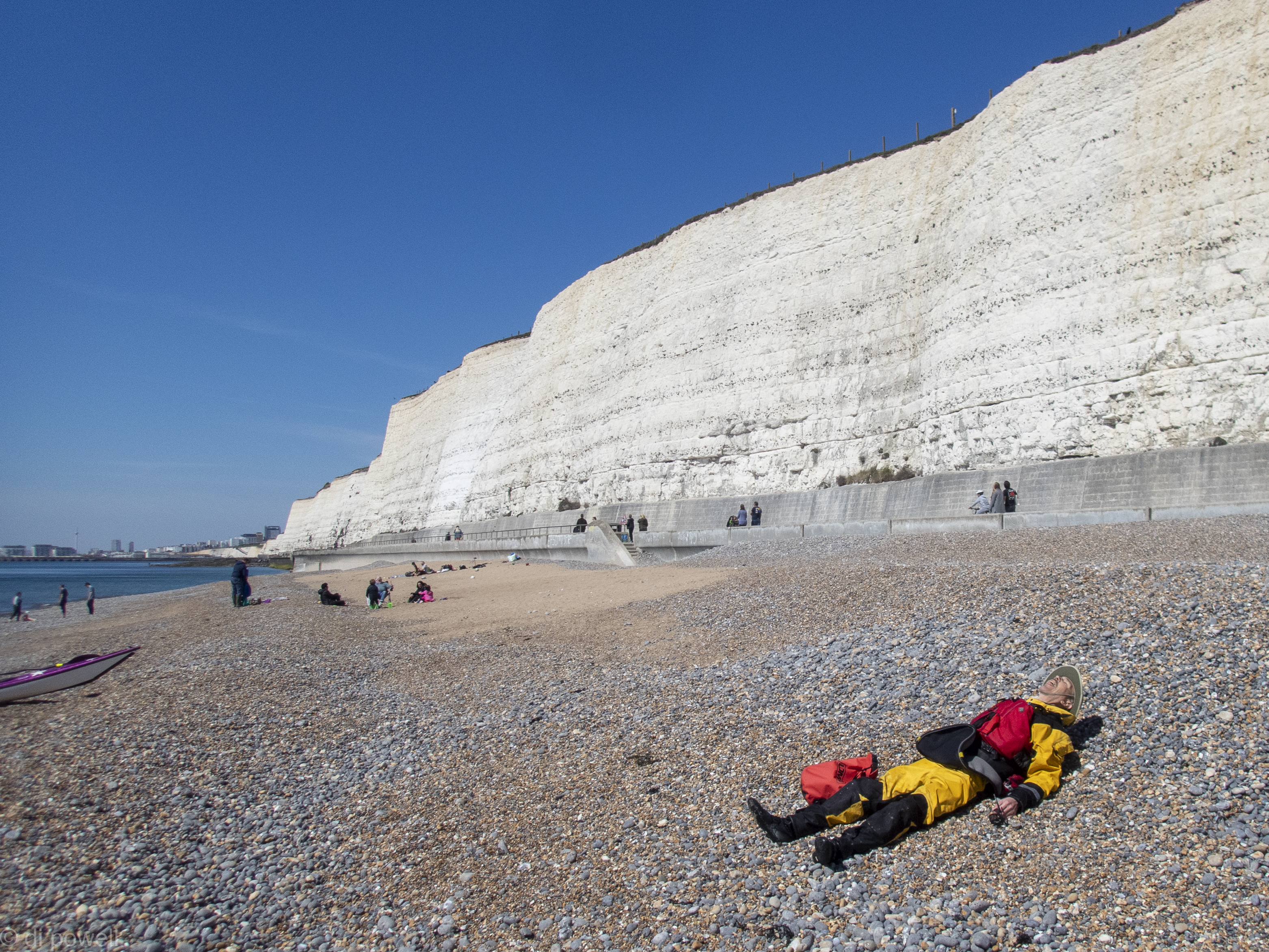
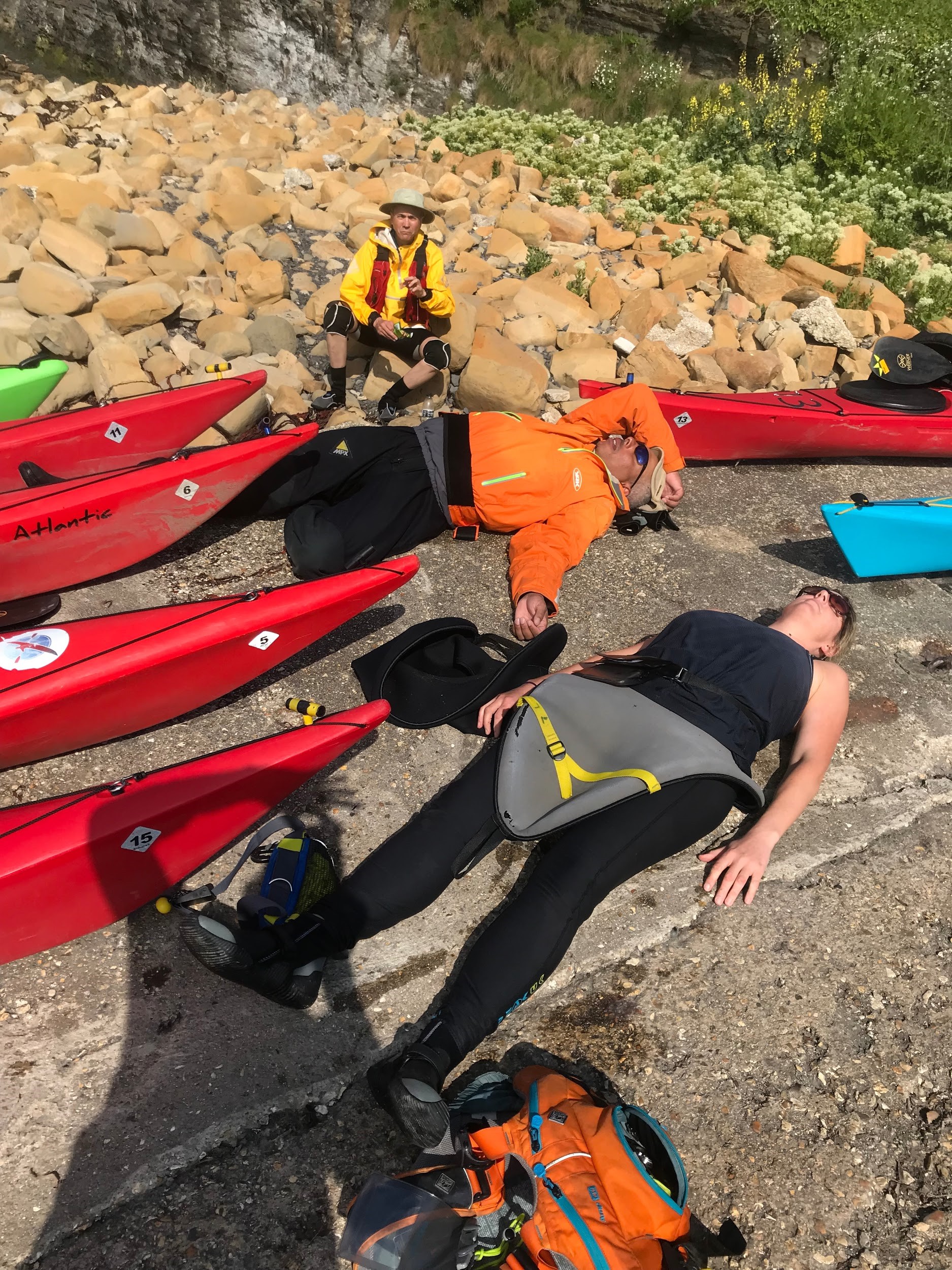
We have a slightly longer than planned lunch break, a lie down on the pebble beach in the sun next to a gorgeous long white cliff. On the way back we decide not to retrace our steps but go on the same bearing without going out to sea. Although about 8nm away, we can actually see Shoreham Harbour from our lunch spot. Closer in to the beach we come across a lot more boat traffic including a bunch of jet skis.
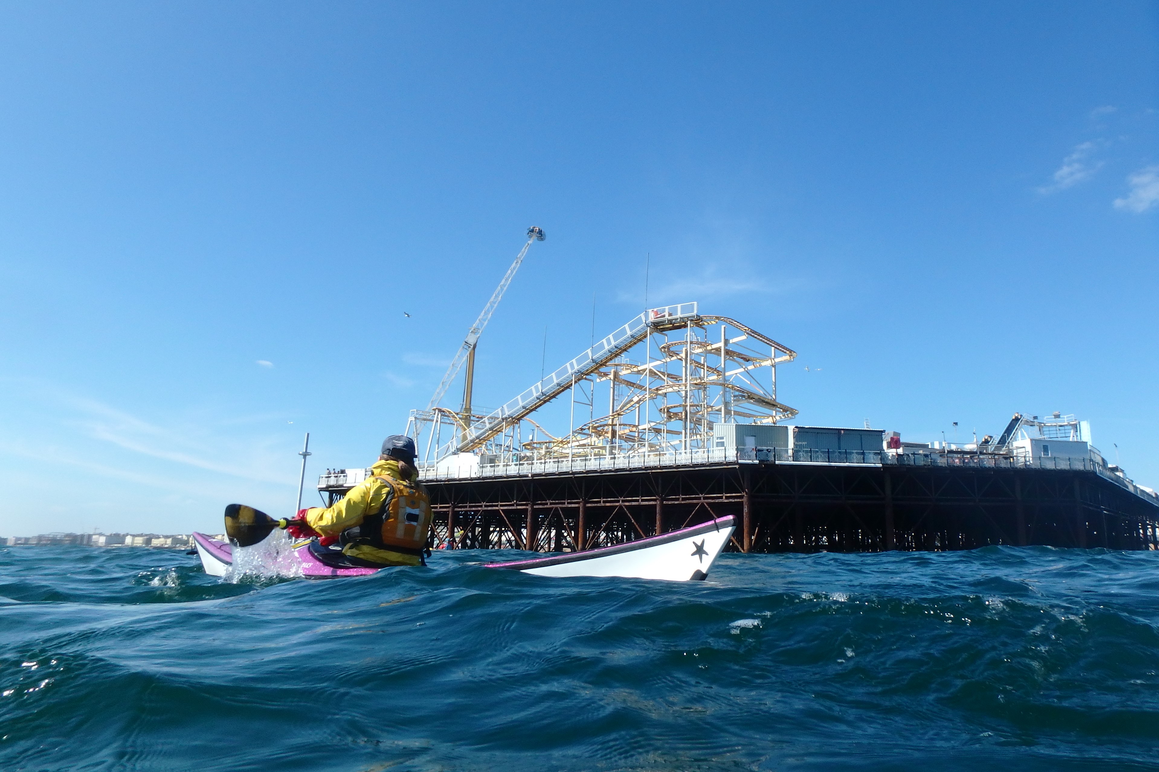
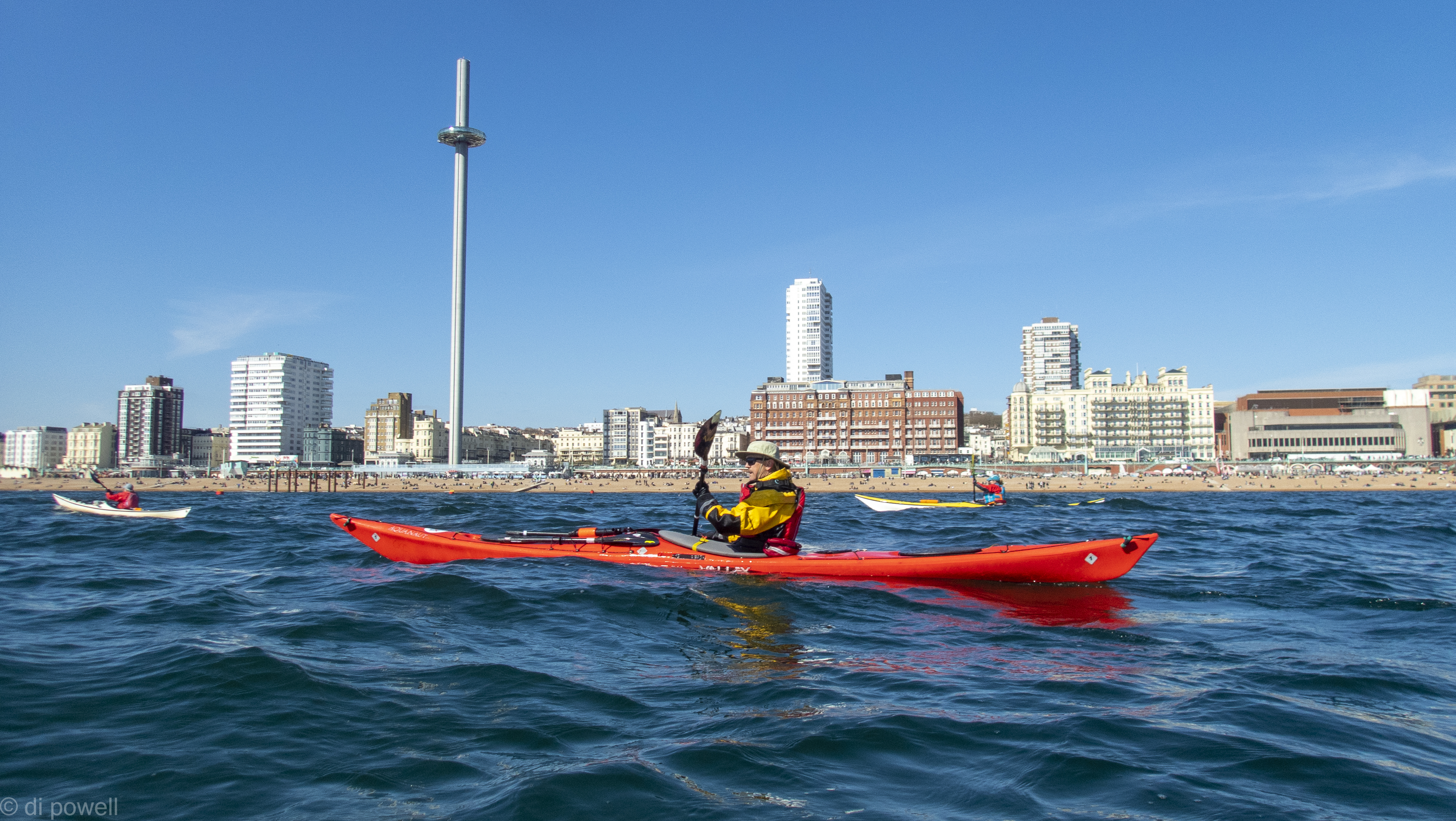
Arriving at Brighton Palace Pier (also Grade II listed), we see a fairground ride flinging people into the air at an alarming rate, see a large number of people gathered on Brighton beach and a large pole with a bobble on it. Olwen advises us that the bobble goes up and down and is actually a bar.
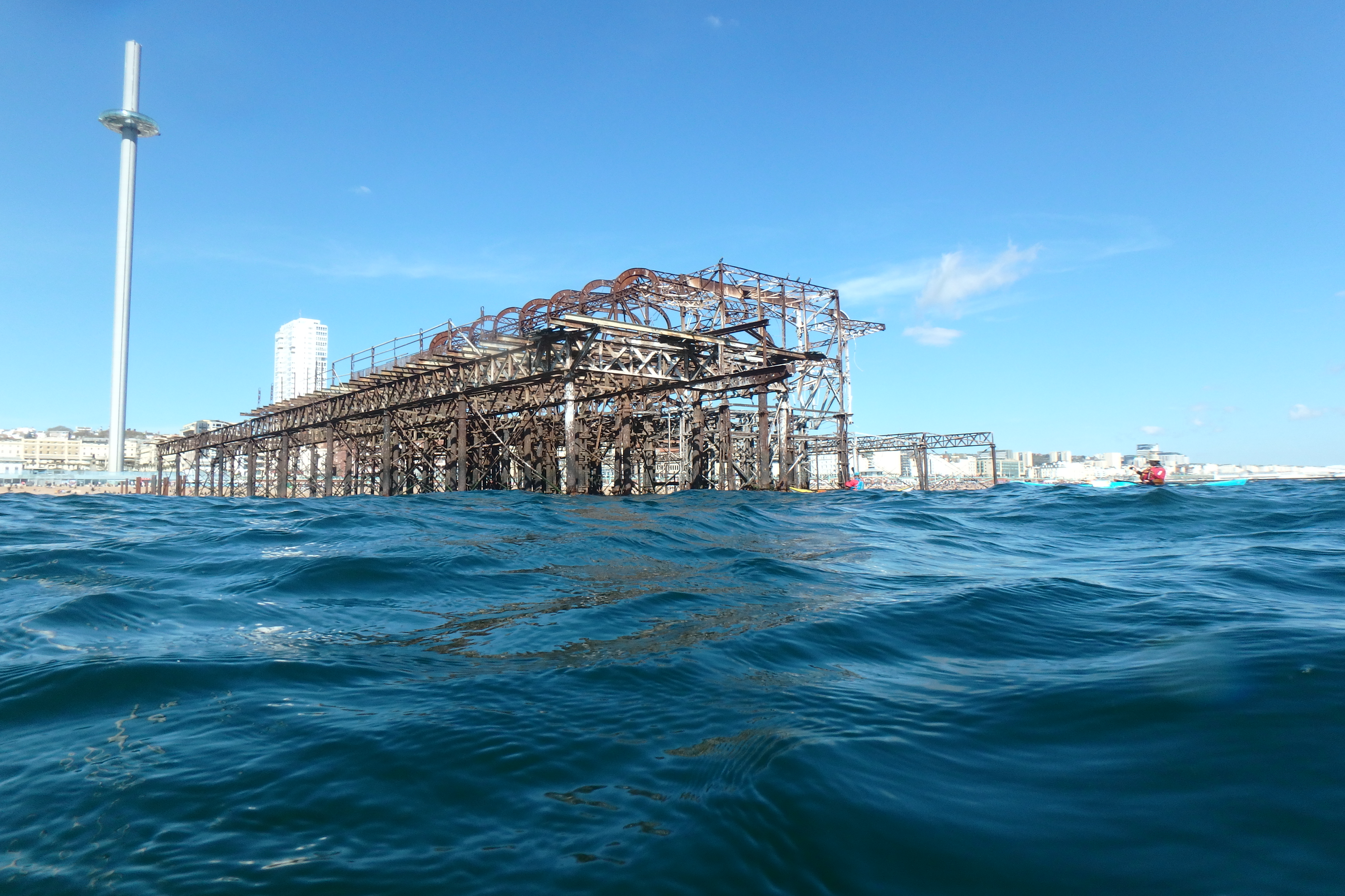
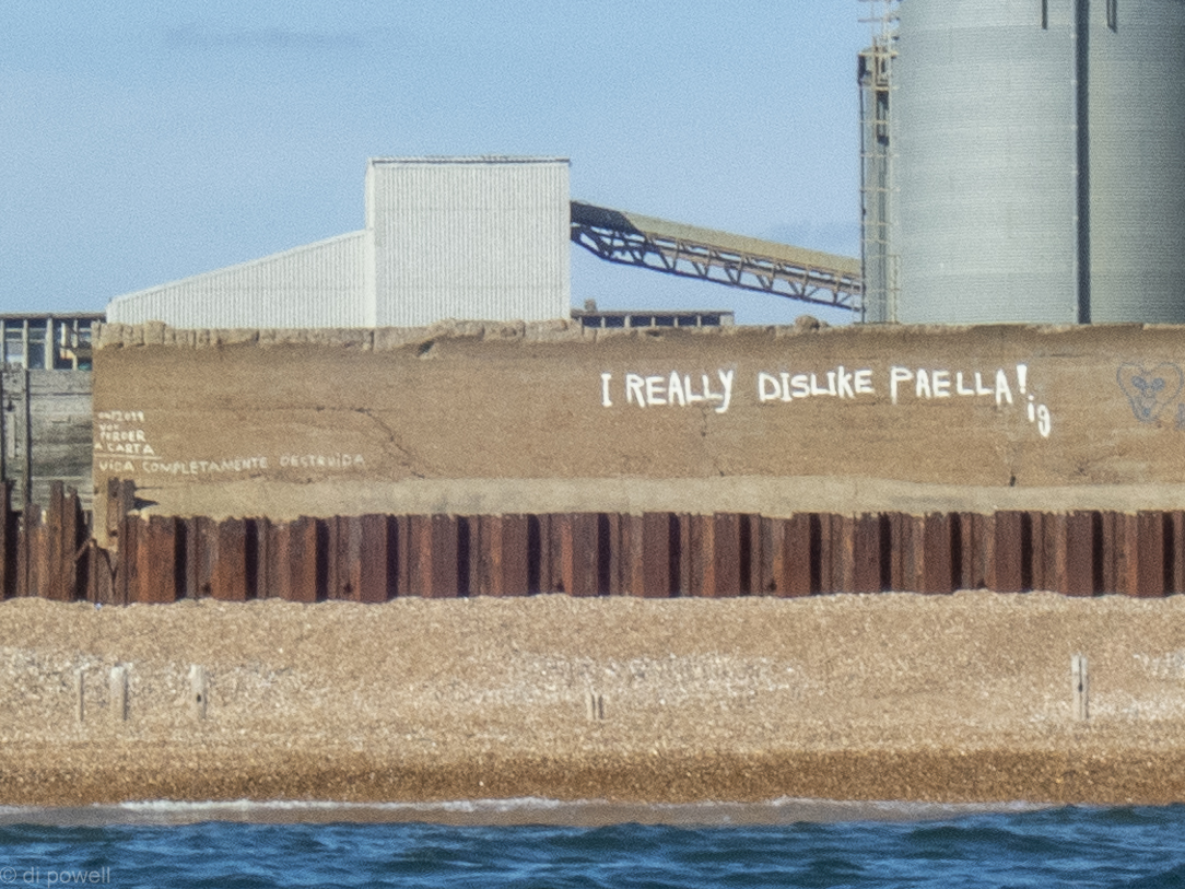
After passing the old pier and beach huts we paddle back to Shoreham with a surprisingly strong tidal flow. In fact the whole trip was quietly surprising: a fast trip down, a lack of buoys, sunshine, a quiet beach for lunch, beautiful white cliffs and most surprising of all: how pleasant it was paddling on the south coast, even in a fairly built up part of the coastline. Then just to emphasis the surprising-ness of the day, near Shoreham, we see some graffiti that announces “I really dislike paella”. Definitely surprising.
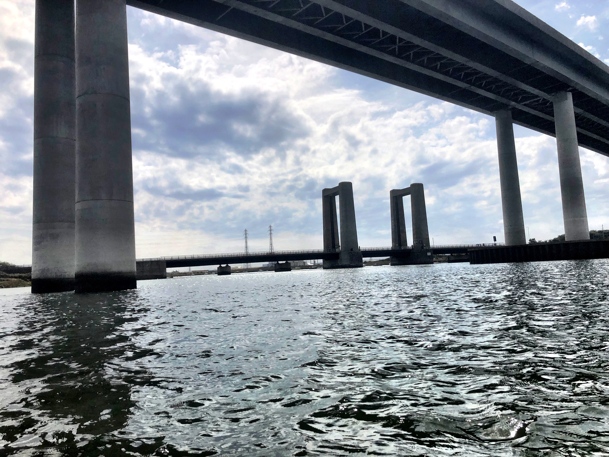
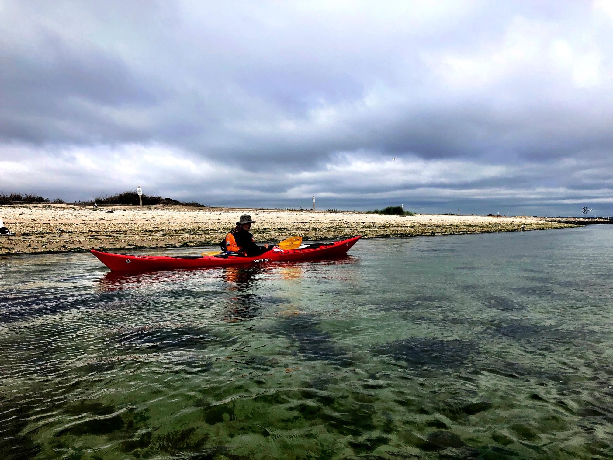
Hayling Island Circumnavigation, Jan 2020. F3, N; HW Portsmouth 0624, LW 1154
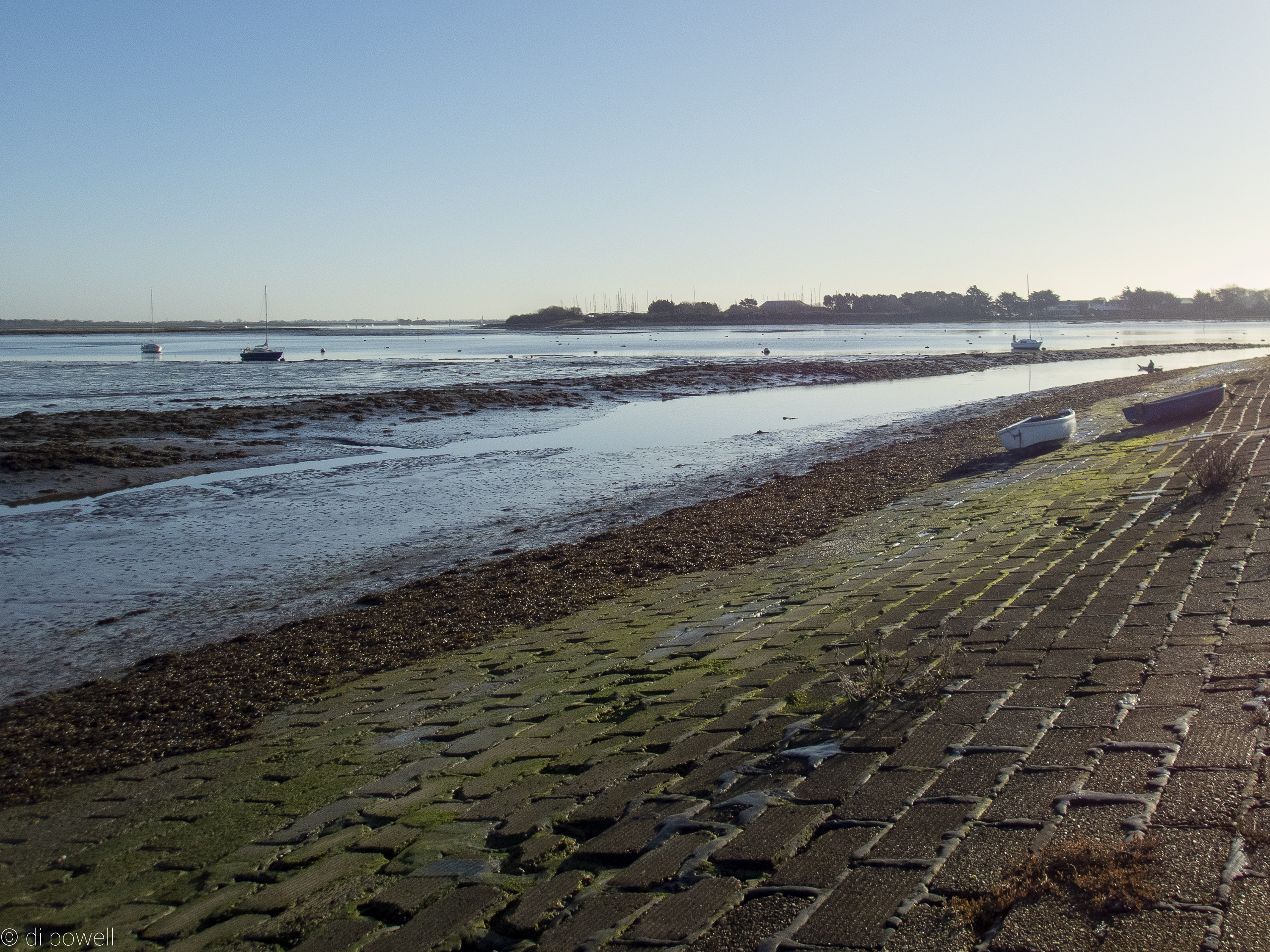
Travelling down to the launch point at Langstone Bridge on a frosty Sunday morning in January, as the sun rose into a cloudless blue sky, it seemed a paddle around Hayling Island would be great way to banish those January blues. Although the temperature was -2C when we arrived, after we’d dressed, got our kit ready and moved the boats along the quay, we were all surprisingly hot. Partly that was because we knew we had a deadline: we were launching 4 hours after high water and this meant the water levels were dropping visibly each minute. As the water dropped greater expanses of mud were being exposed. The mud here is a special type that oozes, sucks and sticks to everything, so best avoided at all costs. As a result we carried our boats about 100m along the quay, to launch at the point of minimum mud, and then quickly we were under Langstone Bridge and through the disused railway bridge.
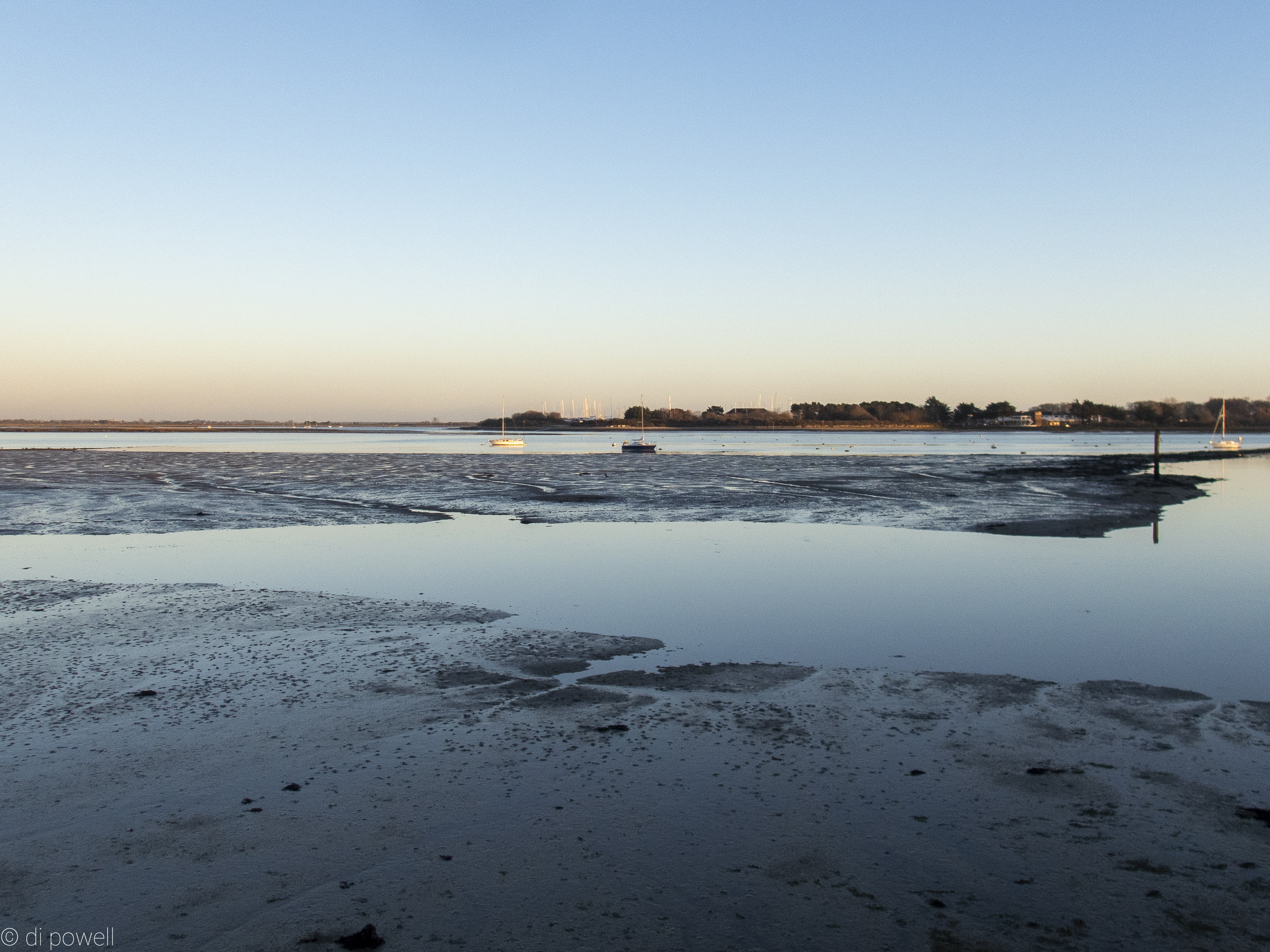
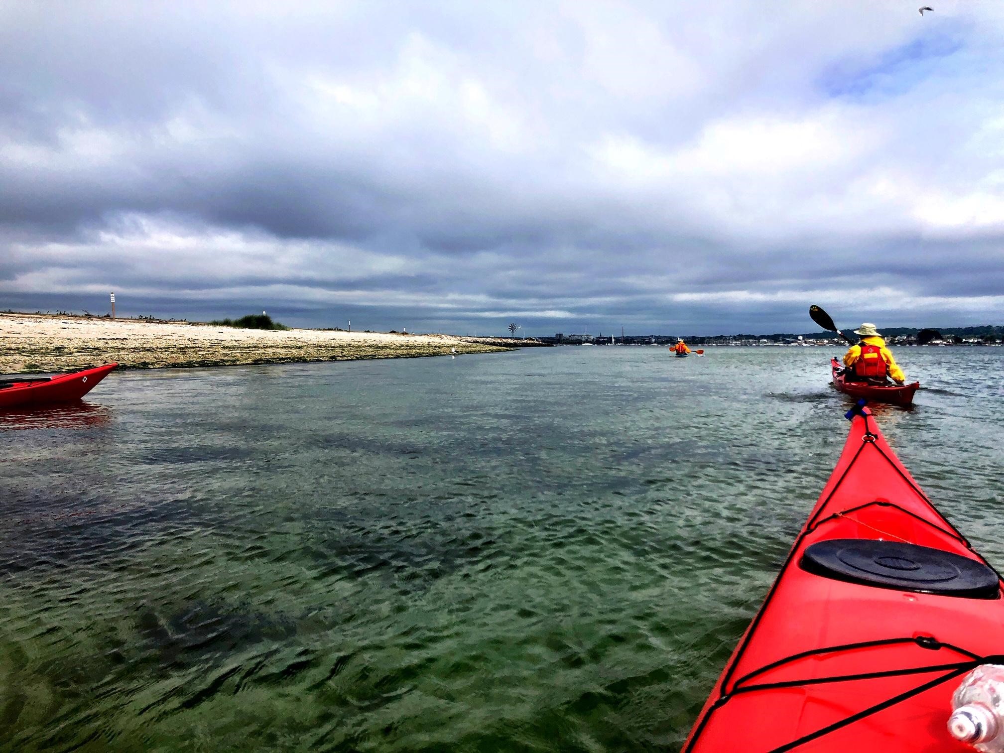
 Langstone 
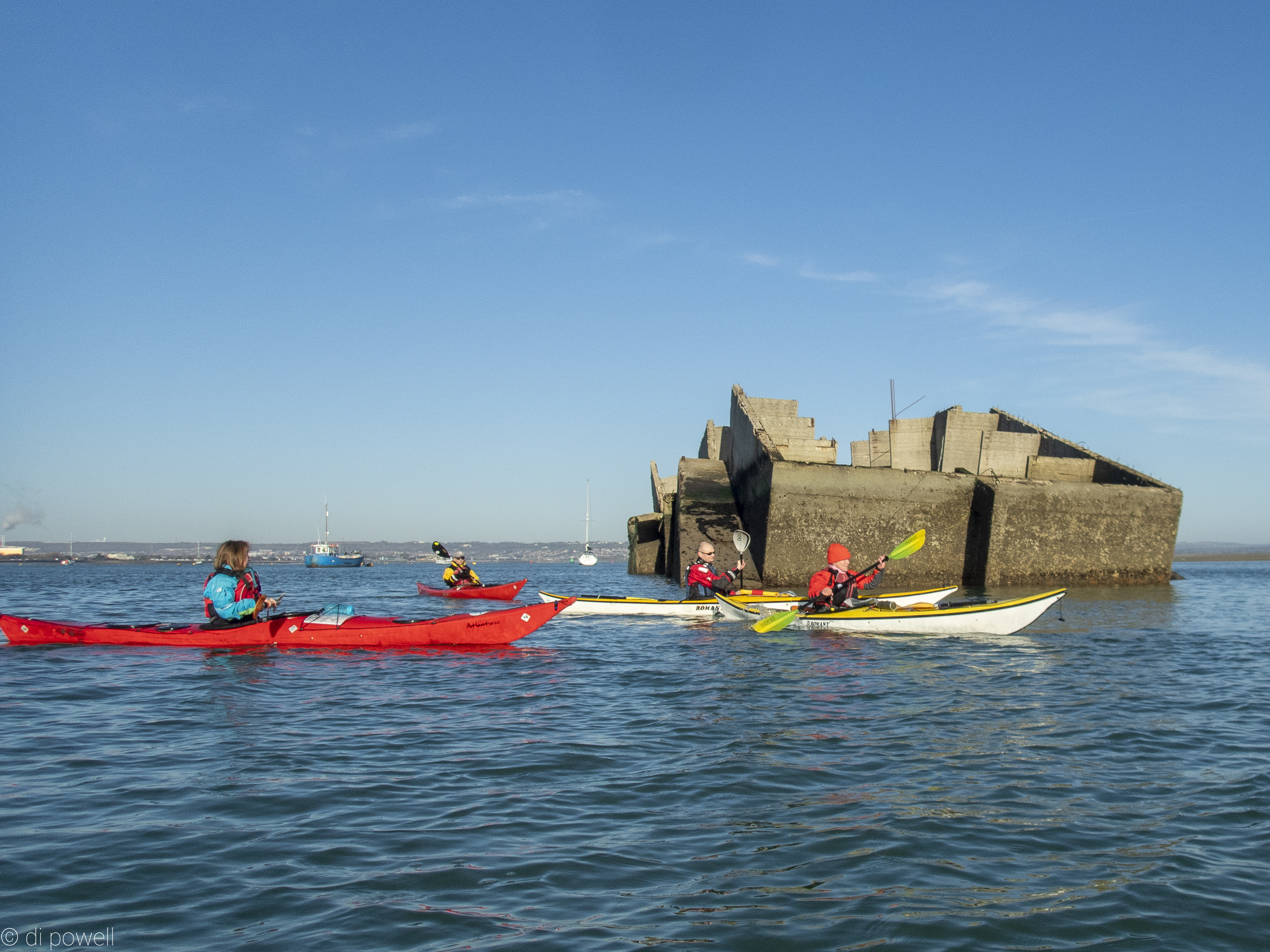
With calm winds, sunny and bright conditions we were able to practice our navigation identifying buoys on the marine charts and matching those on the water, and identifying land based features and identifying those on the OS map too. After ticking off the buoys at Stoke, Sinah and NW Sinah we arrived at the feature unromantically called ‘Concrete Structure’ on the marine chart. In reality it is a Mulberry Caisson, a relic from the second world war.
After a quick snack on the ramp at the east side of the mouth of Langstone Harbour we set off for the next leg. It was now low tide which meant that the East Winner sand bank was exposed and a 2km detour was required to go south and then east round the sand. It looked possible to drag the boats a short way to reach a small channel at the top of East Winner and take advantage of a short cut but we are a kayaking club not a dragging club so we stuck to the sea. East Winner must be a local attraction at low water as there were dozens of walkers on it, lots of dogs and a few horse riders.
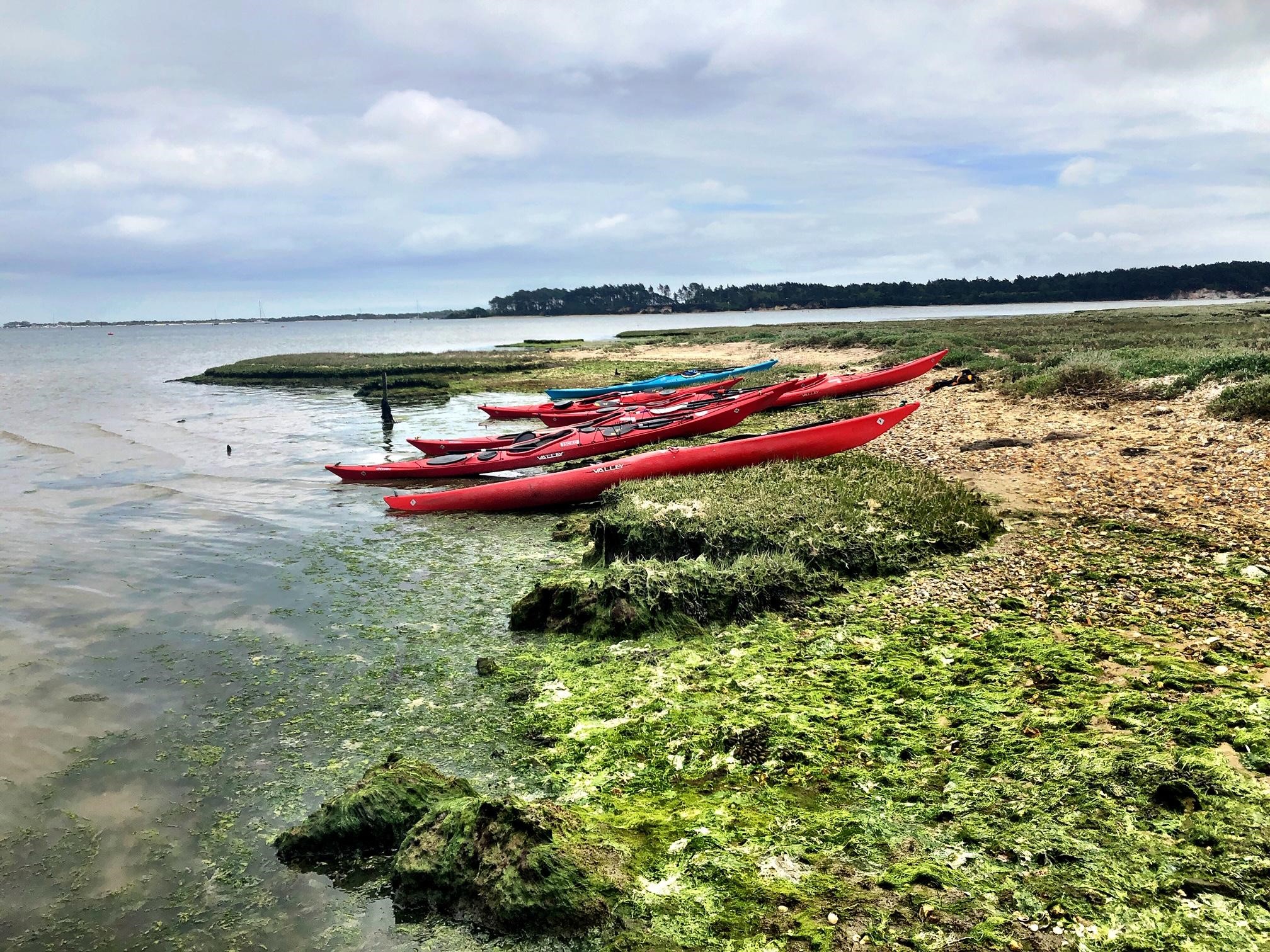
Along the south coast of the island there was a gentle following sea from the beginnings of the flood tide. Approaching Chichester Harbour entrance we saw breaking waves ahead and it wasn’t obvious from our position on the water what the best route would be. However, Liza knew that if we stayed out to sea until the red channel marker, and turned left into the harbour only after we had passed the marker, then we could avoid a sand bank and the white horses it was creating. This plan worked perfectly and we had a smooth paddle into the harbour and to the beach near Hayling Island Sailing Club which was the designated lunch spot. A time check showed that David’s prediction of when we would get to the sailing club for lunch was absolutely spot on. The strict schedule was disrupted, however, by a couple of the group searching for the loo after lunch, and we set off for Langstone a full 19 minutes late (as David noted), although it did give us time to check the route on the map.
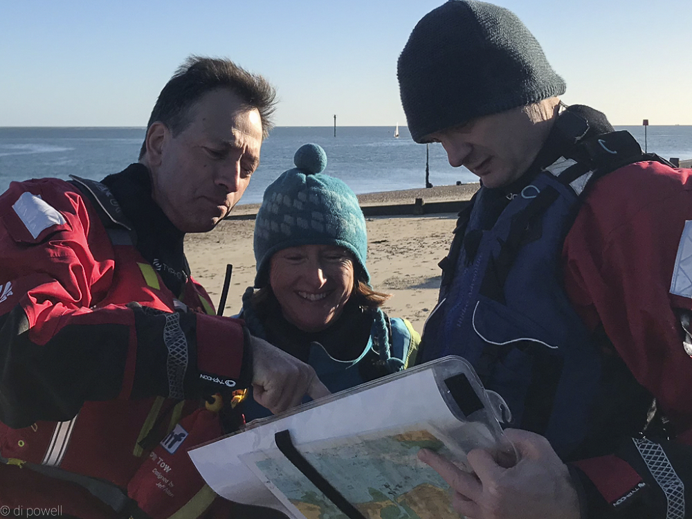 Checking the route 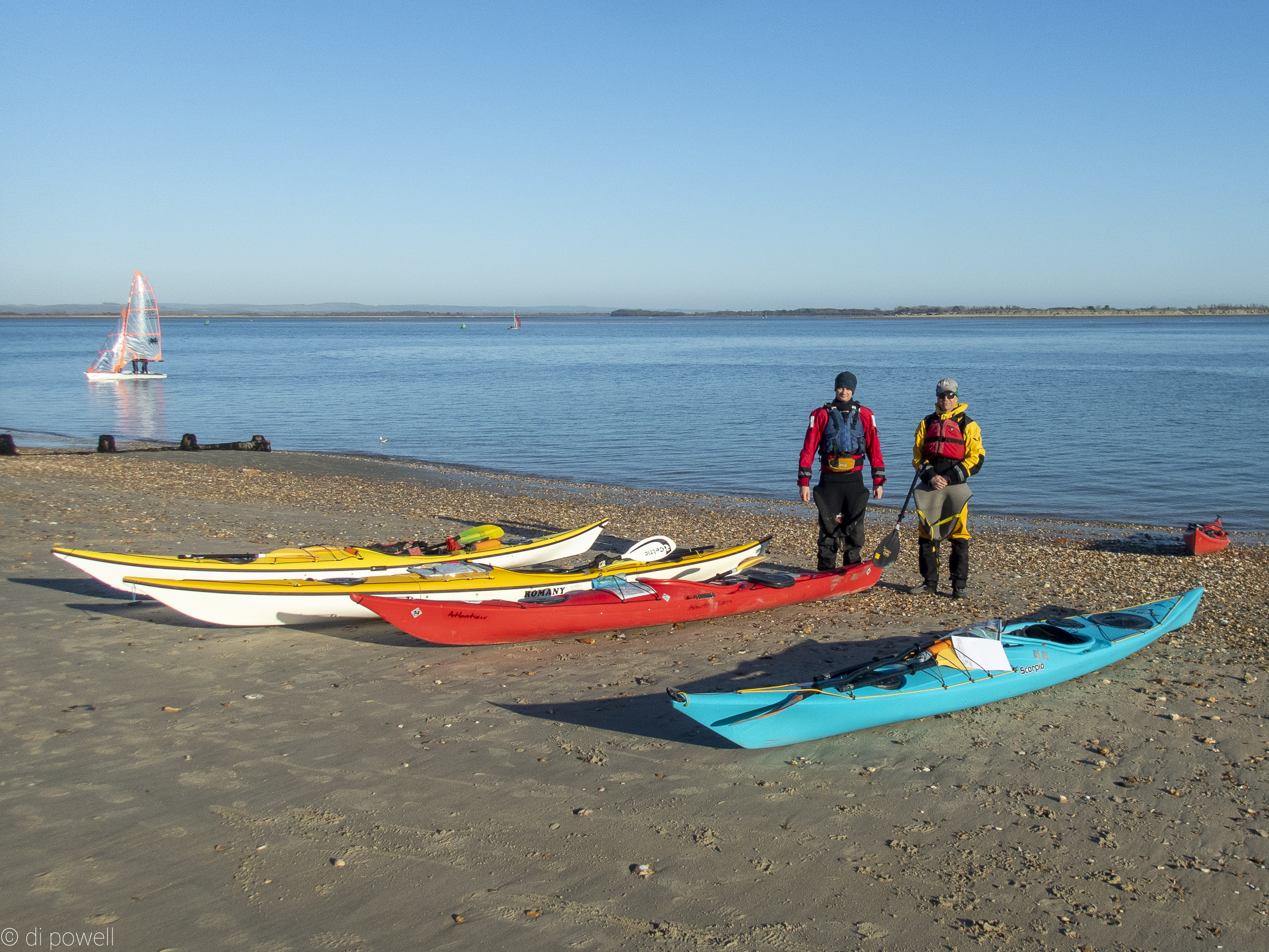
Paddling up the east side we saw a solitary Solent seal, plenty of oyster catchers and a flock of unidentified birds (a murmuration of dunlin perhaps?). We stayed just out of the channel to avoid the boats, and previous experiences from group members meant we concentrated on not being sucked into deviating up dead end channels to the west, or heading into Emsworth by mistake.
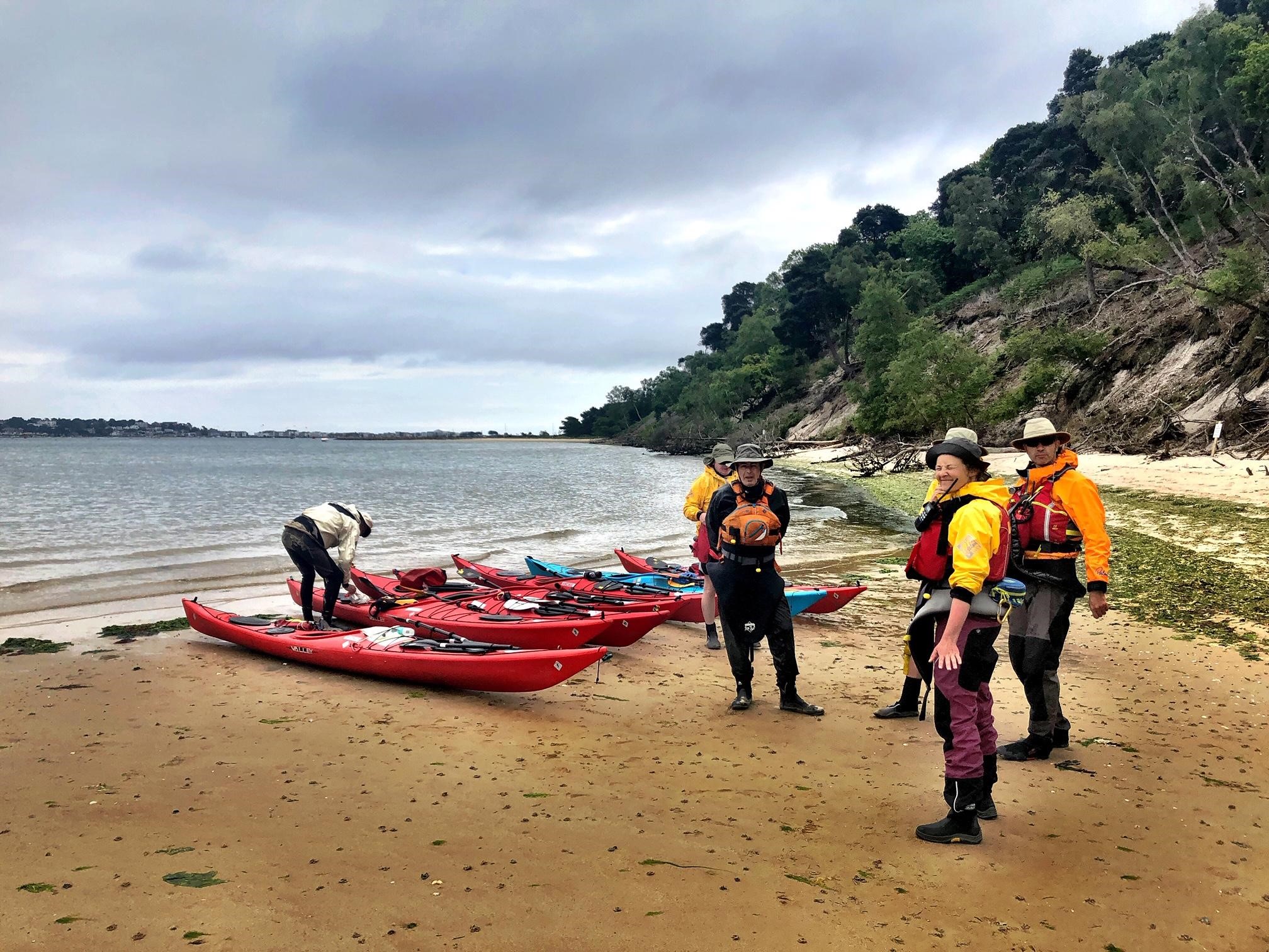
We arrived back at Langstone at about 3.45pm, and landed at the ramp rather than up the small channel to Langstone to avoid the dreaded mud. It was a bit of walk back to the Ship Inn car park and David’s trolley came in useful. After loading up the boats we had a drink in The Ship. At 5pm sharp Tudor and David took themselves to one side in the pub to hold a sub-CKC committee meeting where lots of important decisions were no doubt made. For the record, the meeting closed at 5.13pm. Shortly afterwards we headed off back to London.
A great trip to start 2020 with, which was expertly organised by Liza. It was also Rachel’s first sea trip ever, and Robert’s first sea trip with the club.
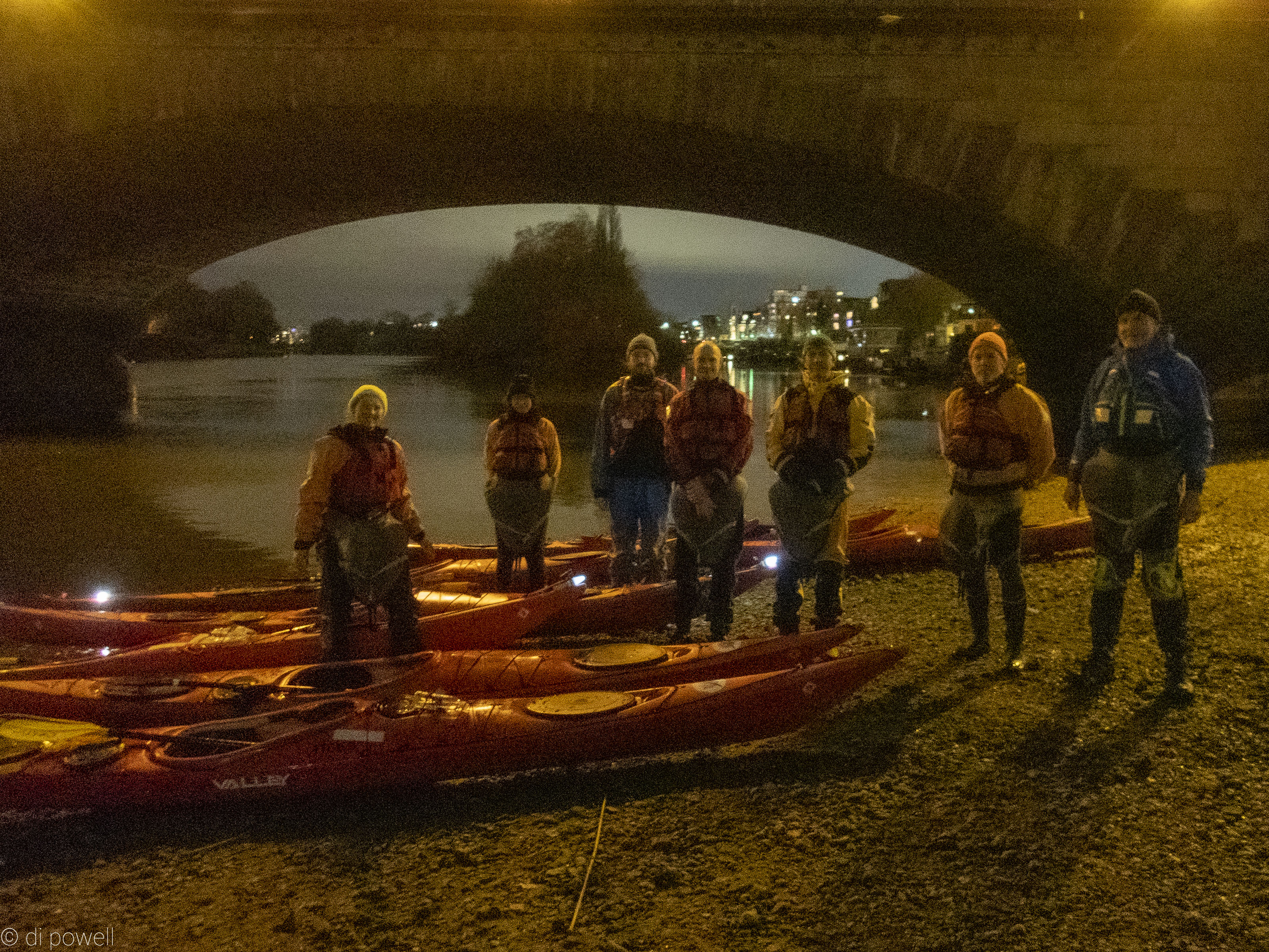
A new year, a new decade, and what better way to start it than with a paddle on the Thames. Seven CKC paddlers set off from Kew Bridge on 4th January, led by Fiona, with the objective of paddling down the river until the tide changed, and then returning with the flow. Conditions were good, no rain or wind to speak of, but for some reason the tide never really changed so the paddle back was harder work than expected. Anyway, 17 miles paddled between setting off at noonish and returning before 6pm with a few stops on the way, was a good effort.
 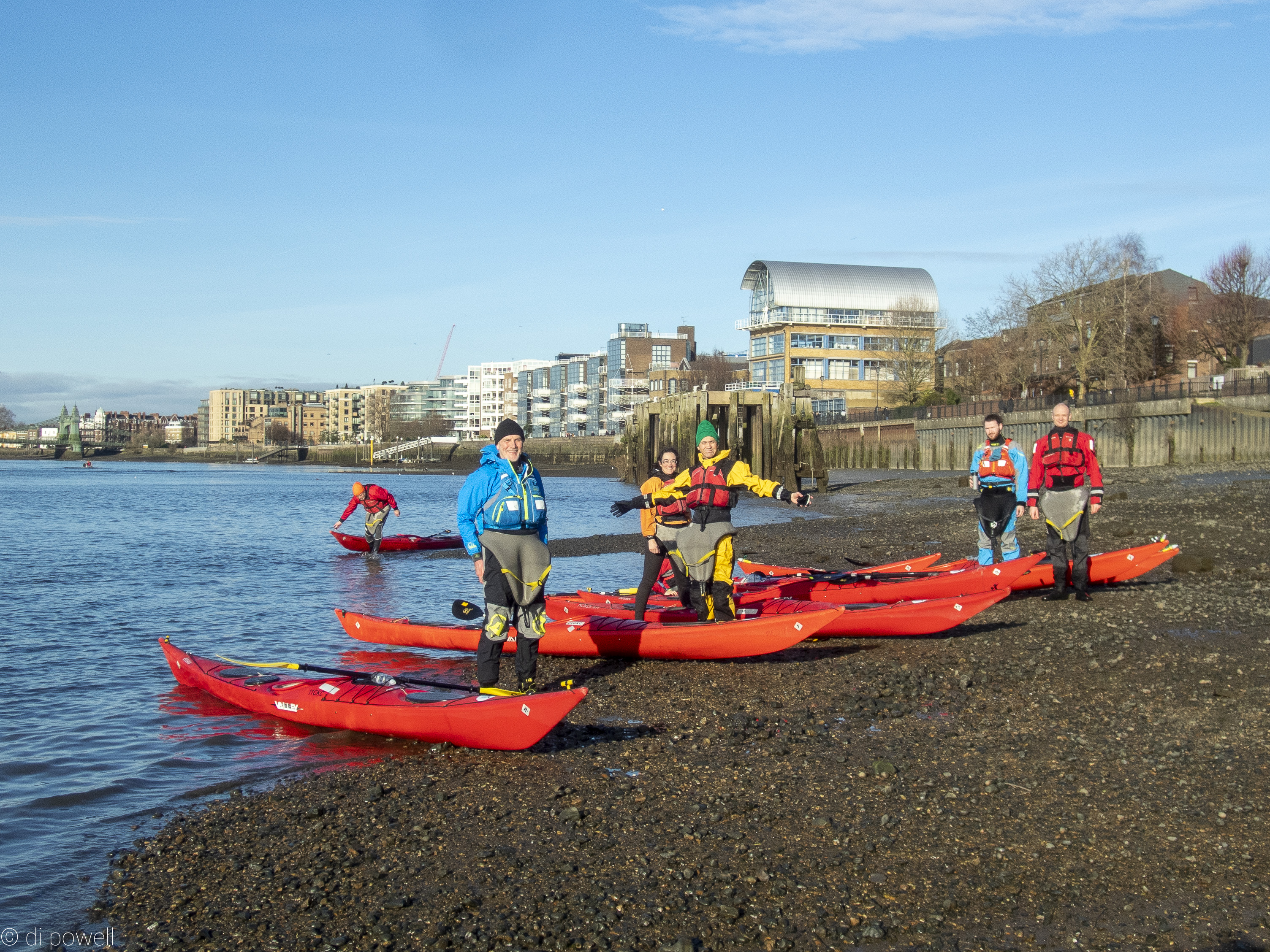
We had a lunch stop at Putney but more memorable was the coffee break at Battersea Reach which was at the end of our downstream paddle. Firstly we had some delicious Palestinian bread (cake), then Fiona took (most of) us to a very friendly Italian family run bar/ restaurant/ coffee shop in Battersea Square that found us a table they didn’t mind us dripping on. A trip to the toilets was rewarded with an opportunity to look at their AstroTurf covered wall dotted with plastic flowers. A home décor style several of us will now be copying. Thanks go to David who selflessly stood on the beach guarding the kayaks while the rest of us warmed up with coffees in the restaurant.
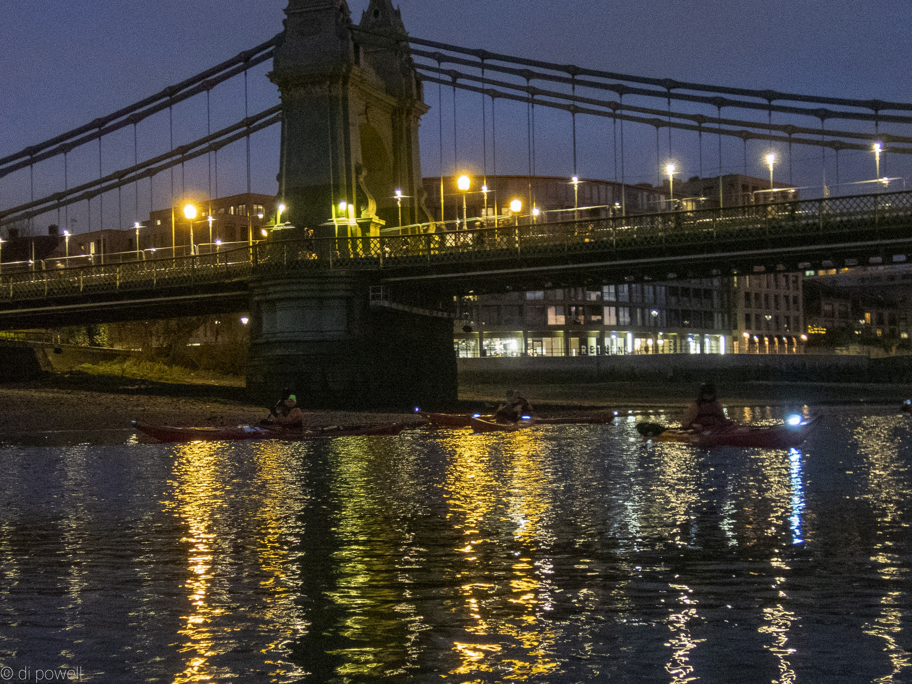
The return journey burnt off more Christmas calories than the downstream leg due to the unexpectedly weak incoming tide, but there were fewer rowers to look out for. One highlight was passing Fulham FC’s ground just as the crowd erupted into applause as the home team went one up against Aston Villa in the FA Cup. We then spent a few minutes trying to guess what was happening on the pitch from the noises coming from the stands. Final score was 2-1 to Fulham, if you’re interested. But I guess if you are interested you already know that! There was also a colourful sunset to keep spirits up on the homeward leg.
Those who didn’t need to rush off after returning to base celebrated the first CKC trip of the year with a swift drink at the Express Tavern . If you ever see raspberry ripple stout on offer at your local I recommend giving it a go. Sounds weird but somehow it works.
Looking forward to more enjoyable trips during 2020.
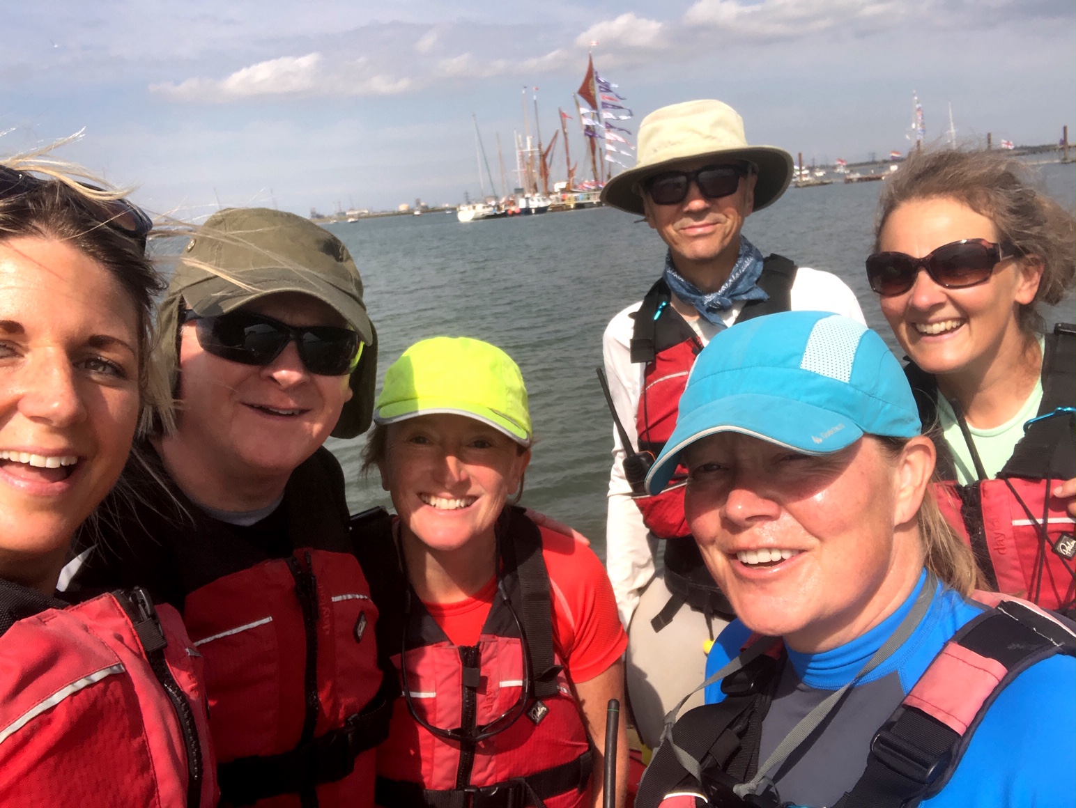
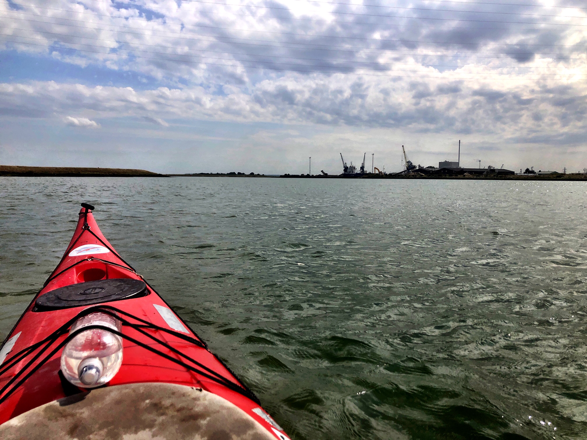
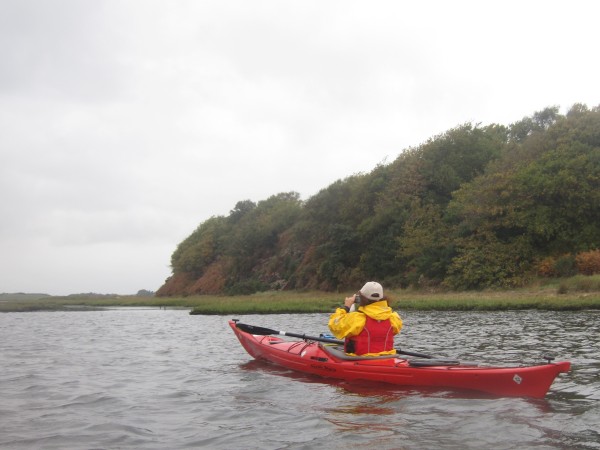
On Saturday 31st August a group of six (Rachel, Fiona, Charlie, Ronan, Liza and Tudor) headed to the Isle of Sheppey. I must confess to never having heard of the Isle of Sheppey, so this added an air of mystery to the trip!
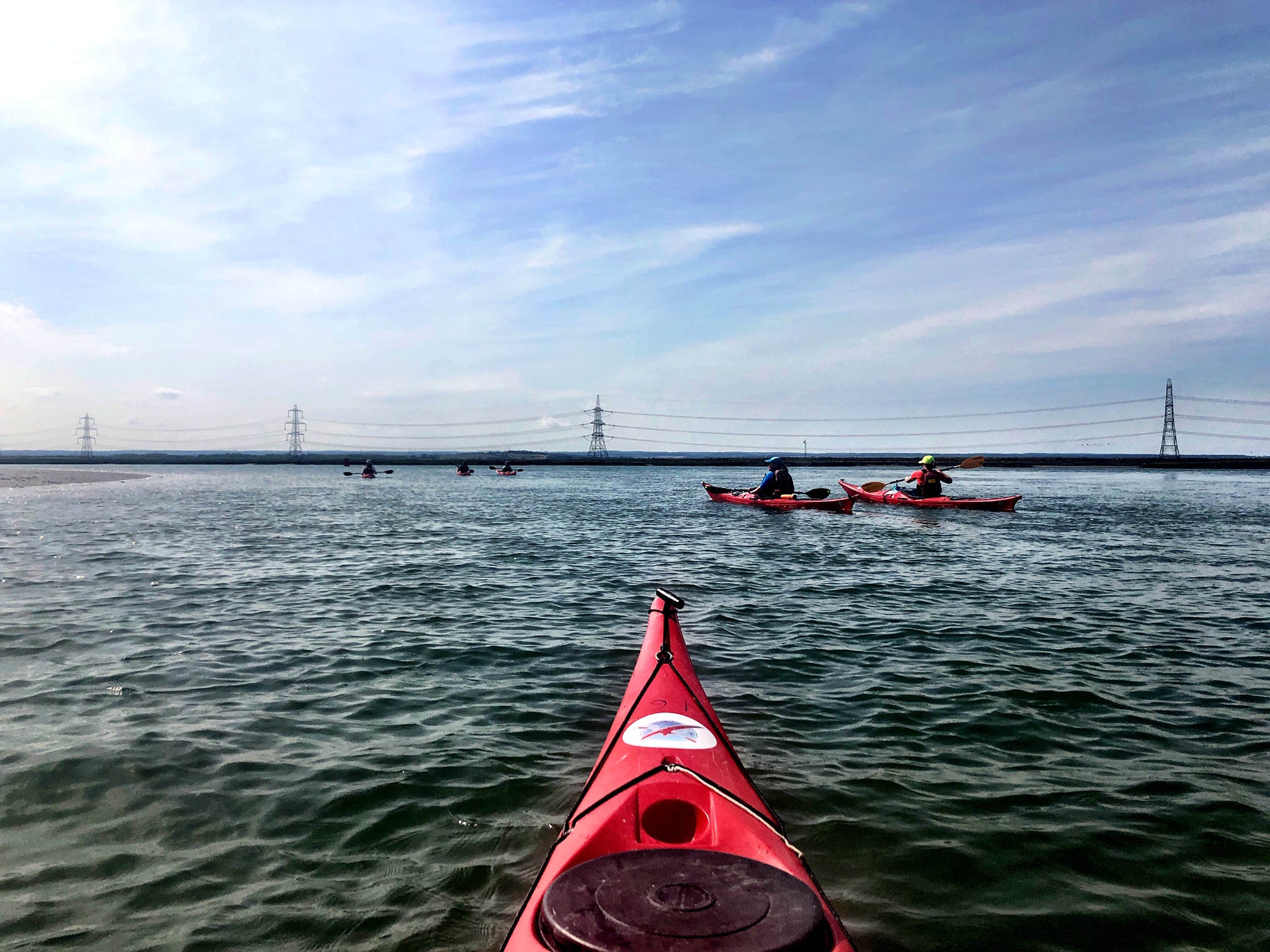
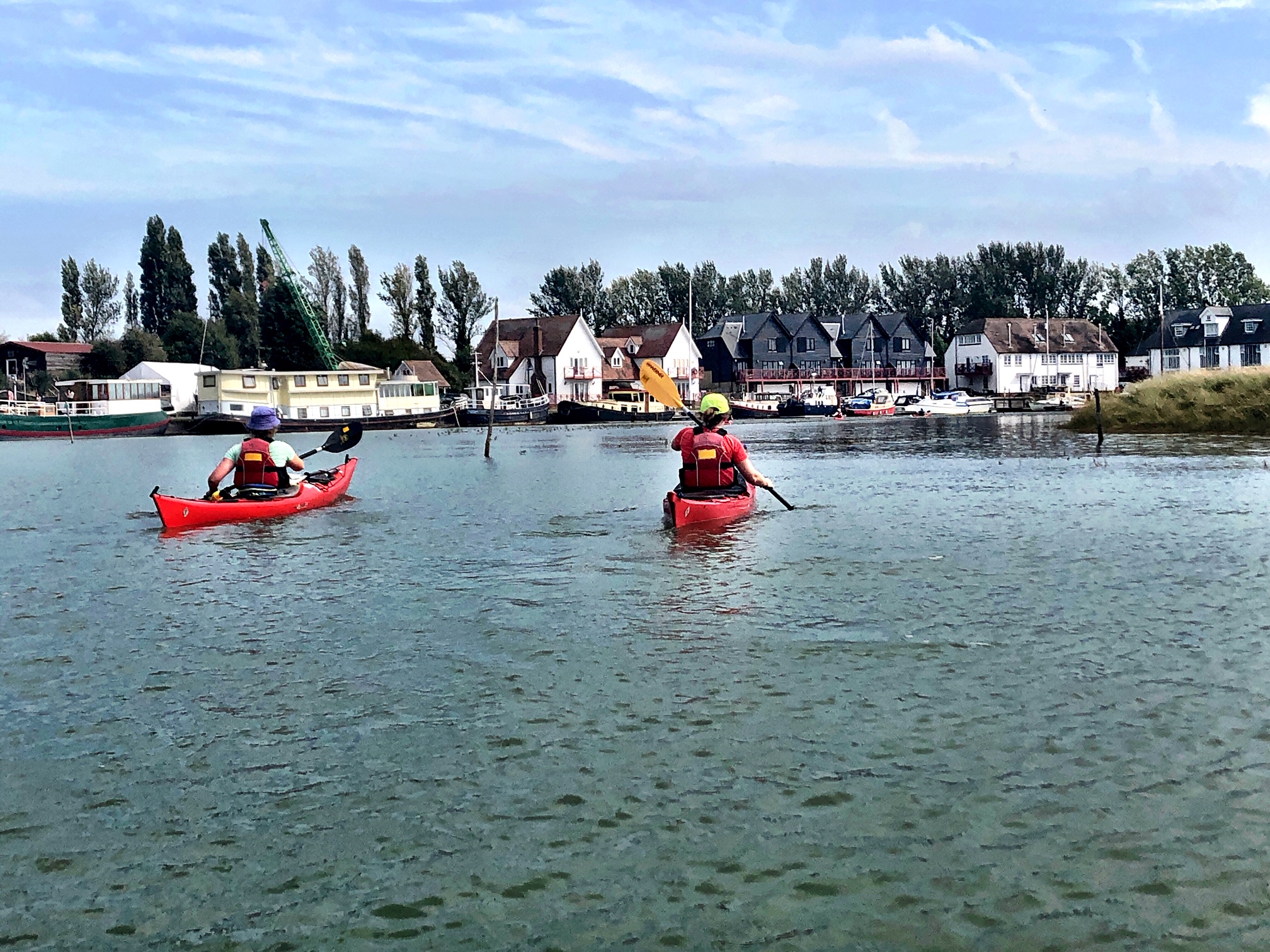
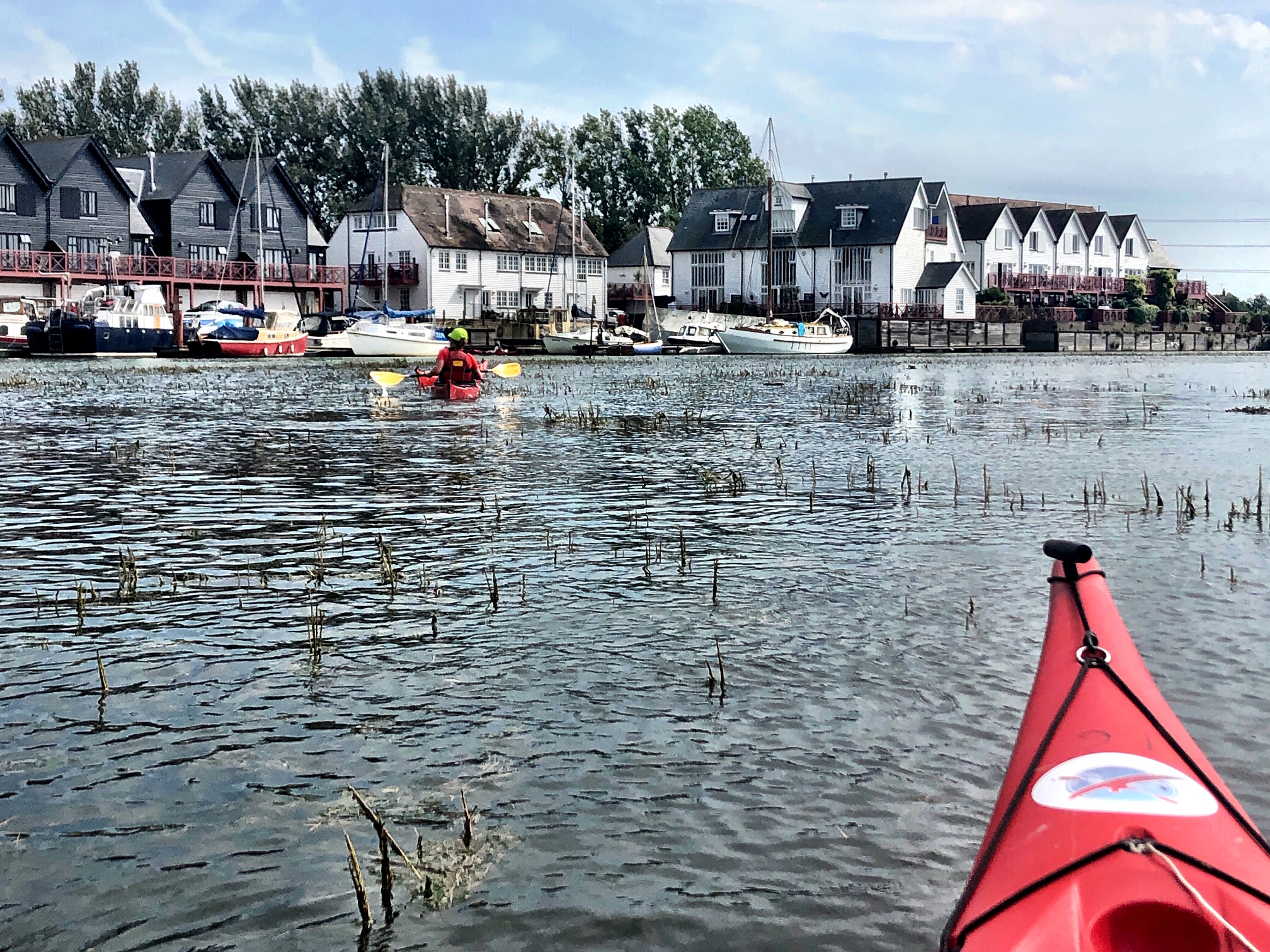
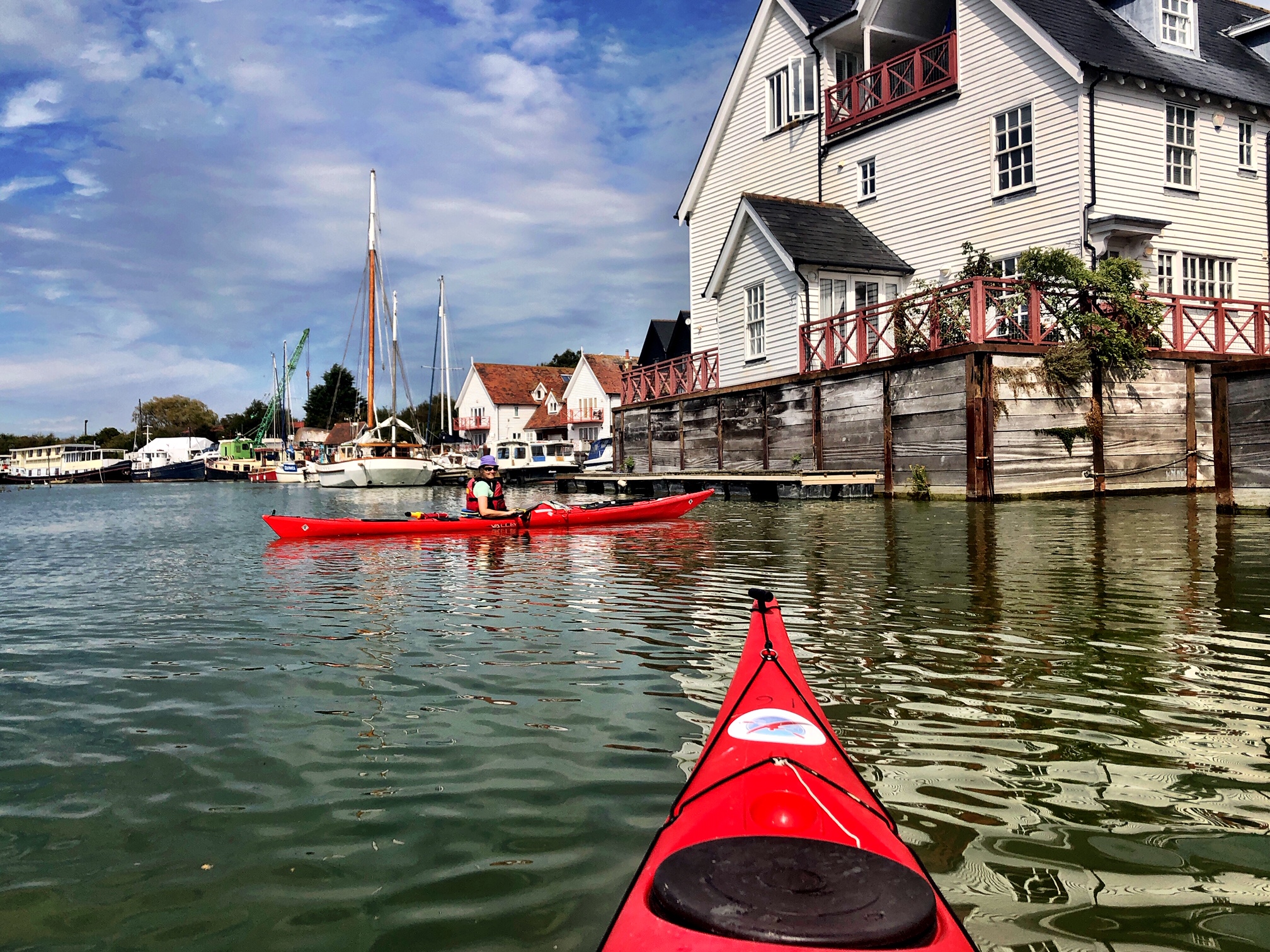
We set out from a slipway at Queenborough in Kent heading down the River Swale. The Swale is a tidal channel of the Thames estuary that separates the Isle of Sheppey from the rest of Kent and forms both a National Nature Reserve and a Special Protection Area.
It was a very enjoyable paddle despite the flat scenery and plyons, as there were lots of birds and reasonably good conditions. And any time spent in a kayak is always good, as we all know.
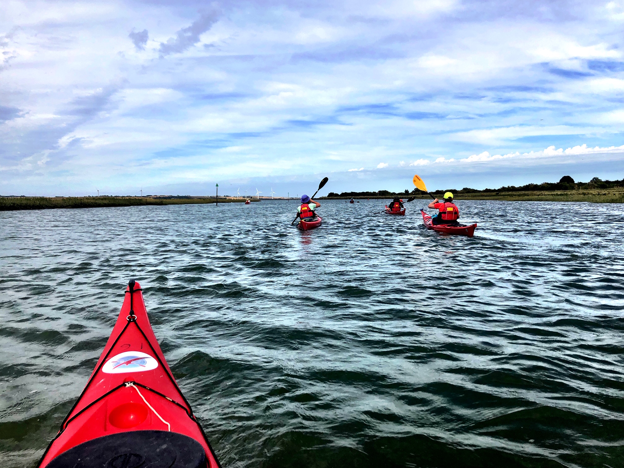
There was the option of exploring Sittingbourne but this was quickly vetoed by a reliable Irish source….that didn’t encourage us any further!
The weather was sunny and warm and so the lunch stop ended up being sitting outside a lovely pub in a hamlet called Conyer which is at the head of Conyer creek. There was at the start of the trip scope for, to coin a phrase, someone to be paddling up a creek without a paddle….Liza had forgotten her own paddle (preferred) but luckily we had paddles for everyone.
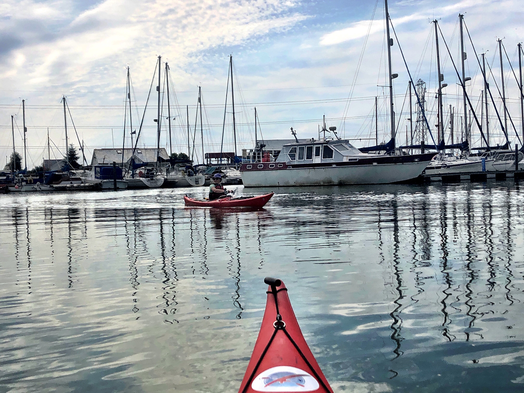
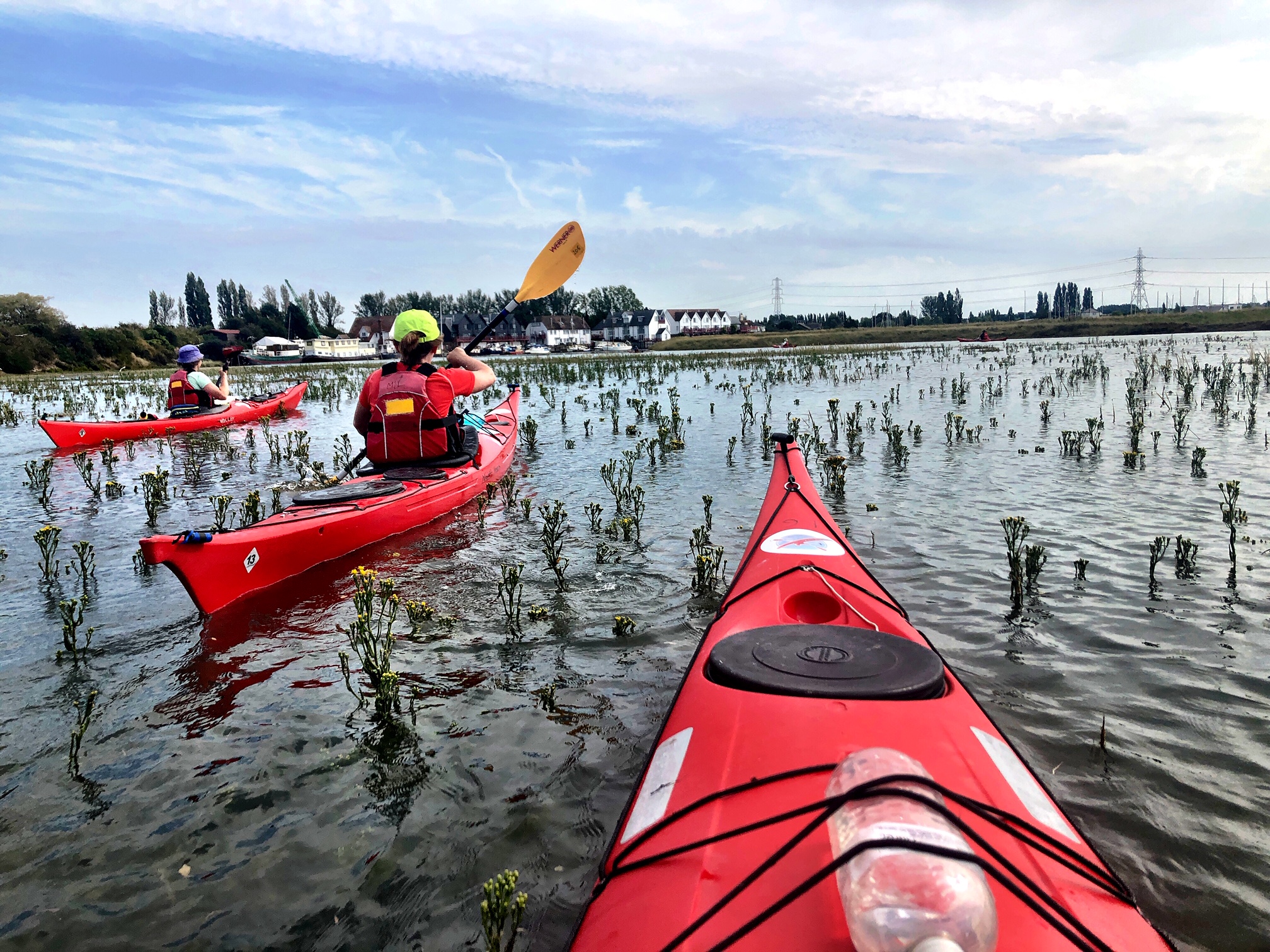
The paddle into Conyer was a highlight with its lovely riverside houses. A nifty little shortcut was taken paddling through some reeds which we renamed as paddling through broccoli!. We pulled in at a slipway to be met by a local who seemed hesitant for us to leave our kayaks there as some previous kayakers I believe had left a negative impression on him! This was quickly dispelled by our friendly faces.
With the tides moving in a favourable direction after lunch we sped on! At times the water became a bit choppy (where the Swale meets the Thames Estuary) and Fiona did an excellent job of instructing those less experienced. The trip ended at a slipway near the Ferry House pub. The weather was beginning to turn at this point so it was a timely finish.
It was an excellent trip enjoyed by all.
A weekend of rock hopping and paddling in the summer sun, around the beautiful south coast of Devon near Salcombe and Dartmouth.
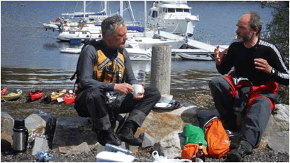
Arriving on Thursday evening, we were the first campers to setup at the Slapton Sands camp site. Although the evening was warm and mild, some CKC members had taken the easier option and rented the mobile home on the campsite and that was to become CKC HQ for the weekend.
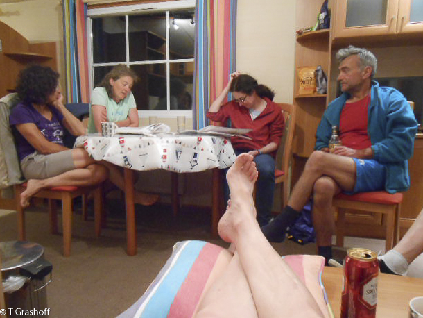
CKC HQ
So after some fortifying fish and chips and, gin and tonics inside CKC HQ, our attention turned to planning for the next day.
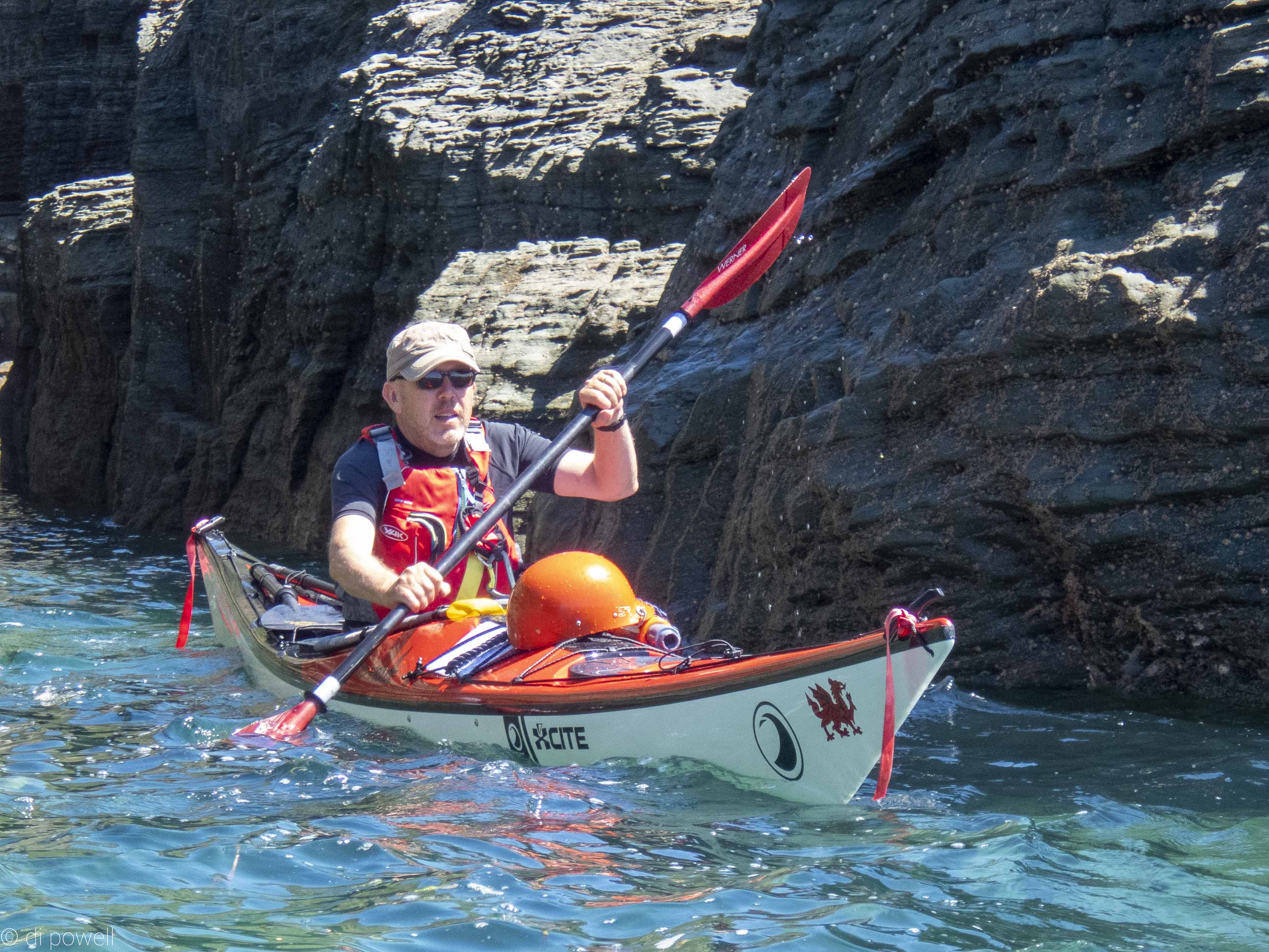
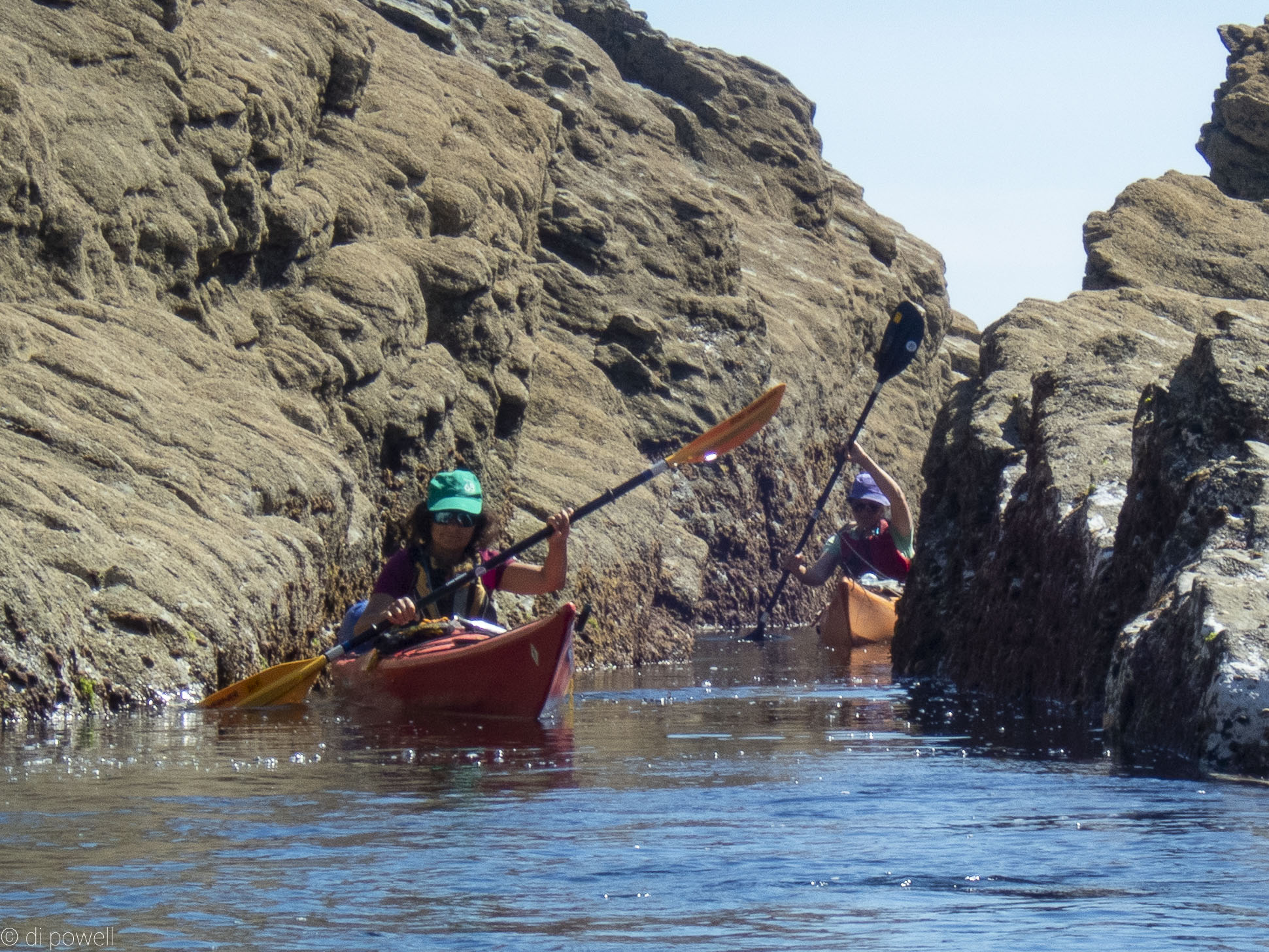
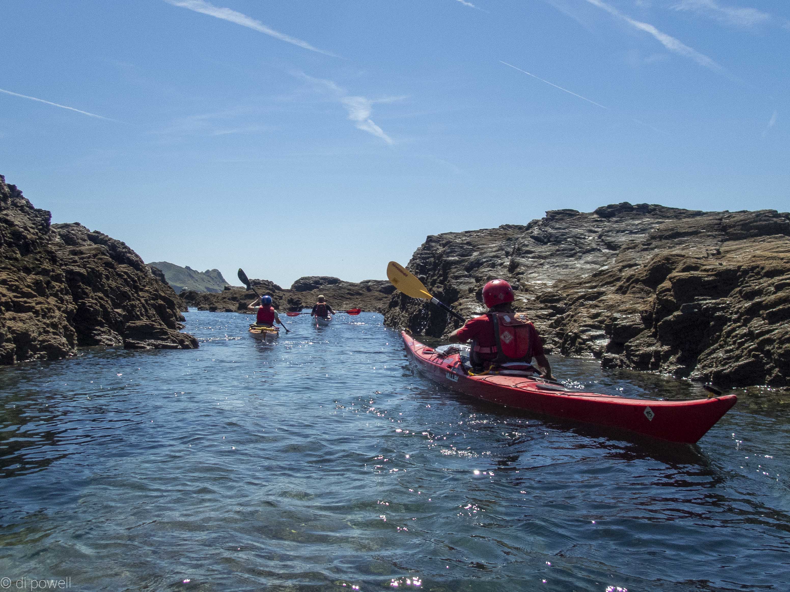
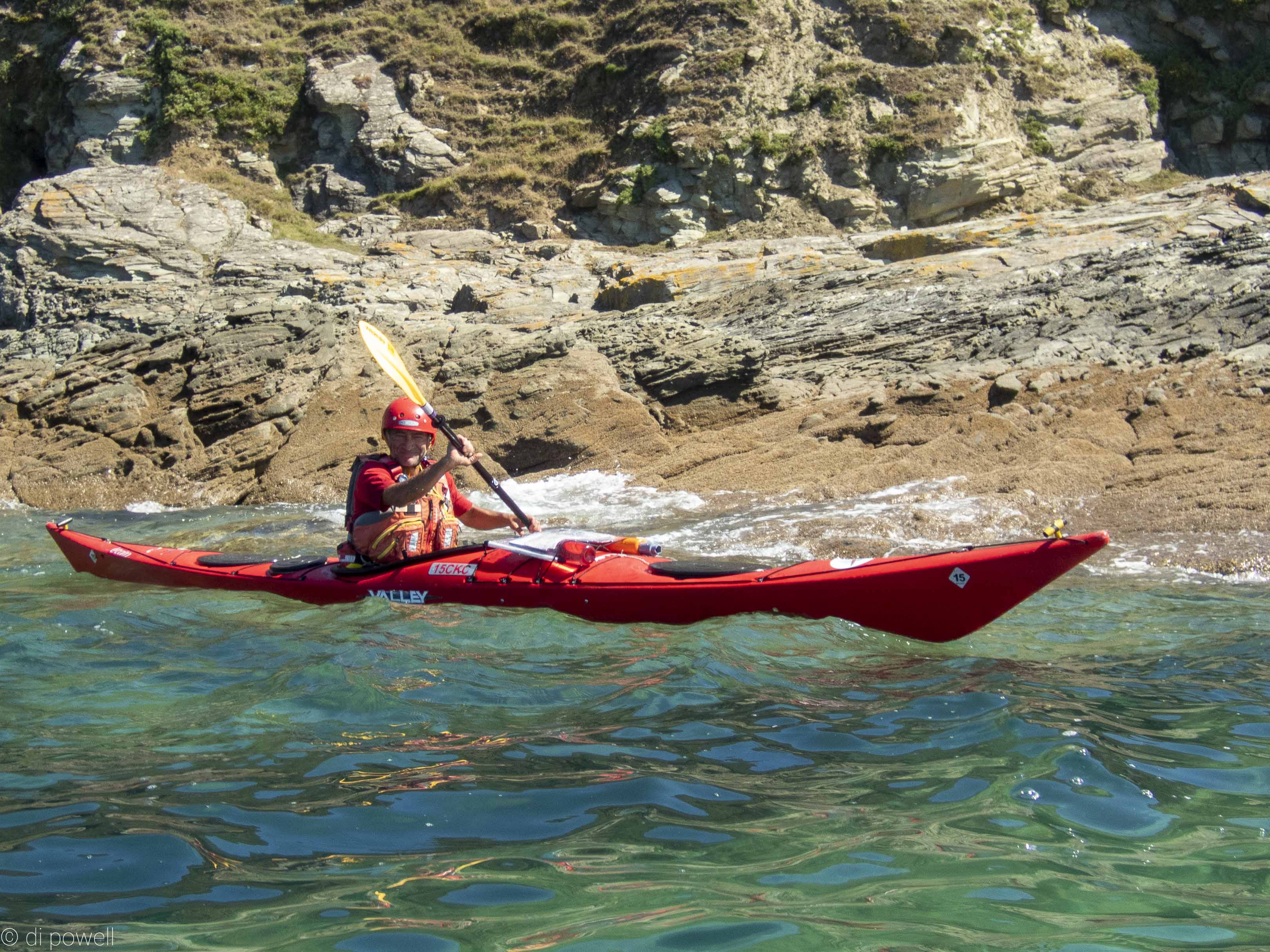
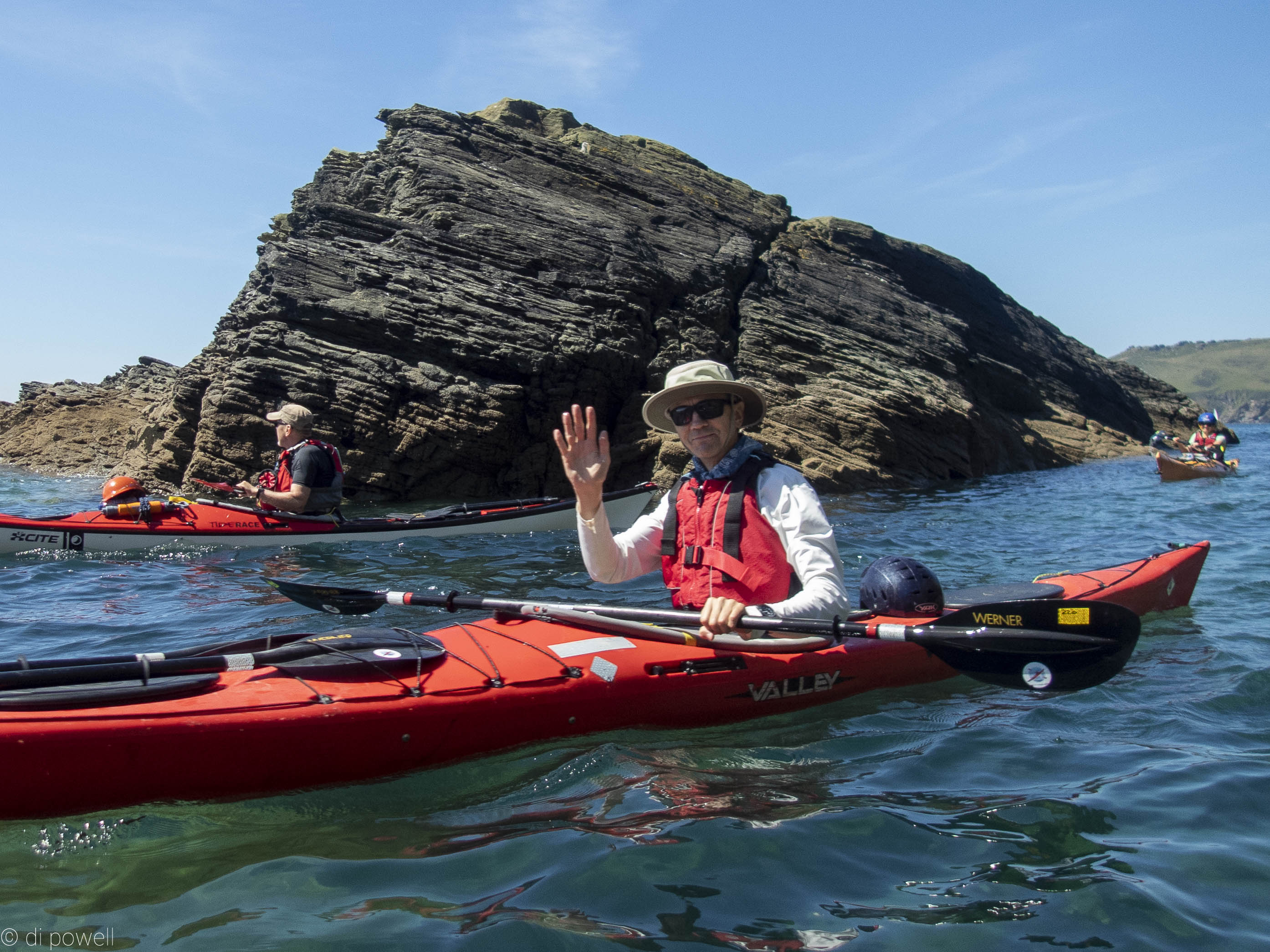
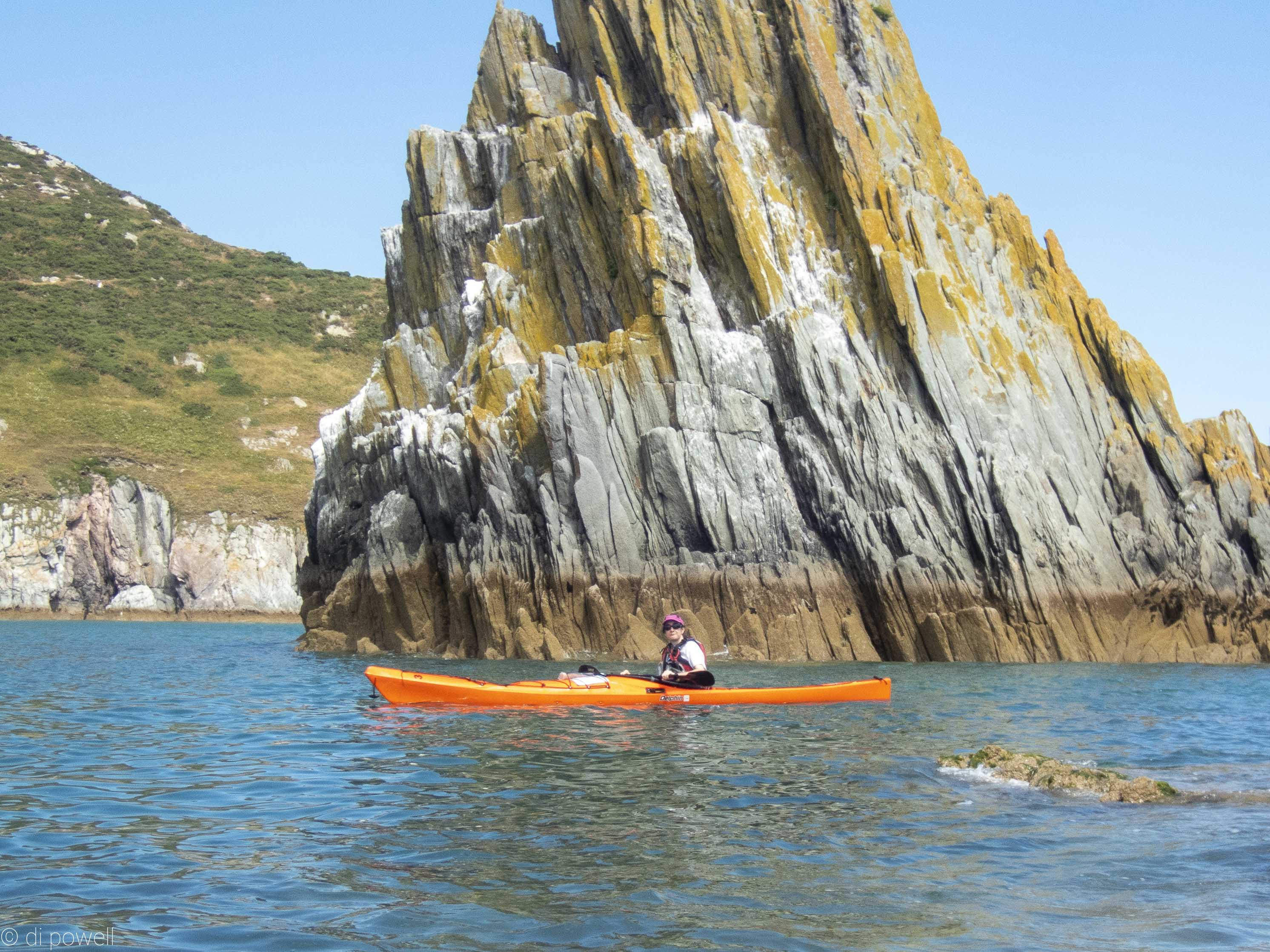
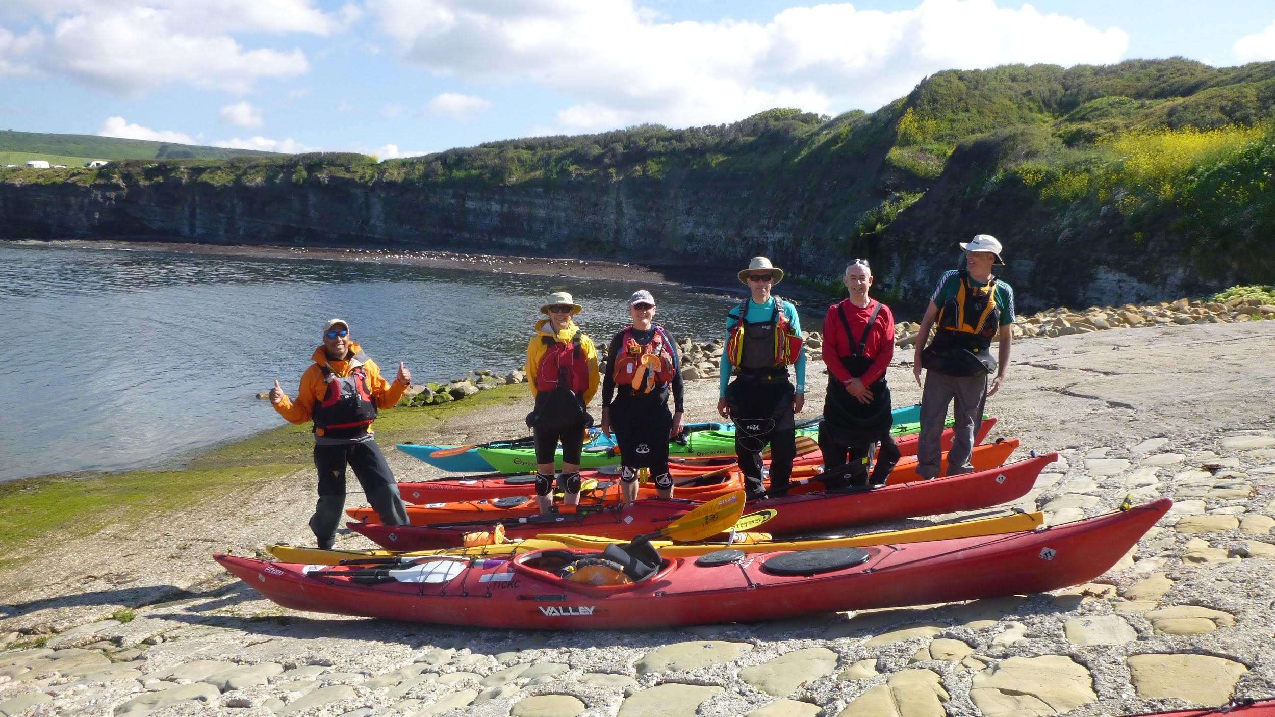
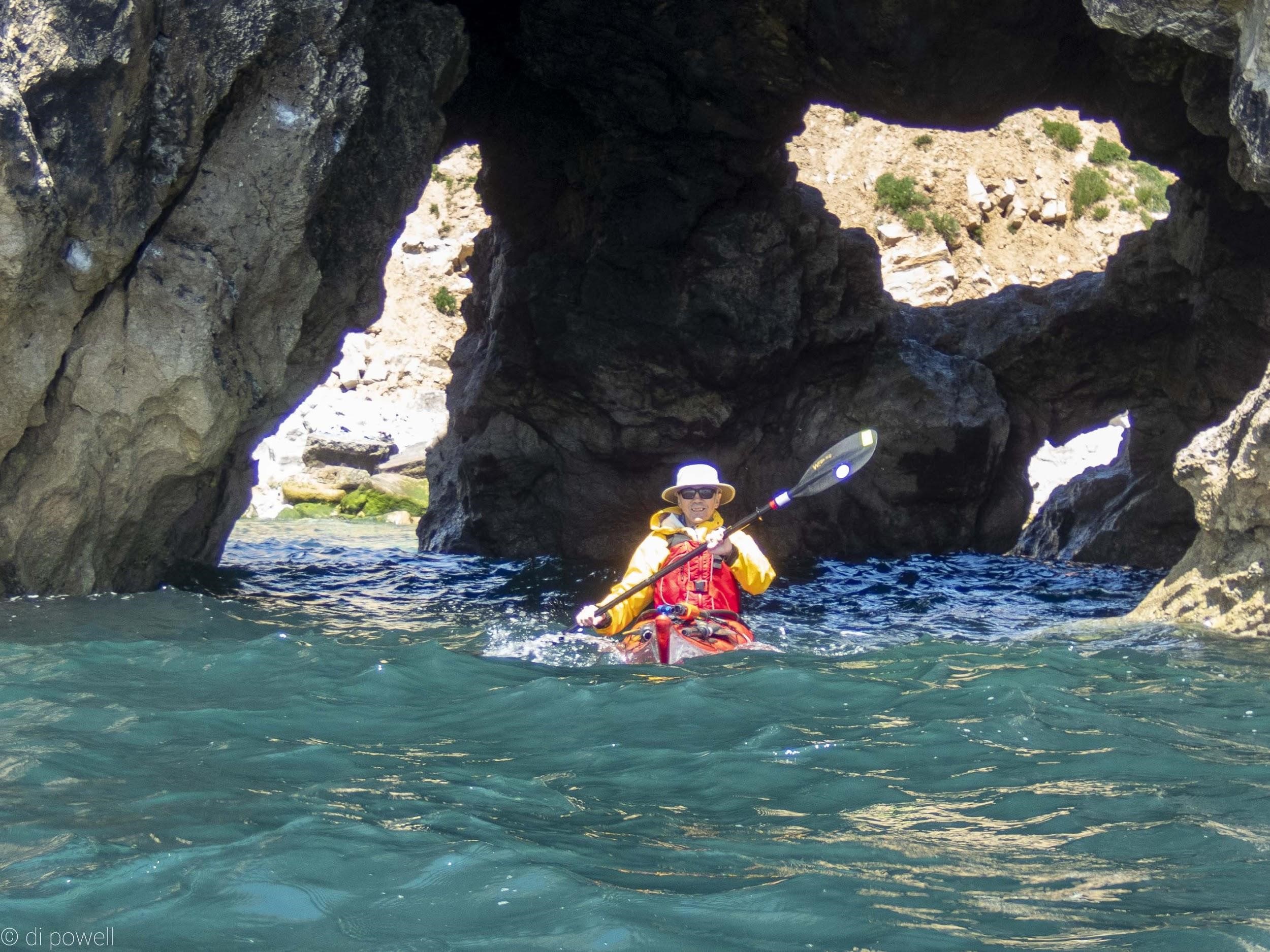
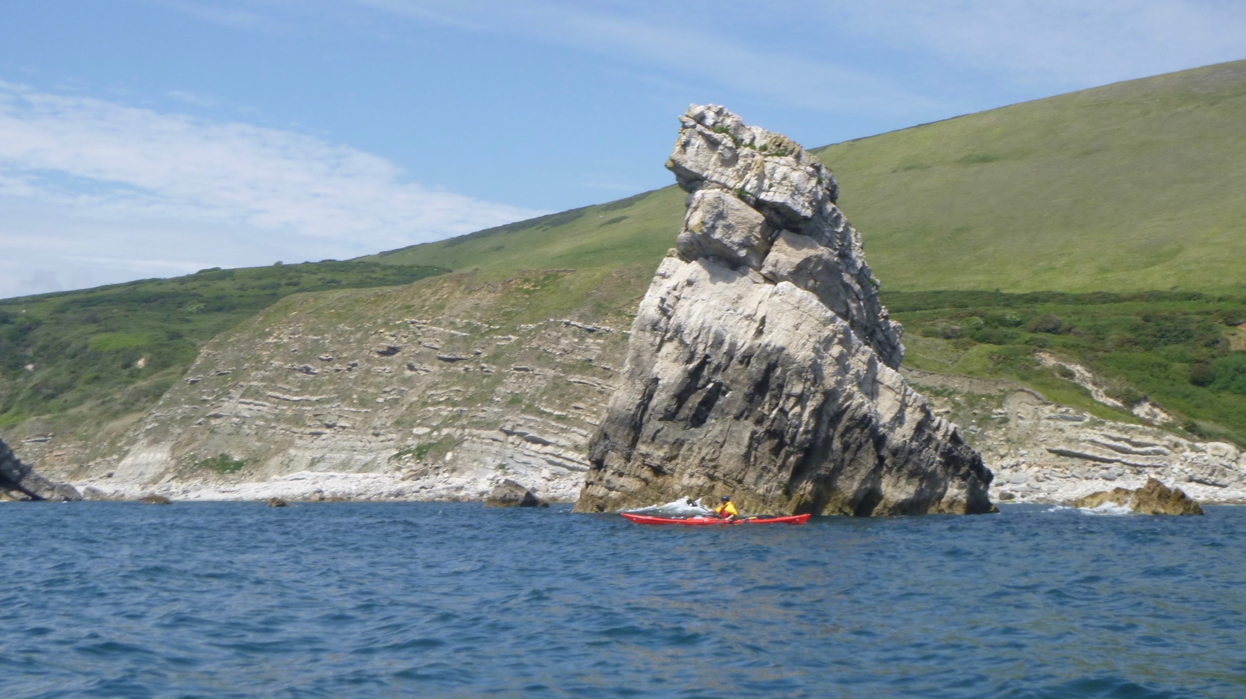
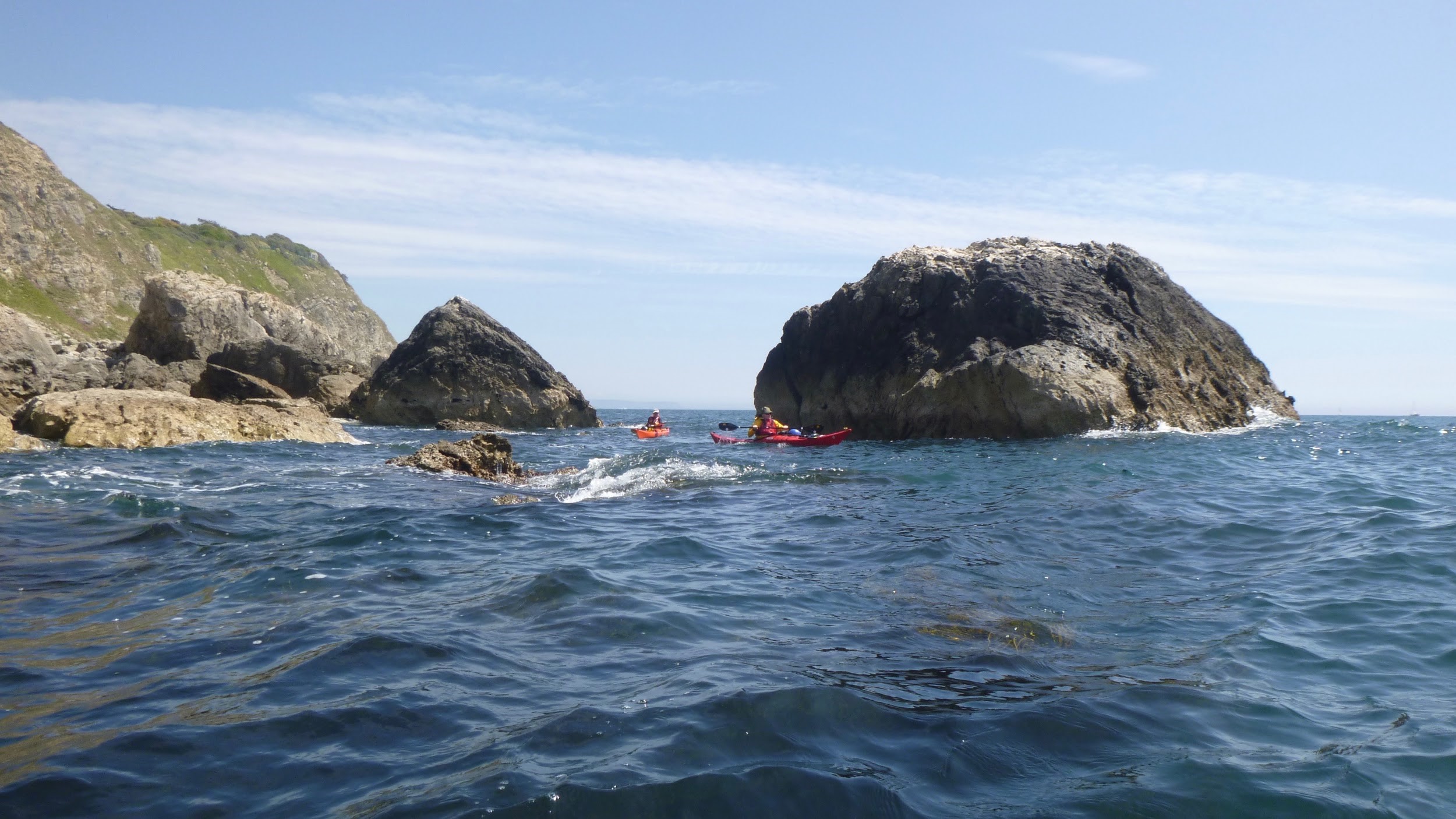
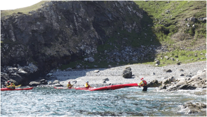
The next morning in brilliant sunshine, we met David Jones from Dartmouth Yacht Club who had kindly offered to accompany us and offer some local advice. We arrived at North Sands car park after traversing an incredibly windy road down to the beach that felt more like the Italian Riviera than Britain. We launched from North Sands as the beach goers started to arrive, and crossed the Kingsbridge Estuary boating channel in a group over to Hipples. Following the coast south easterly with light winds (F2), full sun (23C), waves less that 0.3m and no clouds, we immediately started to rock hop. The coastline here is amazingly intricate with big and small rocks to manoeuvre around; small arches, holes and corridors to squeeze through; blind passages to investigate and reverse out of backwards (or attempt to turnaround).
 David Jones leads the way. David Jones leads the way.
 Rock hopping heaven Rock hopping heaven
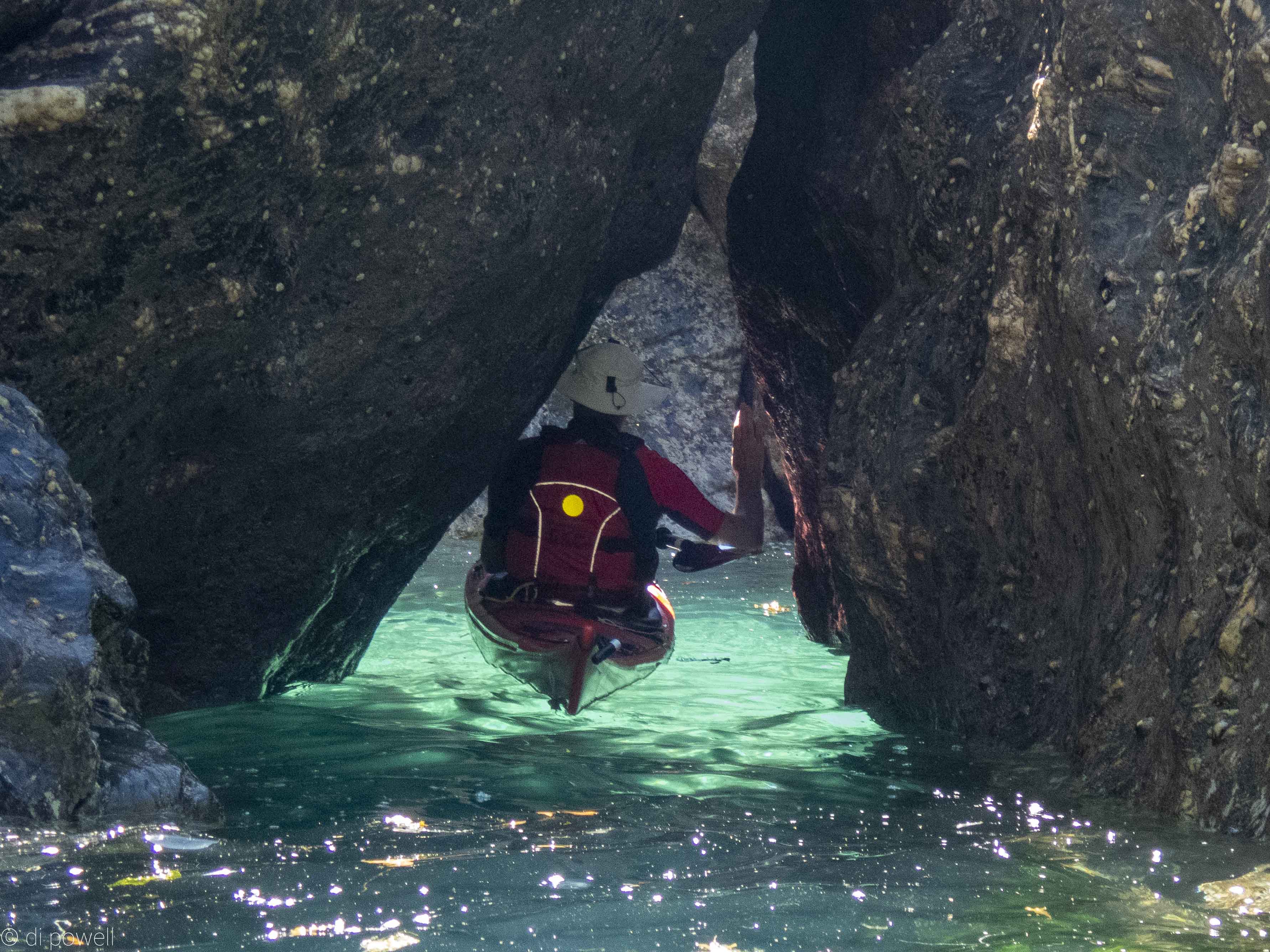 Sometimes the gaps were a tight squeeze. Sometimes the gaps were a tight squeeze.
 Other times not so much of a squeeze. Other times not so much of a squeeze.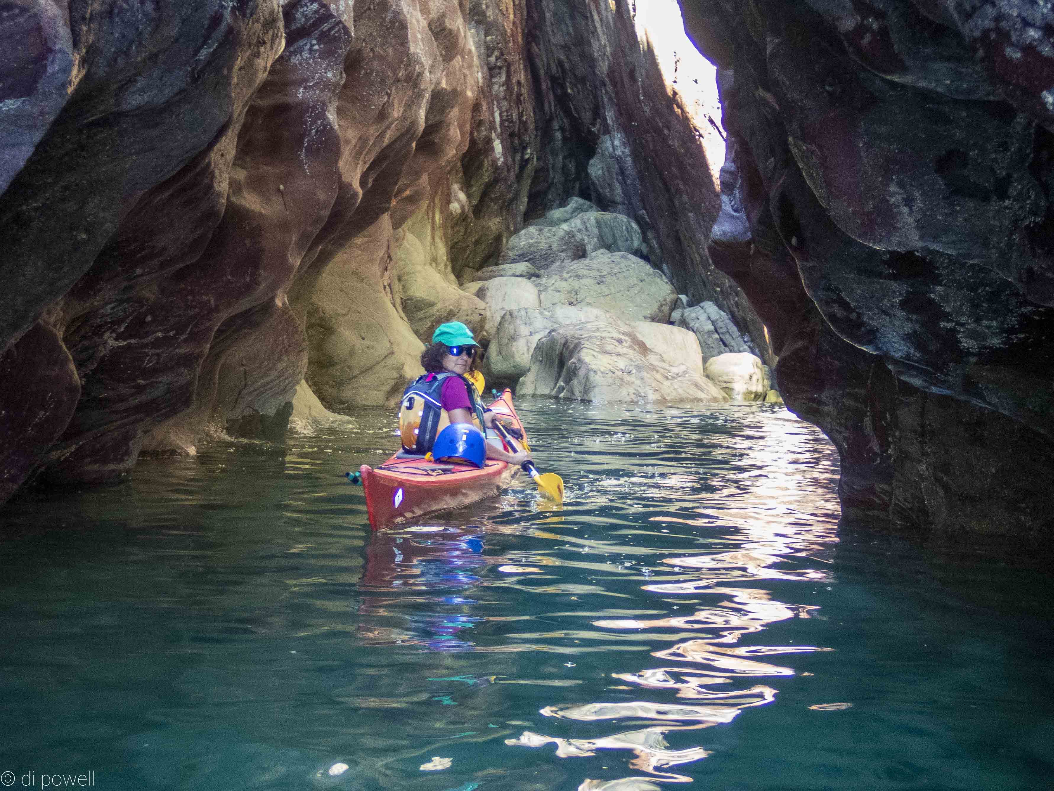 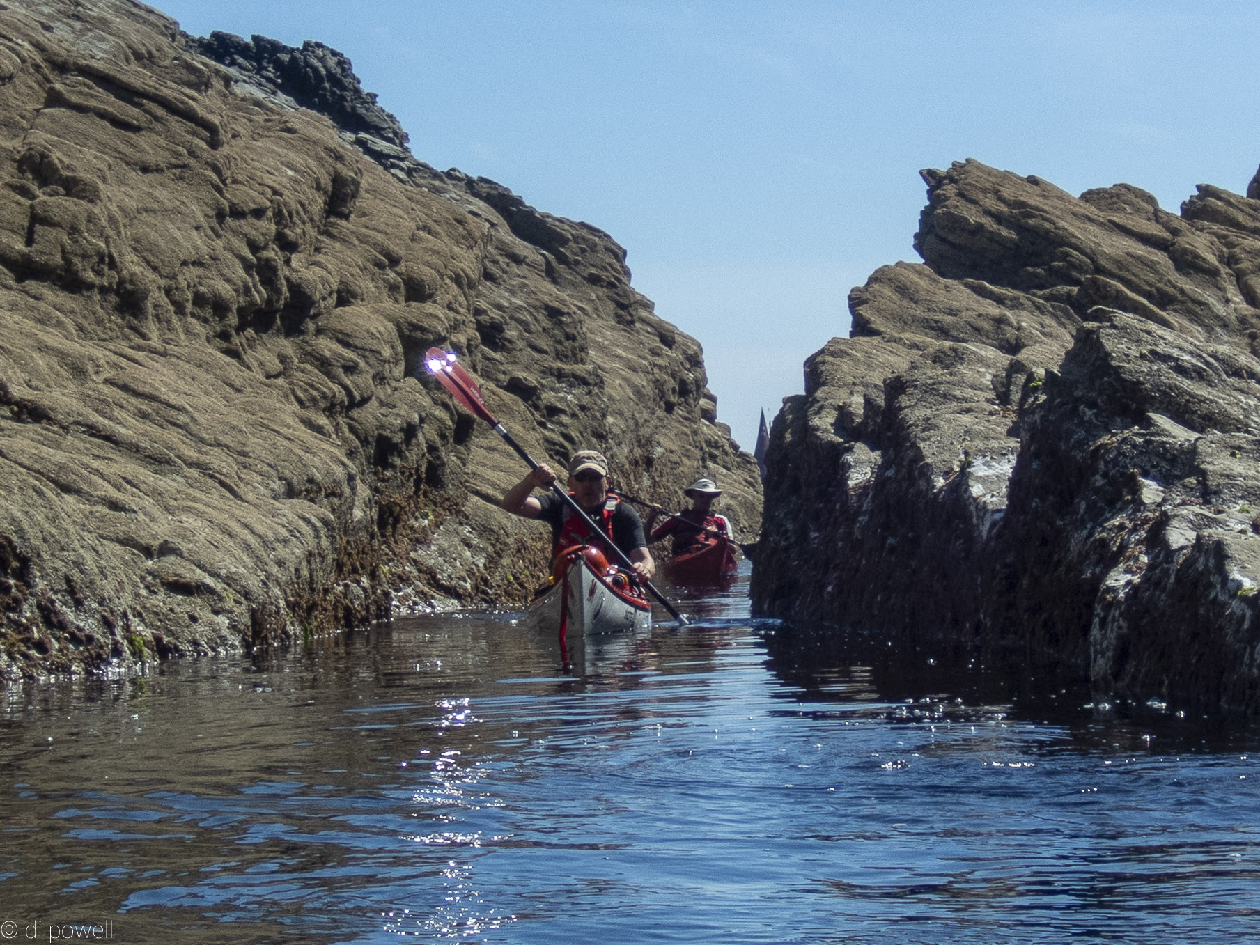 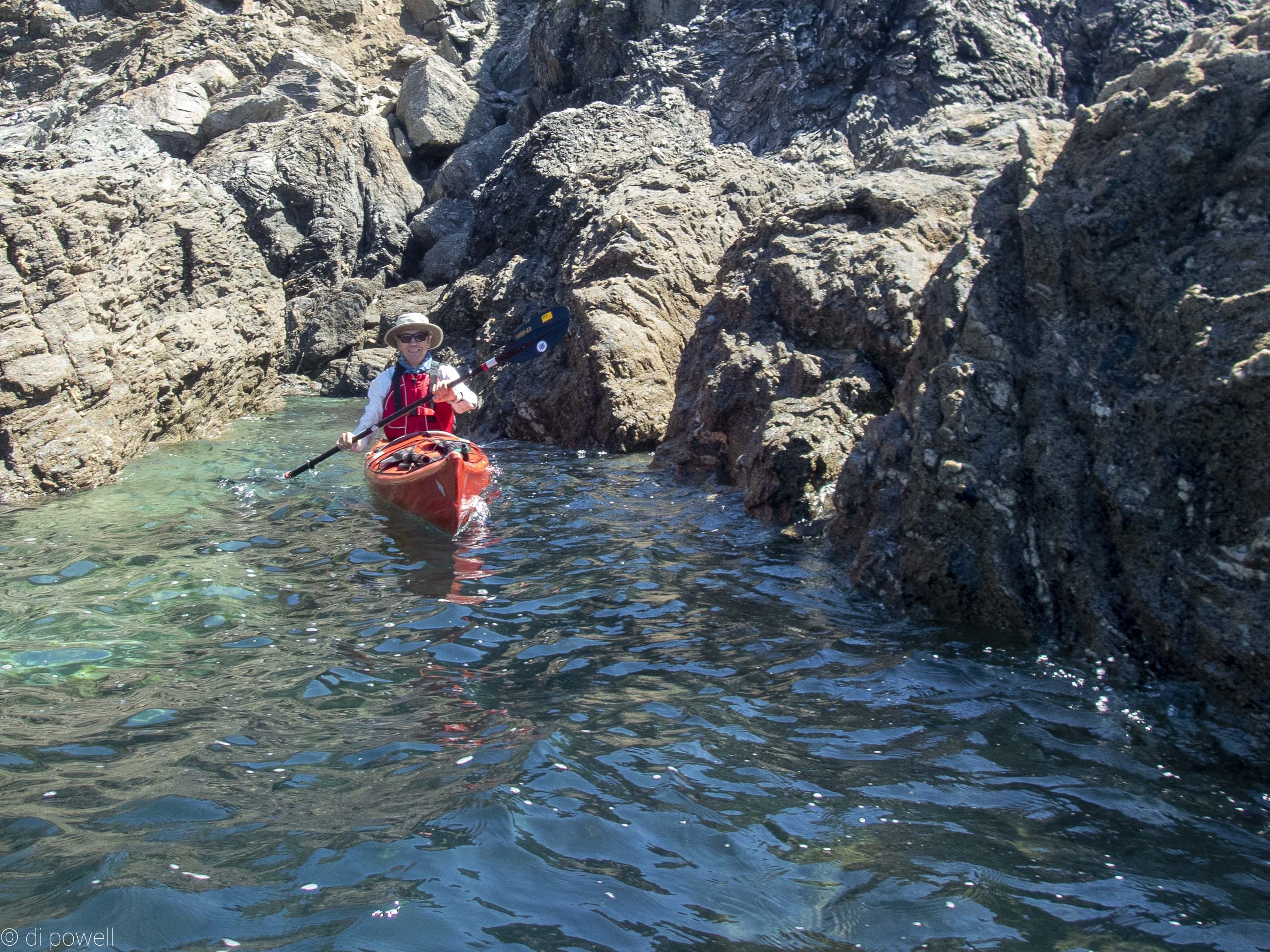 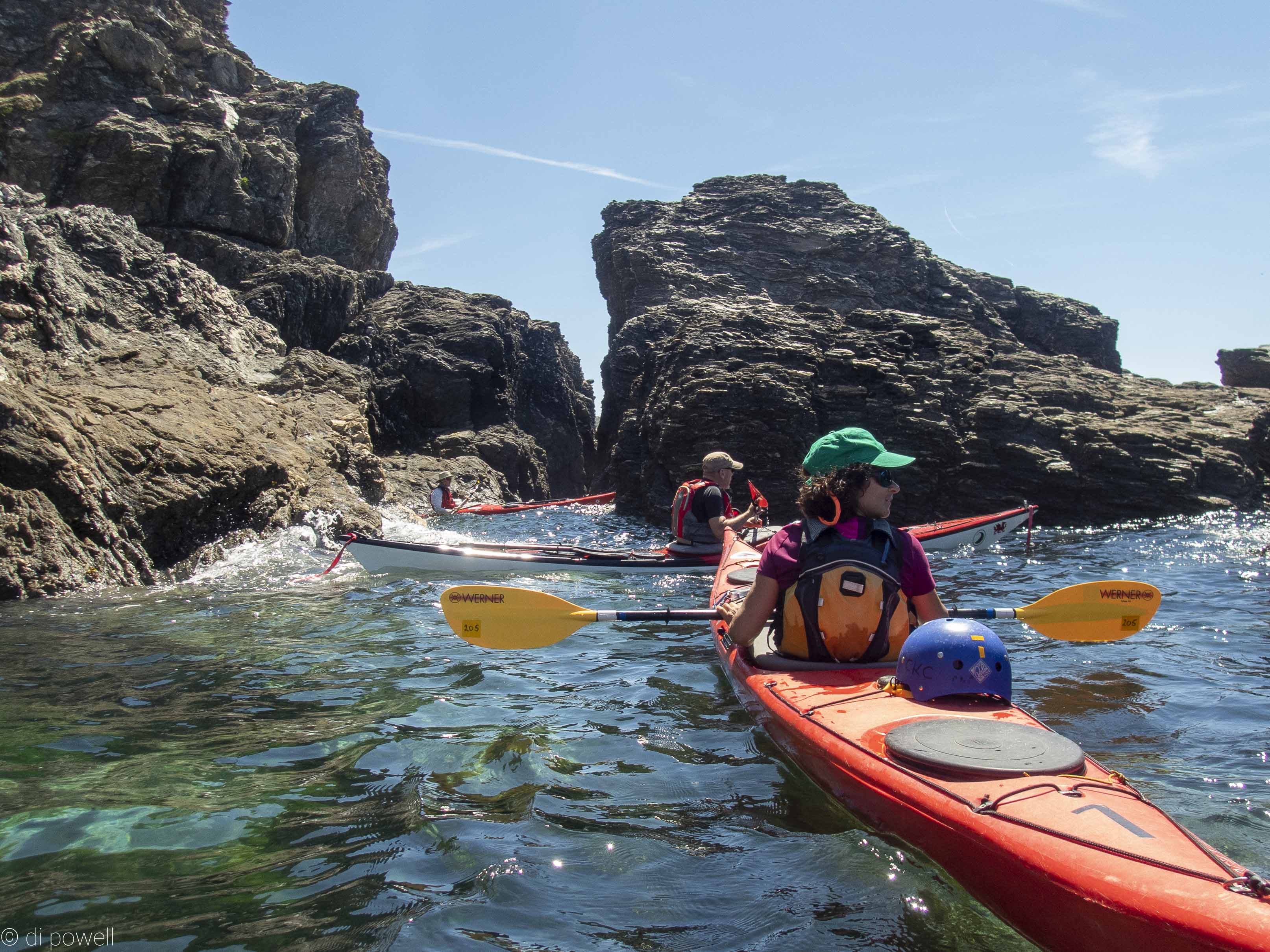 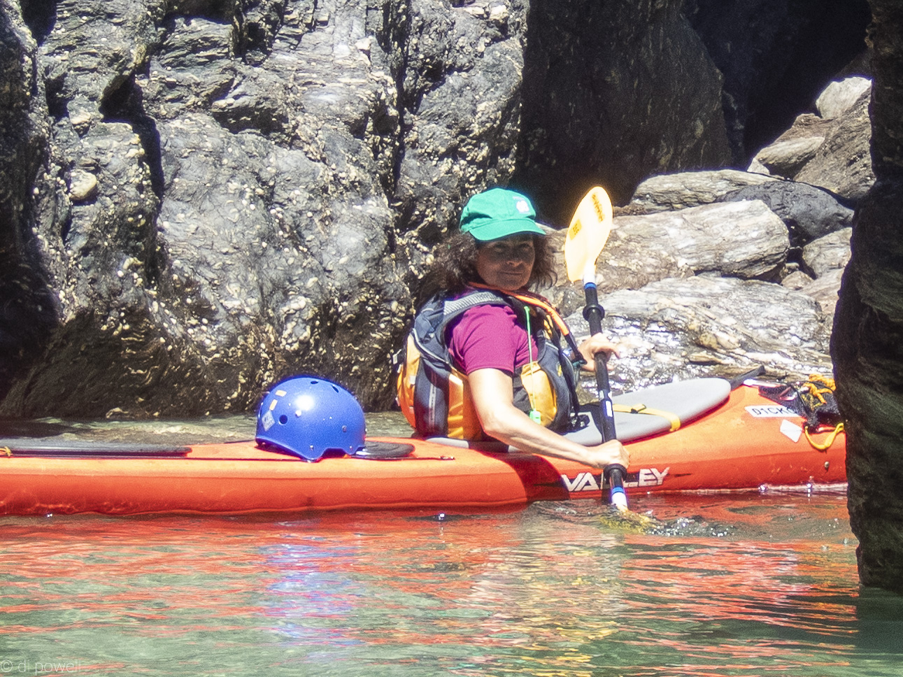   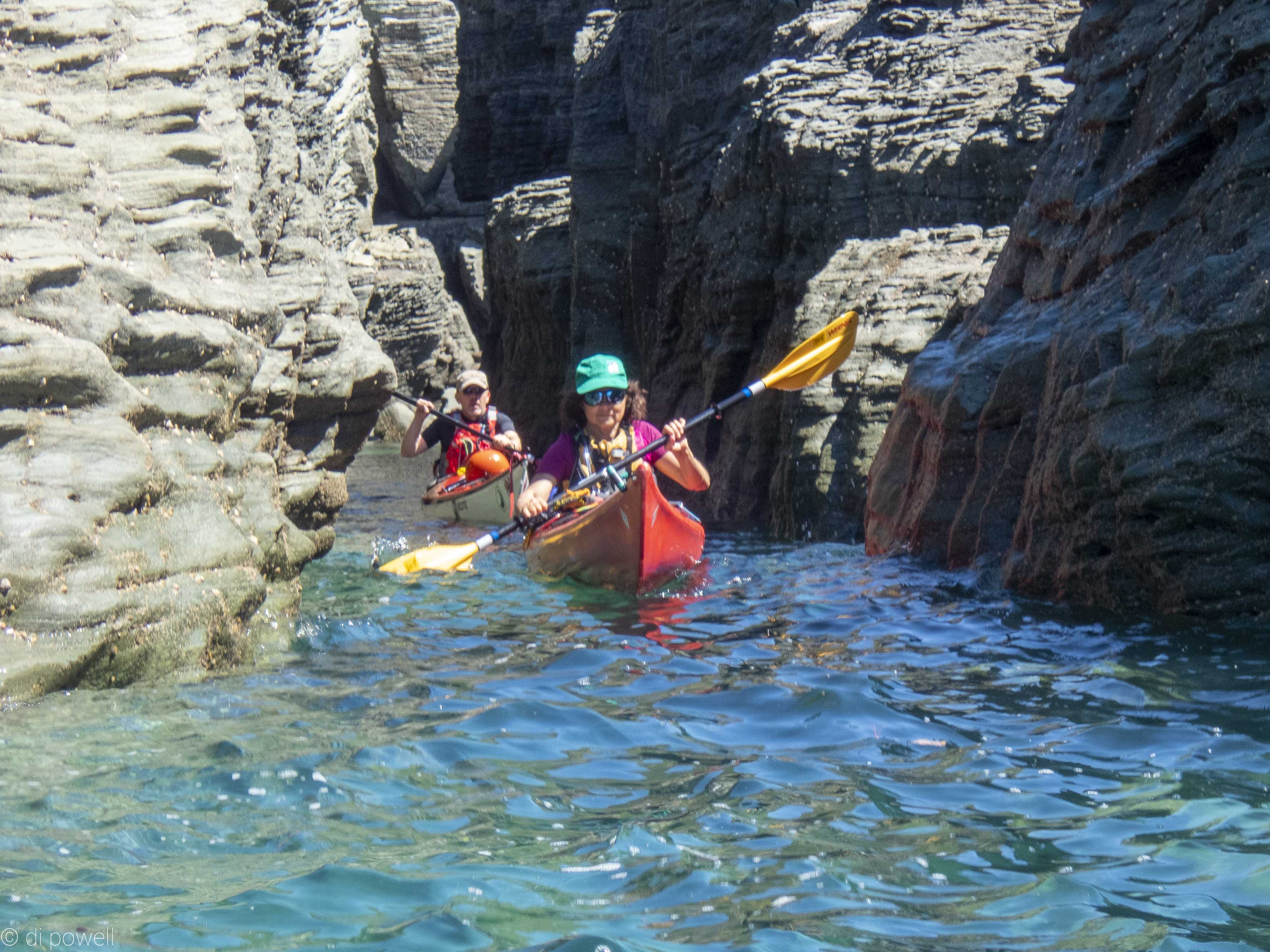 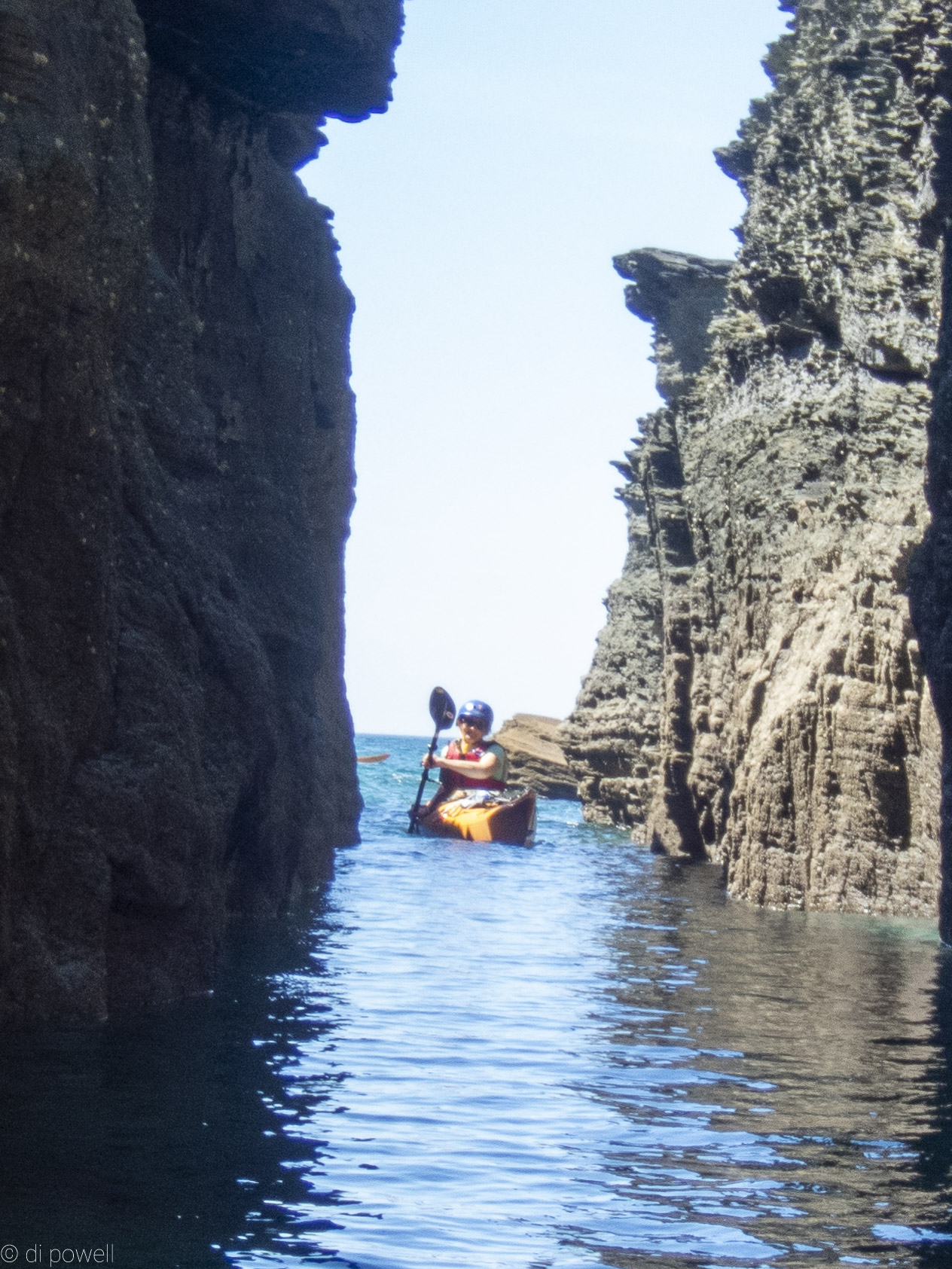
Described as rock-hopping heaven by one of our group, it was a great way to build up those technical skills required for quick decision making and agile manoeuvring.
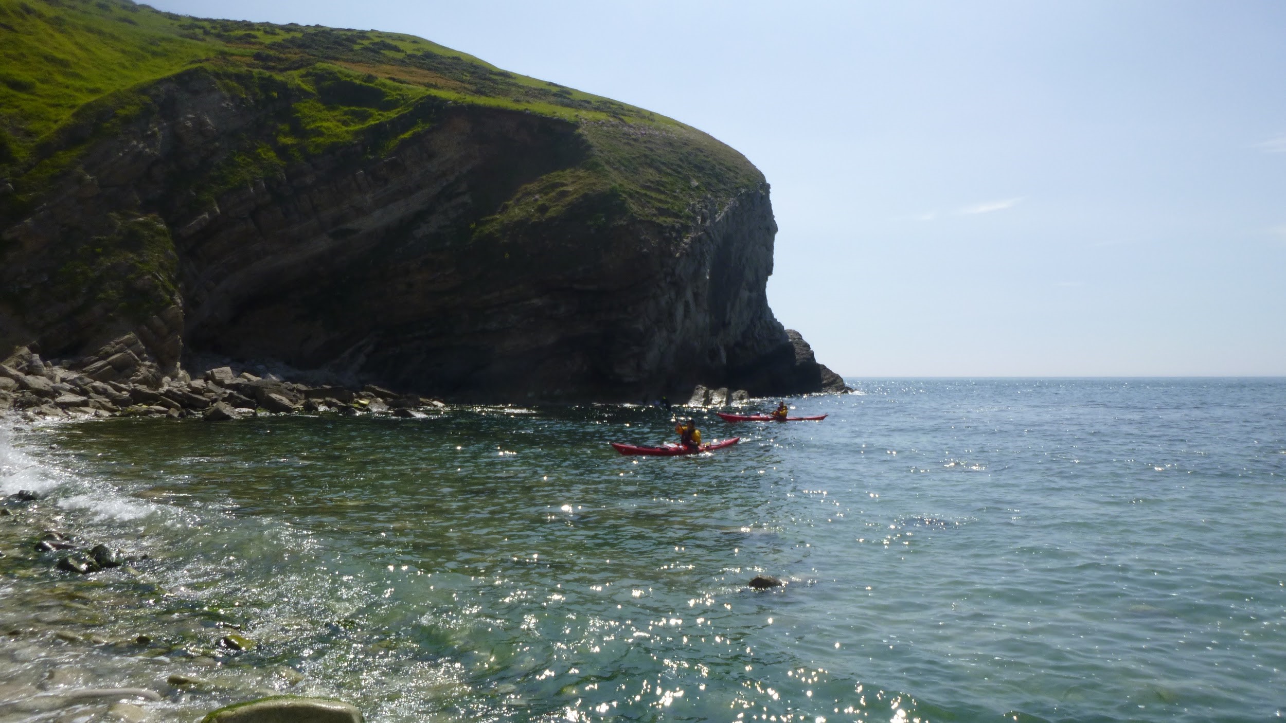
As we approached Prawl Point, on land we could see the bright orange rusting carcass of MV Demetrios which was wrecked in December 1992. It was caught in hurricane winds (F10) while being towed to a breakers yard in the Mediterranean. It was washed up onto the rocks and then abandoned by the company towing it. As we moved closer to get a better look at the remains, the ‘rock’ in the sea turned out also to be part of the superstructure of the ship. However, as we were joined by an inquisitive seal at the same time so we had to divide our attention between taking pictures of the wreckage and watching the seal.
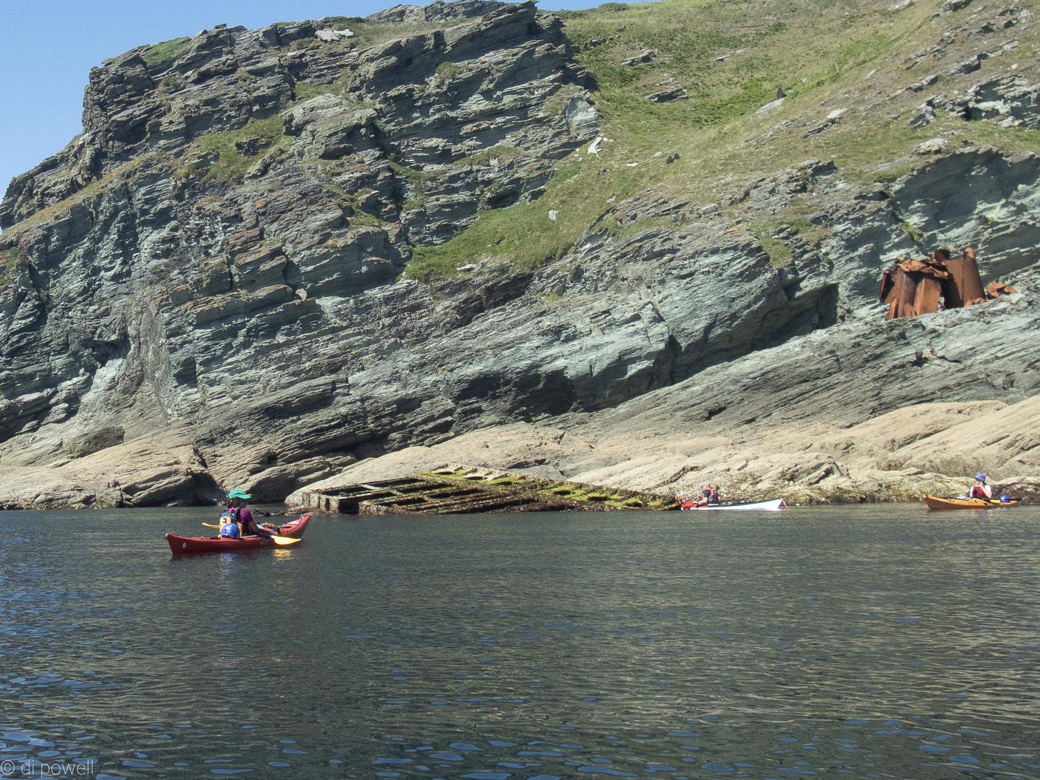 Remains of MV Demtrios Remains of MV Demtrios
We passed around the arch of Prawle Point, although without enough water it wasn’t possible to pass under it this time.
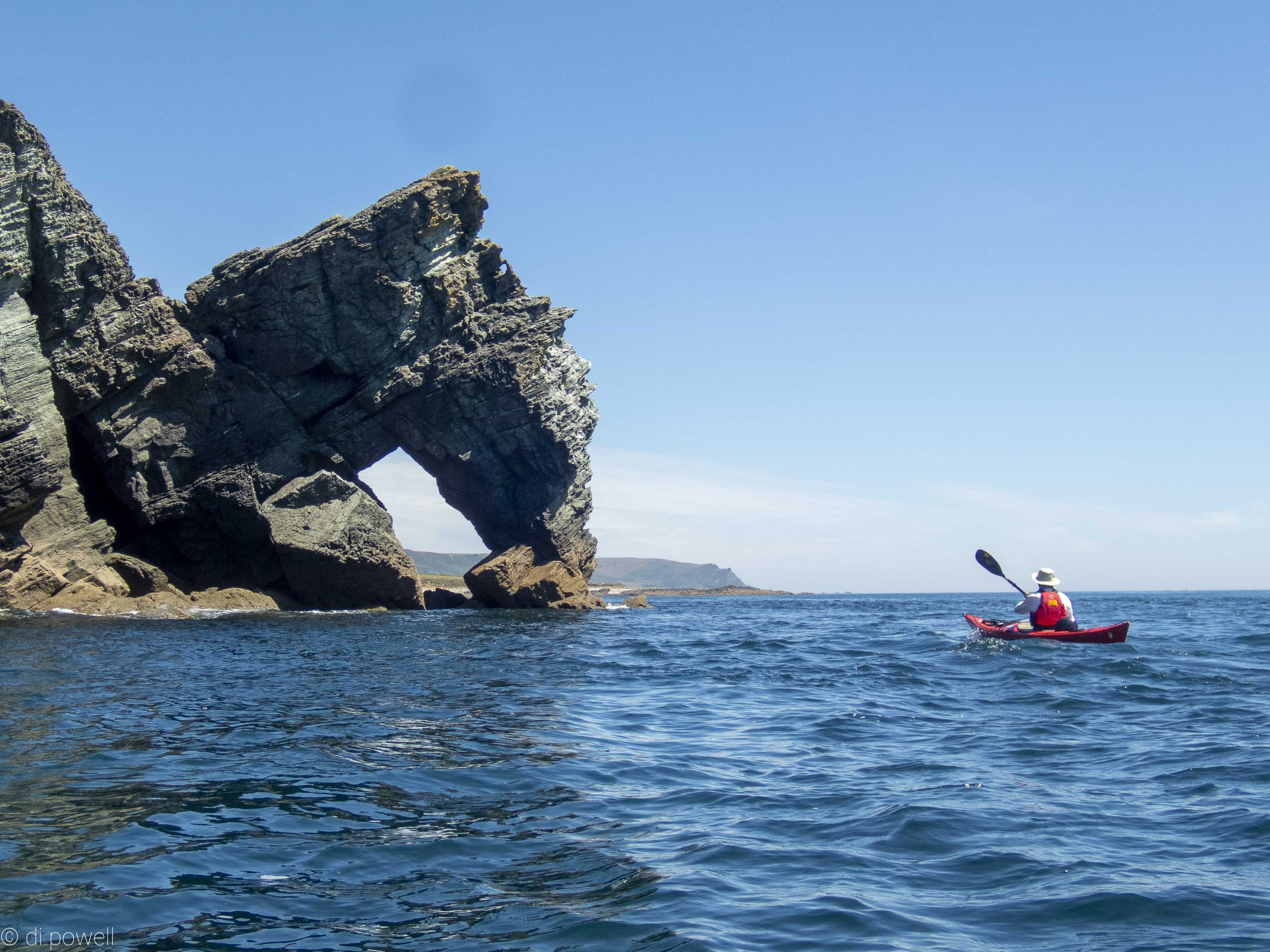 Prawle Point Prawle Point
After a short lunch break at Horseley Cove, we returned the same way. Through the pristine clear water we were able to follow the ropes threaded through lobster and crab pots lying on the bottom of the sea bed and saw a huge spider crab sitting on top of one.
 Looking for (and finding) spider crabs Looking for (and finding) spider crabs
Unbelievably we had spent the whole day rock hopping, covering 23km – the longest distance and time that any of us had spent playing in rocks in the sunshine.
After all that excitement the only thing to do was to retire to the Start Bay Inn at Torcross for a further dose of fish and chips while standing outside overlooking the pebbled beach.
Somewhat surprisingly, outside the pub was an original Sherman Tank. It was recovered from the bay and now used as a memorial to the more than 1000 people who died when a practice for the D-Day landings went badly wrong.
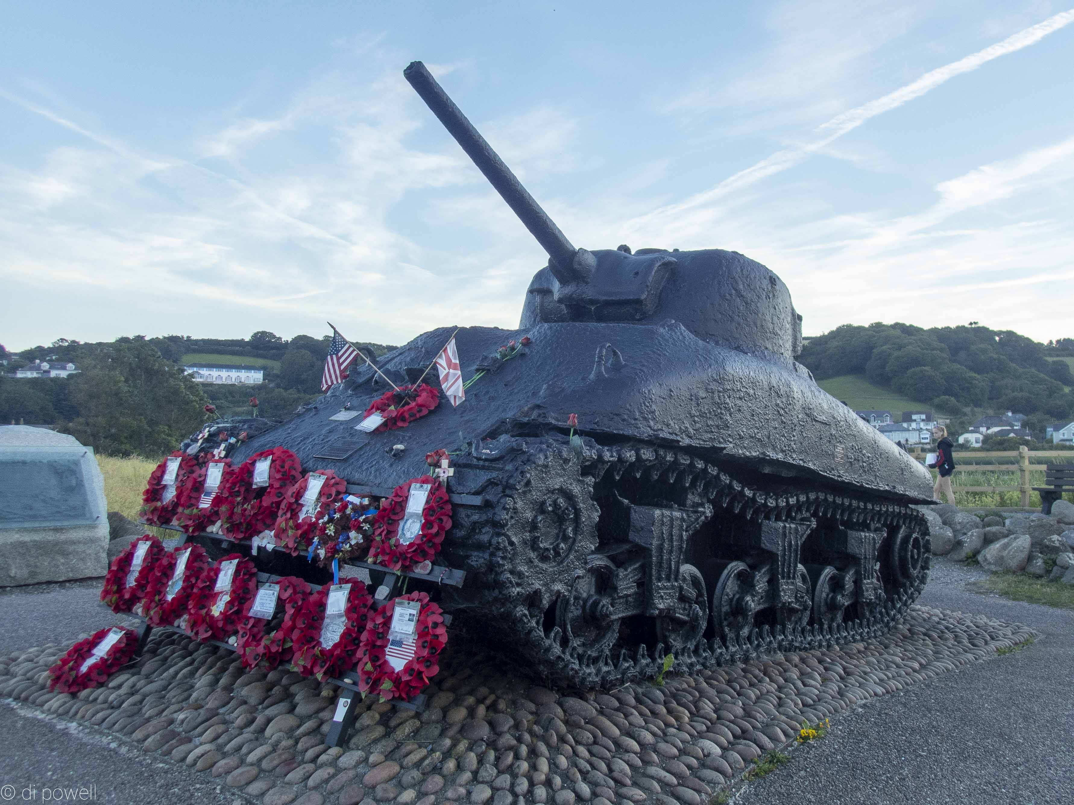 Sherman tank memorial at Torcross Bay Sherman tank memorial at Torcross Bay
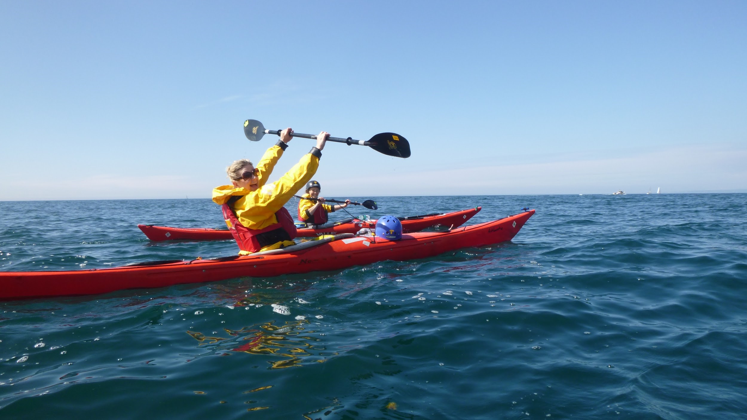
Another beautiful sunny day with calm winds (F2) on Saturday saw us meet up with Tim (who wasn’t able to paddle with us due to eye surgery, unfortunately) and Phil H. both from Dartmouth Yacht Club. Phil had kindly offered to guide us out of Dartmouth Harbour and over to Mew Stone to spot some seals. When we paddled through the chaos that is Dartmouth Harbour, we were pretty happy that Phil knew what was going on! As although very pretty in the summer sun, Dartmouth Harbour has multiple ferries crossing and the truly bizarre Lower Ferry (two platforms pushed by tugs in circular direction from each side of the harbour simultaneously) boggles the mind as to where they were going.

The mind boggling Lower Ferry
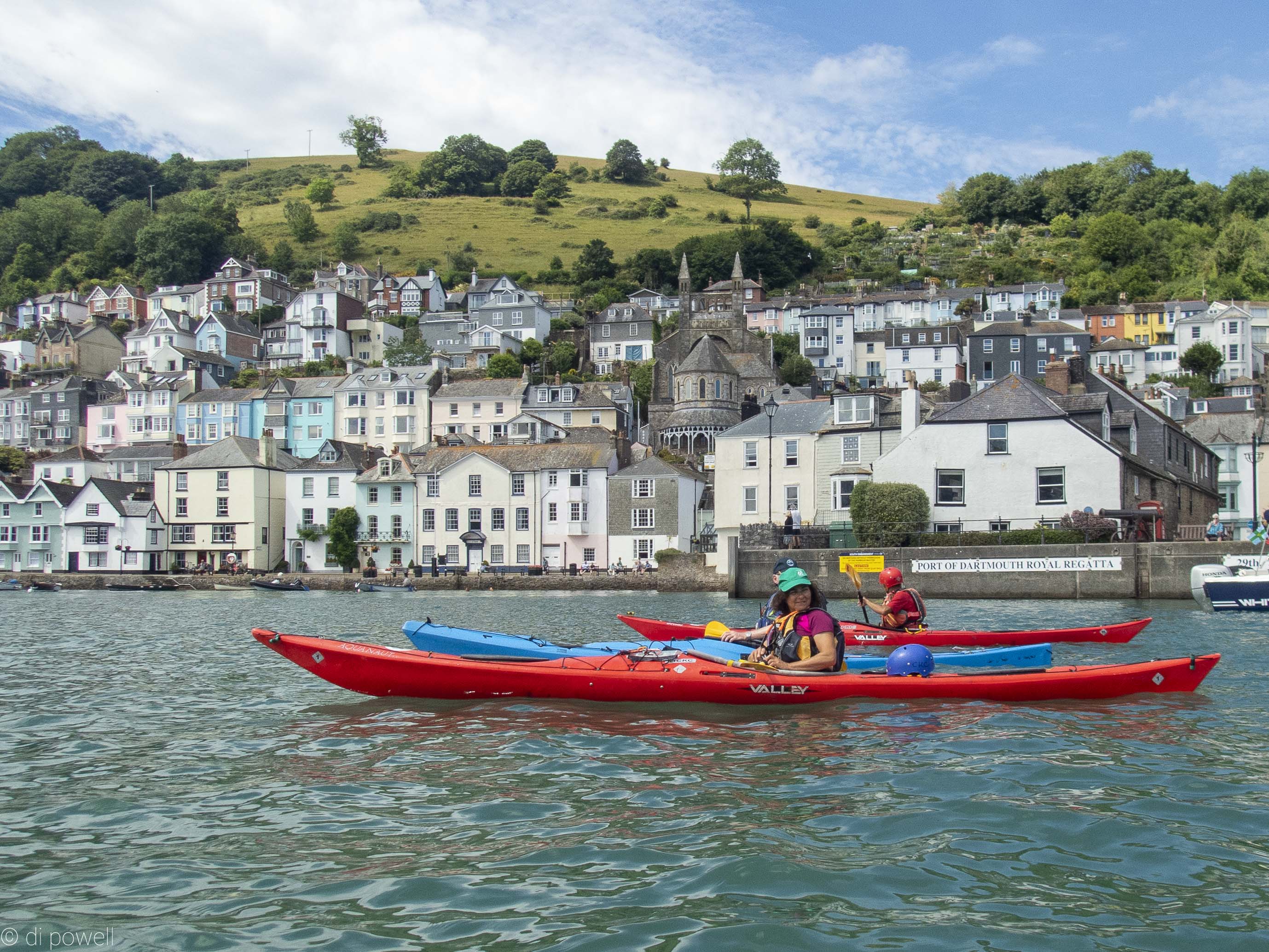 Dartmouth Harbour Dartmouth Harbour
Phil led the paddle through the harbour passed Dartmouth Castle then North along the coast, where we are able to get a rare picture of all paddlers on the sea by Alex on land, who had set off walking while we were unloading the boats and getting ready.
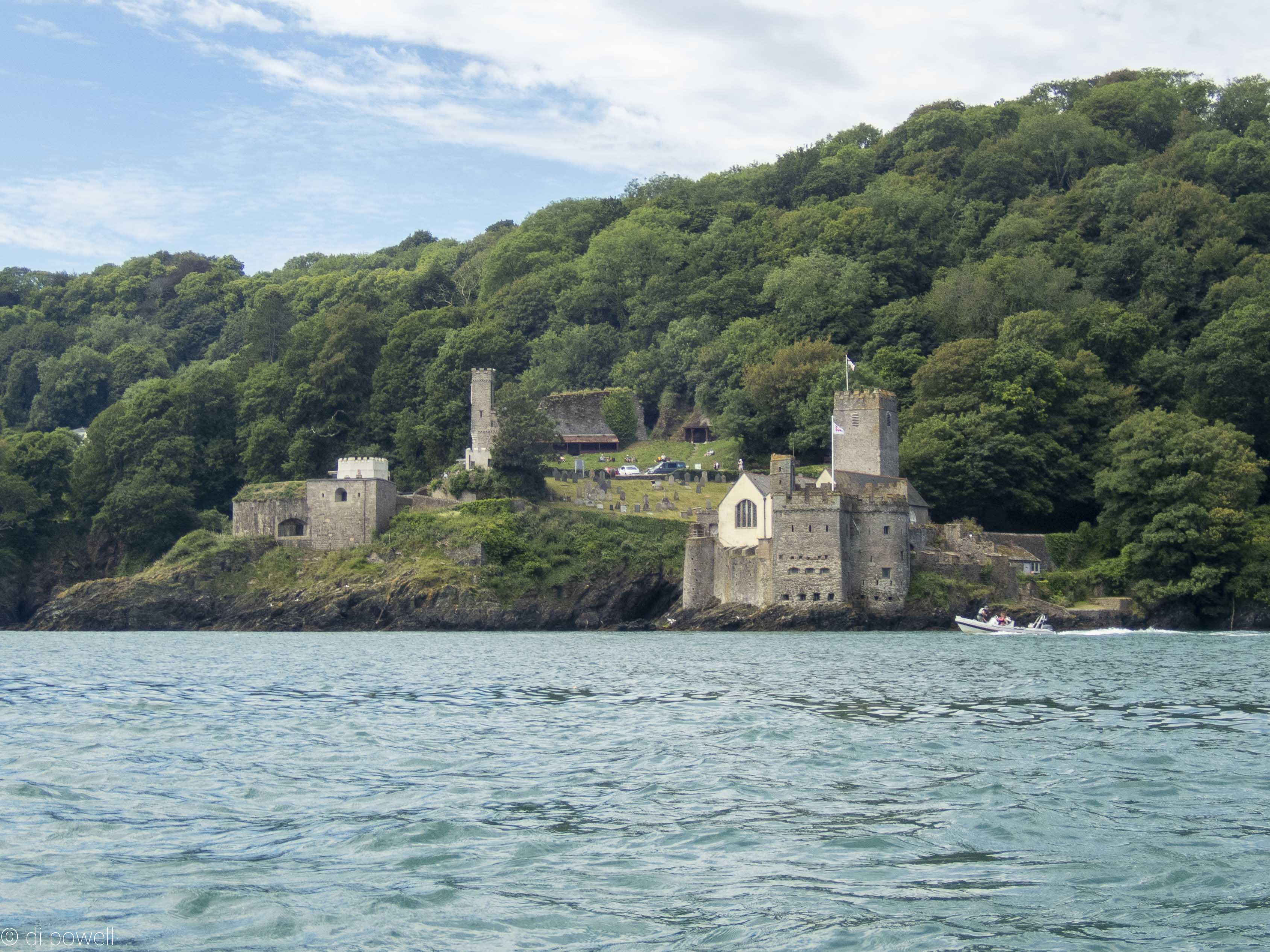 Dartmouth Castle Dartmouth Castle
Official team photo
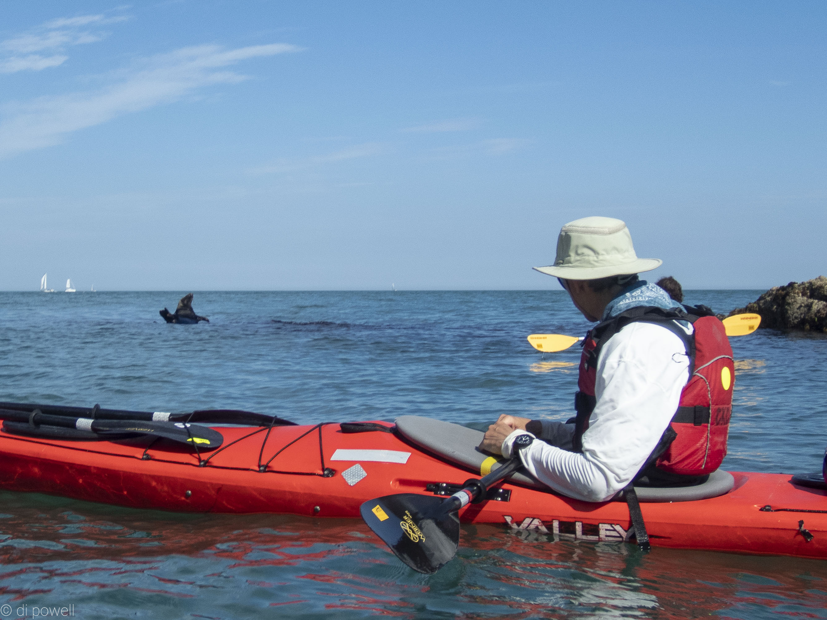
Then we crossed over to Mew Stone to look for seals. We had seen a few on the way, but only one at Mew Stone. As it was high water, most of the seals had gone fishing. After Mew Stone we paddled back across harbour entrance, where Phil left us, then headed south to a small sunny cove for lunch.
 Mew Stone Mew Stone
After lunch we continued on to Blackpool Sands, picking up a surprising amount of swell (0.3m) as we approached the pebble beach, making timing of the landing and departing between waves a bit tricky, but managed without any dramas.
On the way back we encountered an enormous seal sunning itself, with its tail and head curled up, quite oblivious to us. It seems to be floating on top of the water!
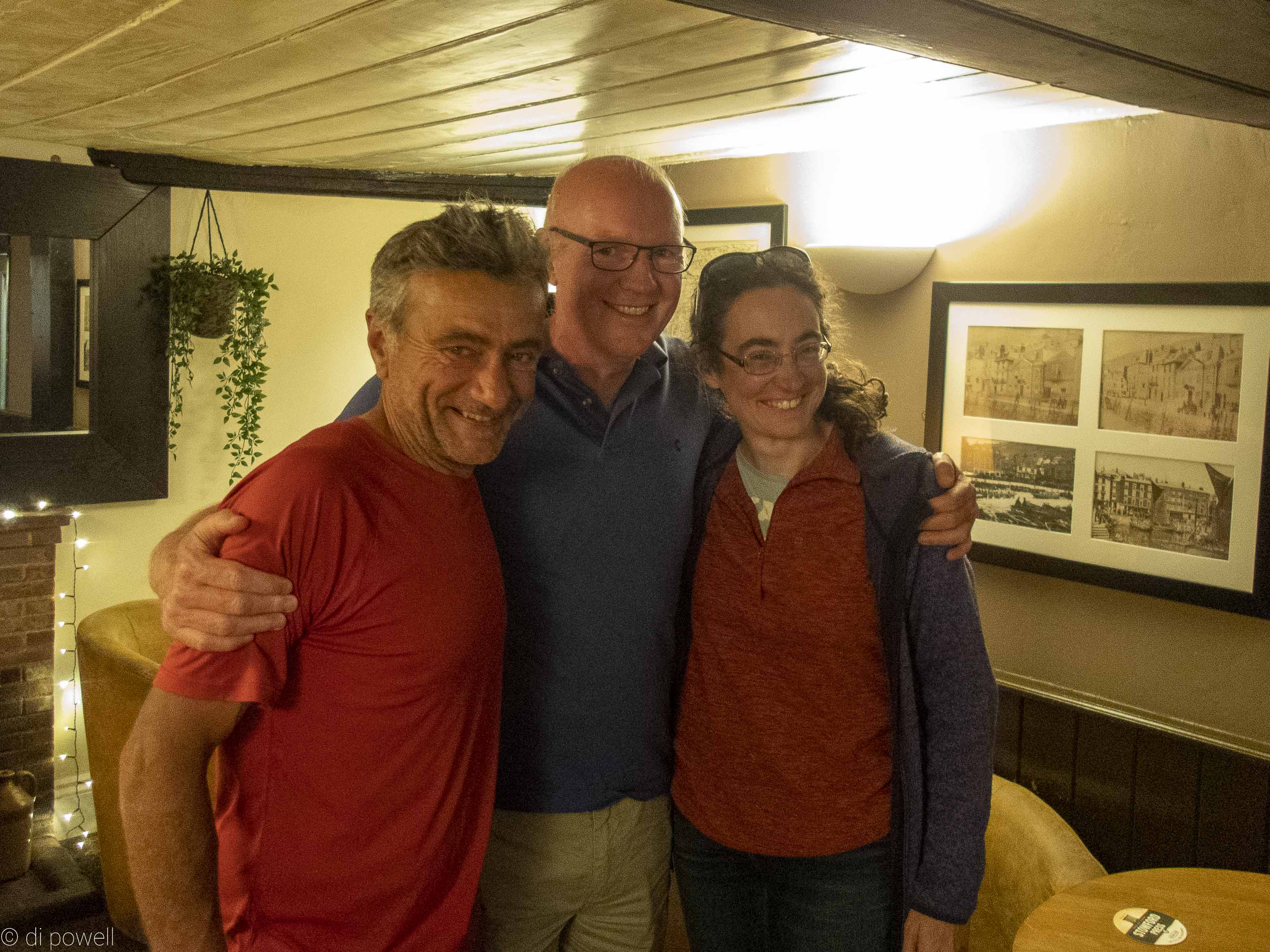
After negotiating the Dartmouth Harbour ferries one more time, we packed up and met Phil and David Jones along with their partners (and David’s dog, Dougal) for dinner at The Dartmouth Inn. We realise that we have a “three Phil” dinner, with Phillippe, Philippa and Phil all together at the same time:
After dinner a short walk back to he cars along the now quiet Dartmouth Harbour, provided an outstandingly pretty end to a day’s paddling.
 Dartmouth Harbour at night Dartmouth Harbour at night
Sunday was cloudy but warm (22C), with light winds again.
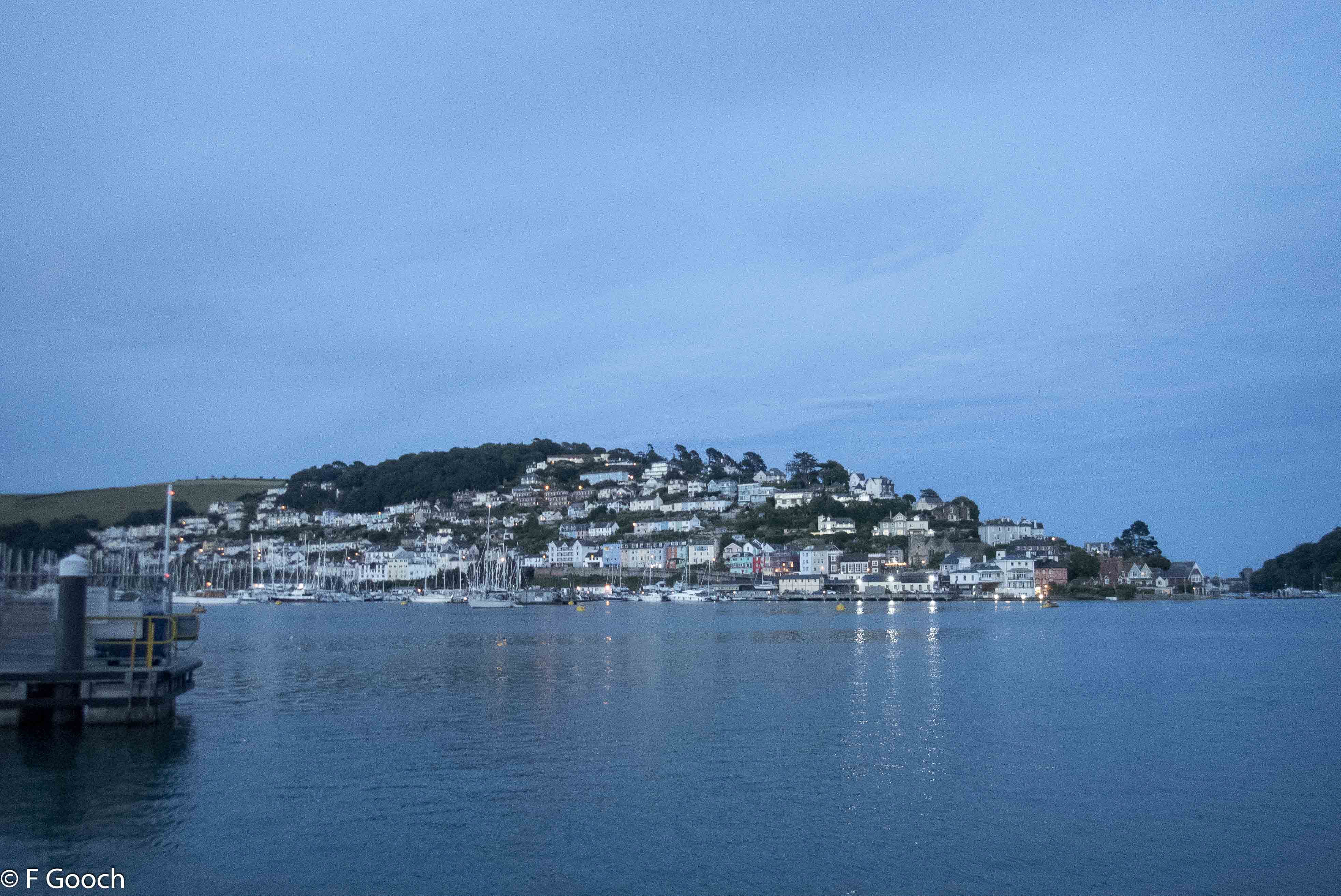
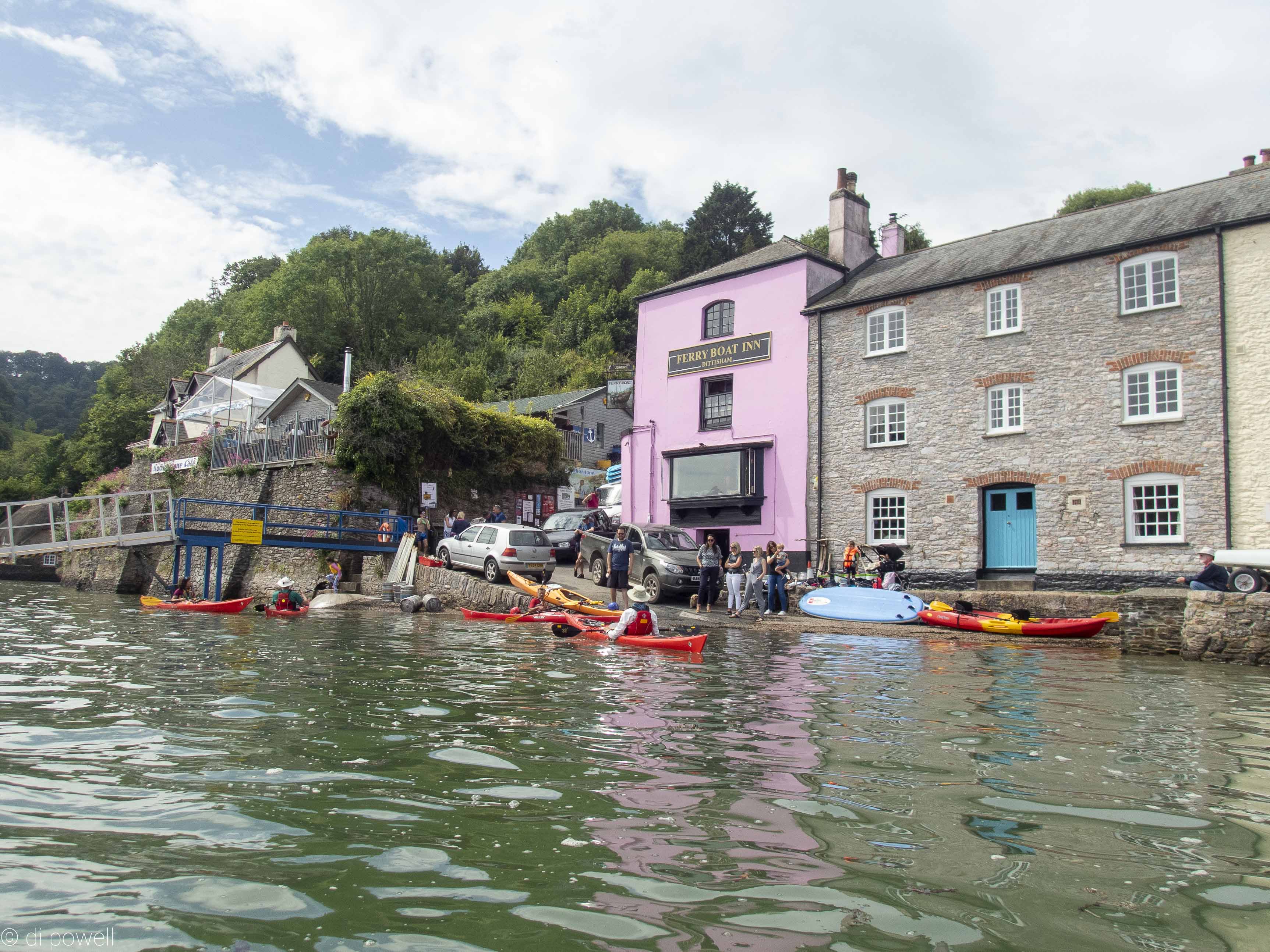
We paddled up river leaving Dartmouth from next to the Higher Ferry boat ramp and followed Old Mill Creek passed the boat yard, until we reach a very low hump back bridge (1m), but then were not able to get further. We returned back along the creek and headed north to Dittisham. Stopping for coffee on tiny beach with pub on the corner, we found the pub landlord getting ready to put up a tent on the shoreline for their regular first Sunday in the month paella and music event.
Fuelled by coffee some of the group made a quick dash up river to Pighole Bay for lunch. After that we paddled back to Dartmouth riding on the tidal flow passed Agatha Christie’s house and boat house.
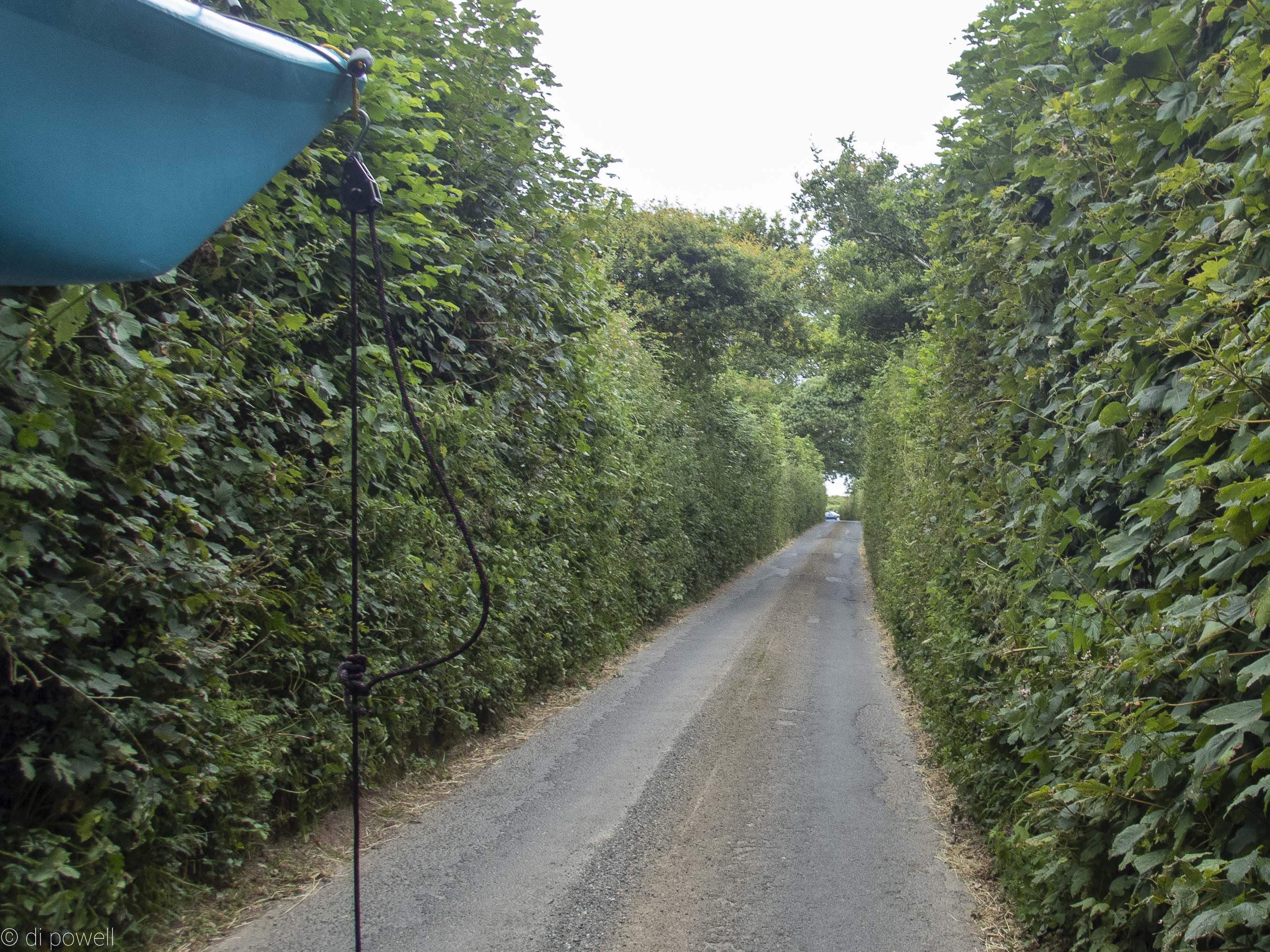
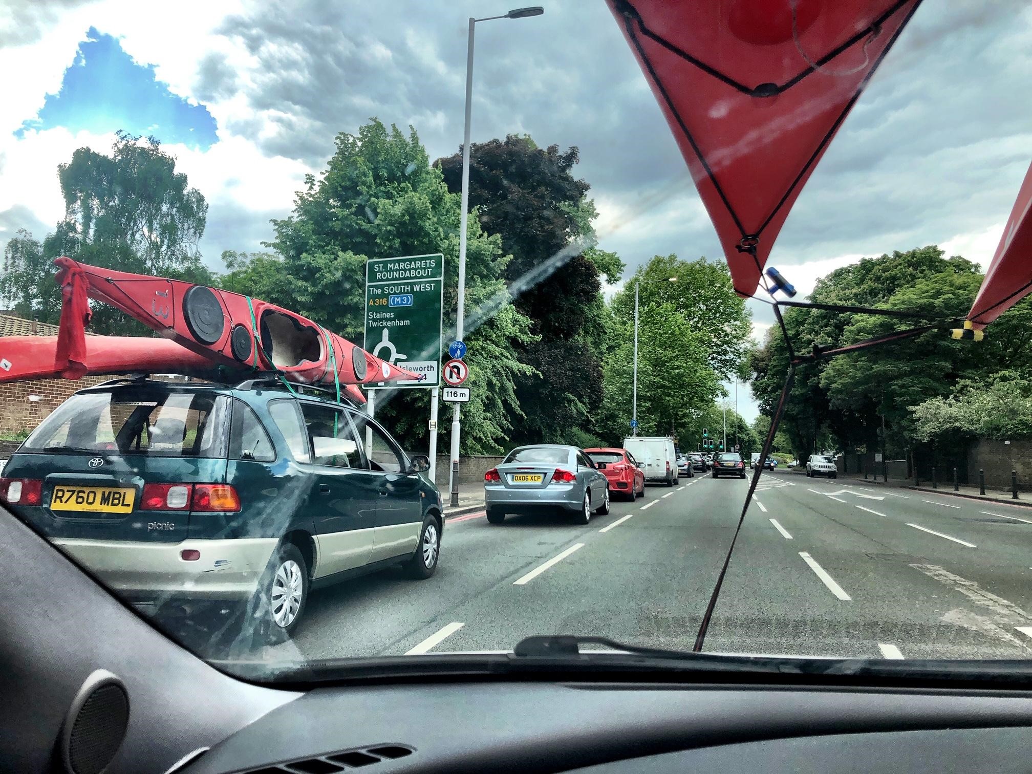
After packing up we departed, once again negotiating the impossibly narrow lanes and high hedges of Devon, to the motorway. Then back to London and the end of a pretty much perfect weekend of paddling and rock hopping in the summer sun.
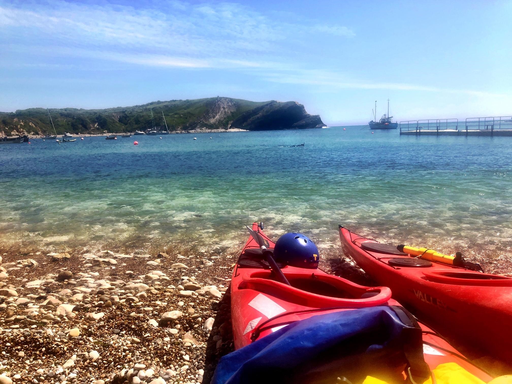
There was one thing on everyone’s mind as we set off from the Chelsea Kayaking Club on the May Bank Holiday weekend: Durdle Door and Lulworth Cove. The weather was looking a bit uncertain, but we weren’t!
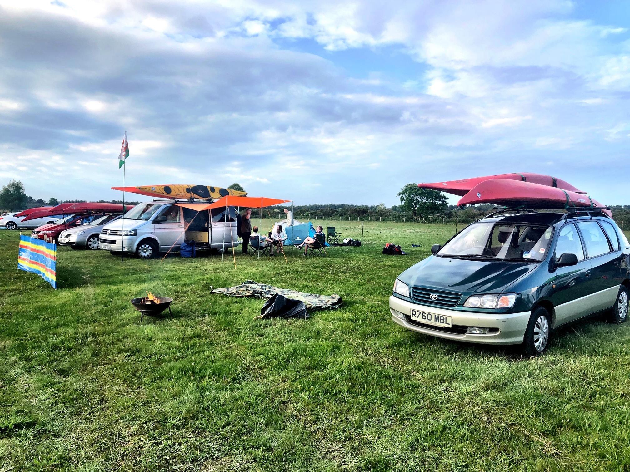
When we arrived at the Primrose Fields Campsite near Wareham, we were welcomed by a Welsh flag and a sea of kayaks on roofs. Some members had camper-vans with fridge freezers and fine wine, others, like myself, had just enough room for a sleeping and a toothbrush (perhaps I should have checked my tent size before setting off).
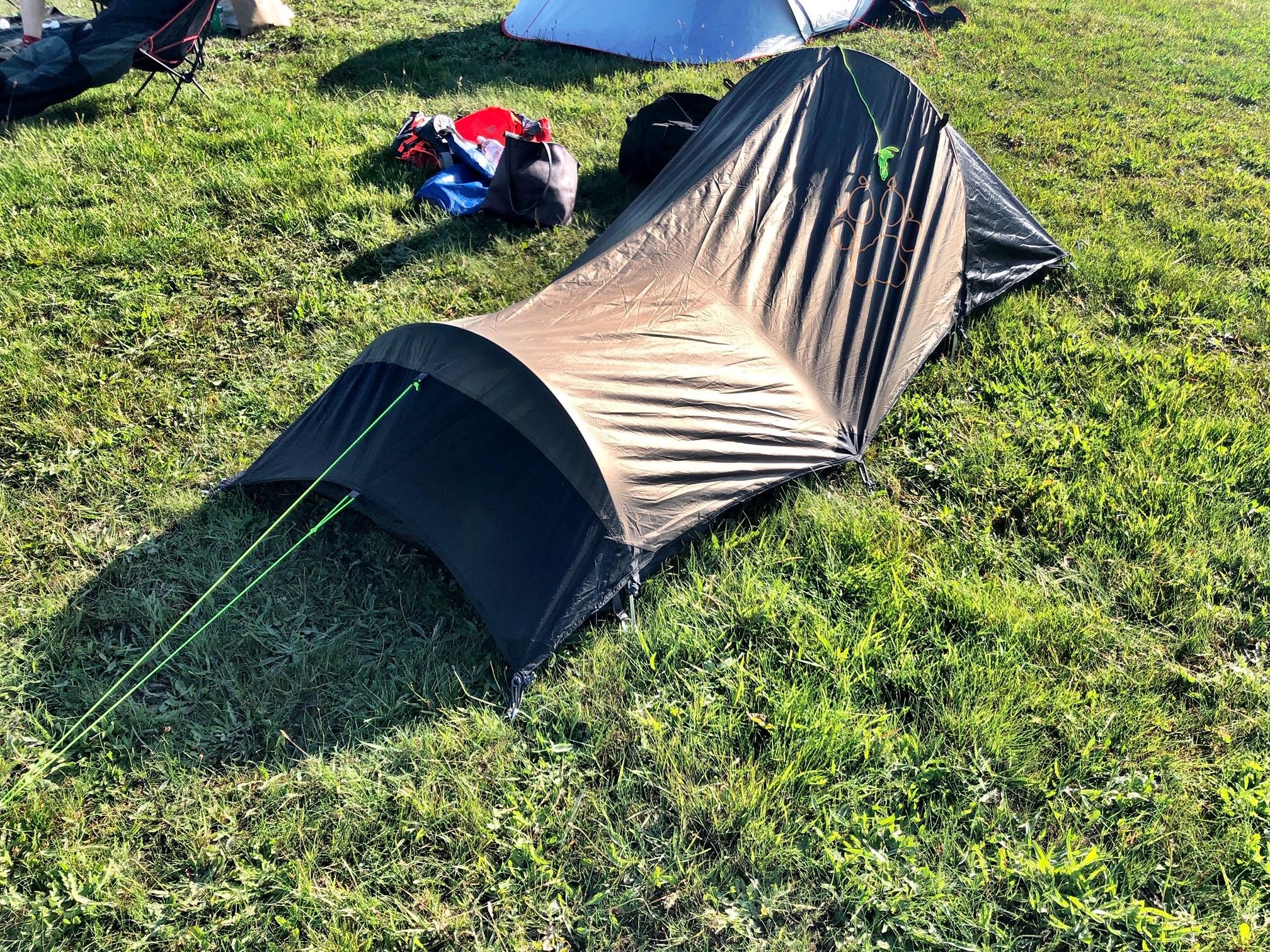
We got settled and erected our tents. Fortunately, due to its size, mine only took a few minutes to assemble (with the help of another camper and a g&t in hand). Next stop was the campsite pub to discuss the logistics of the weekend ahead.
We deliberated on the weather scenarios, areas to launch from, and most importantly, the paddle time to Lulworth Cove and Durdle Door. We already knew the sea would be choppier on the last day, so we planned to go to Poole Harbour where it’s usually calmer.
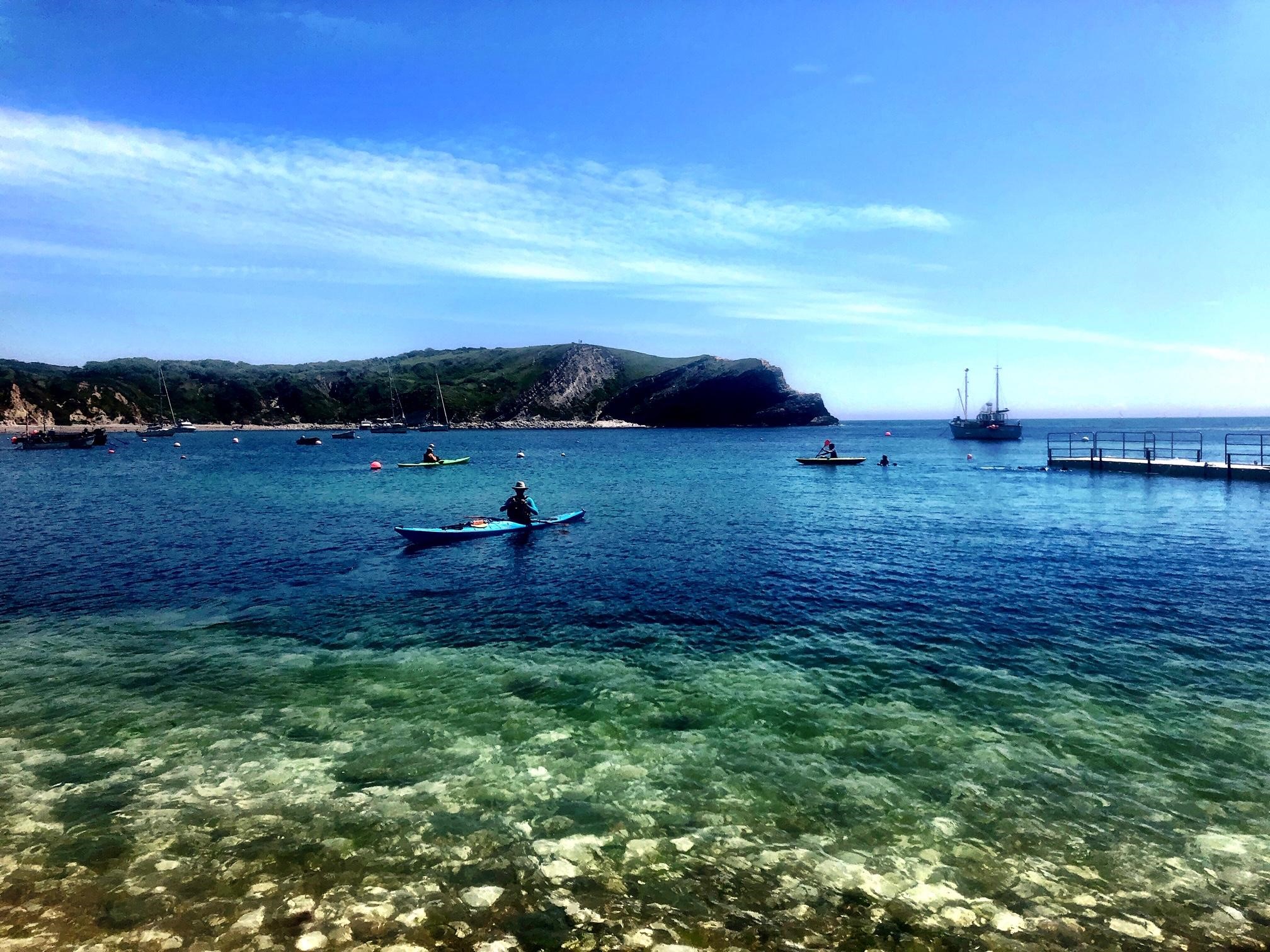
The following morning, we woke bright eyed and bushy tailed. It was a twenty minute drive to Kimmeridge Bay, where we launched from. I understood this was the nearest point to Lulworth Cove as it’s too steep elsewhere. There were a few ribs and paddle-boarders also taking to the water – and I was fortunate enough to get offered a friendly push into the sea. We were off!
The sun was out and it was a glorious day. We were all buzzing to be away from our day jobs and taking to the water in such a beautiful part of the world; I couldn’t believe we were only two hours south west of London.
The sea was calm and the landmarks we’d travelled to see were now within reach via our favourite method of transport.
Wherever you go by water, the view is so different from land. On kayaks you see everyone peering down from the cliffs while you’re nipping in and out of the coves exploring areas they’ll never be able to see.
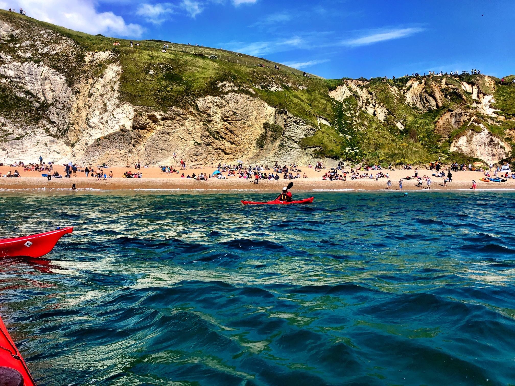
When it was time for a break, we stopped off at a pebble beach with crystal clear water before paddling to Lulworth Cove for lunch.
As it was such a beautiful spot, the beach at Lulworth Cove was quite busy, so I shot off to the nearby café for a cup of tea and water refill – leaving the others to tuck into their packed lunches.
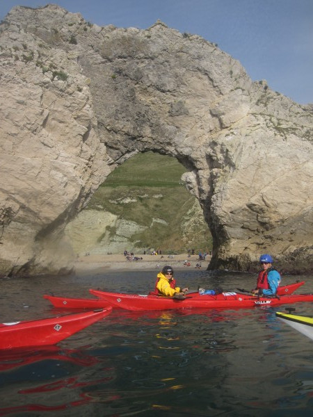
Next stop: a 20-minute paddle to Durdle Door.
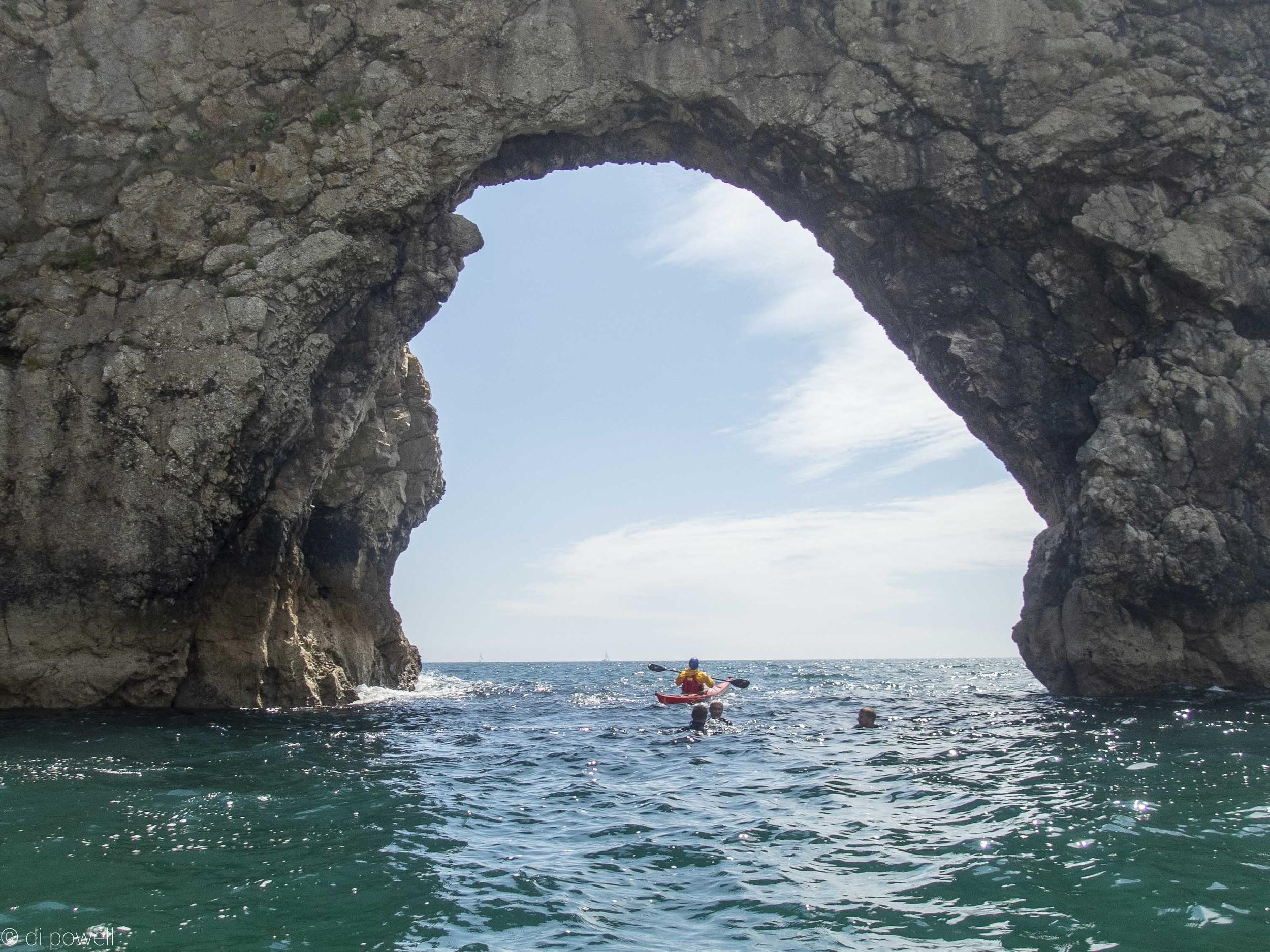
There’s a footpath from Lulworth Cove to Durdle Door, so it’s no surprise to see a few risky tourists on the edge of the cliff taking once in a lifetime photos. We paddled past rocks that jutted out of the sea which then led us to the entrance to Durdle Door.
 As we paddled round the arch a few men in wetsuits emerged, they were climbing the side of the arch. It wasn’t until they leapt into the sea that I realised what they were doing! I was glad for the “safety” of my kayak. We passed a few swimmers towards the entrance of Durdle Door and through to the sea beyond. As we paddled round the arch a few men in wetsuits emerged, they were climbing the side of the arch. It wasn’t until they leapt into the sea that I realised what they were doing! I was glad for the “safety” of my kayak. We passed a few swimmers towards the entrance of Durdle Door and through to the sea beyond.
The final stretch back was hard work as the wind had picked up. So, we decided to abandon the idea to have a break and an ice-cream at Lulworth Cove before heading back to our launch pad.
It was a tough paddle back, but we pushed through. A few of us had only kayaked for a few hours at a time prior to this trip so it felt great to achieve such a big journey. We were welcomed by macaroons and a rest before reloading our kayaks and heading back to the campsite.
After a warm shower, a change of clothes and a nice meal, we crowded round the campfire with some marshmallows (and maybe 1 or 2 g&ts). Then it was lights out to refuel for Poole Harbour.
After a good sleep and hearty fry up from the local pub, we set off to Poole Harbour – one of the largest natural harbours in the world. There were quite heavy winds so we paddled fast over to Brownsea island (where the scouts originated) and hugged the coast to avoid large ferries, sailing boats and jet skis.
The sea changed dramatically as we paddled around Brownsea island, which was great for developing our skills. The route was well planned, we tackled the tougher sea first with a gentle paddle at the end.
We stopped off at a lovely beach for a snack, which we had all to ourselves.
The water was quite shallow but beautifully clear as we completed the final stretch back. Once we’d dried off and packed up the kayaks, we drove towards the ferry (not before fitting in one last snack in the sun) – what a trip!
Now, my arms are toned, I’ve colour in my cheeks and I’m ready for the next adventure as an experienced sea kayaker.
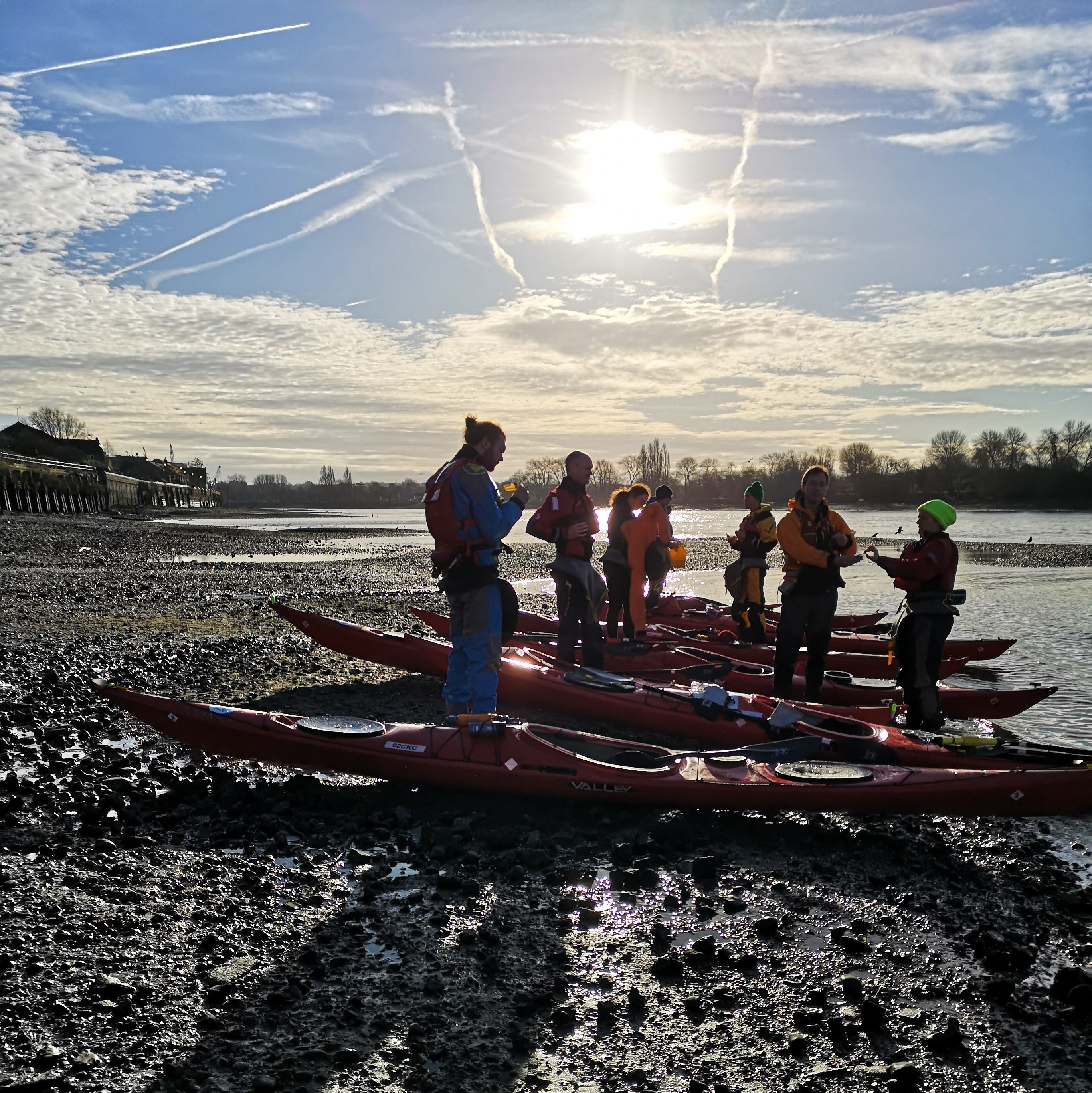
A clockwise circumnavigation of the Portsmouth Harbour, followed by a paddle through a creek to Langstone Harbour, then out to the open sea, covering a total of 32 km.
The date is Saturday 18 May 2019 – FA Cup final day. If you don’t follow football, you might not remember that a team from the bottom half of the premier league were to play the league winners. It looked like a thrashing even before a ball was kicked. So, what to do if you’re from Watford and want to avoid embarrassment? Go sea kayaking around Portsmouth Harbour, obviously!
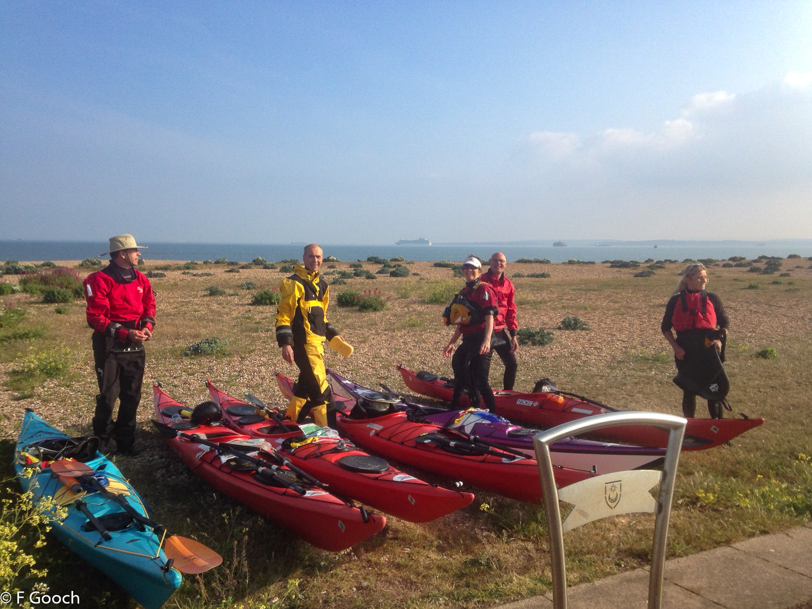
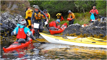
And so it came to be, that the Chelsea Kayak Club Watford contingent joined a footballing agnostic bunch of kayakers to paddle around Portsmouth Harbour and through to Langstone Harbour to reach the open sea: a route that was shaped like a figure ‘9’. Meeting up at Port Solent Marina on Saturday morning, we were quickly on the harbour water with light winds (F1) and cloudy, but warm (15C) conditions.
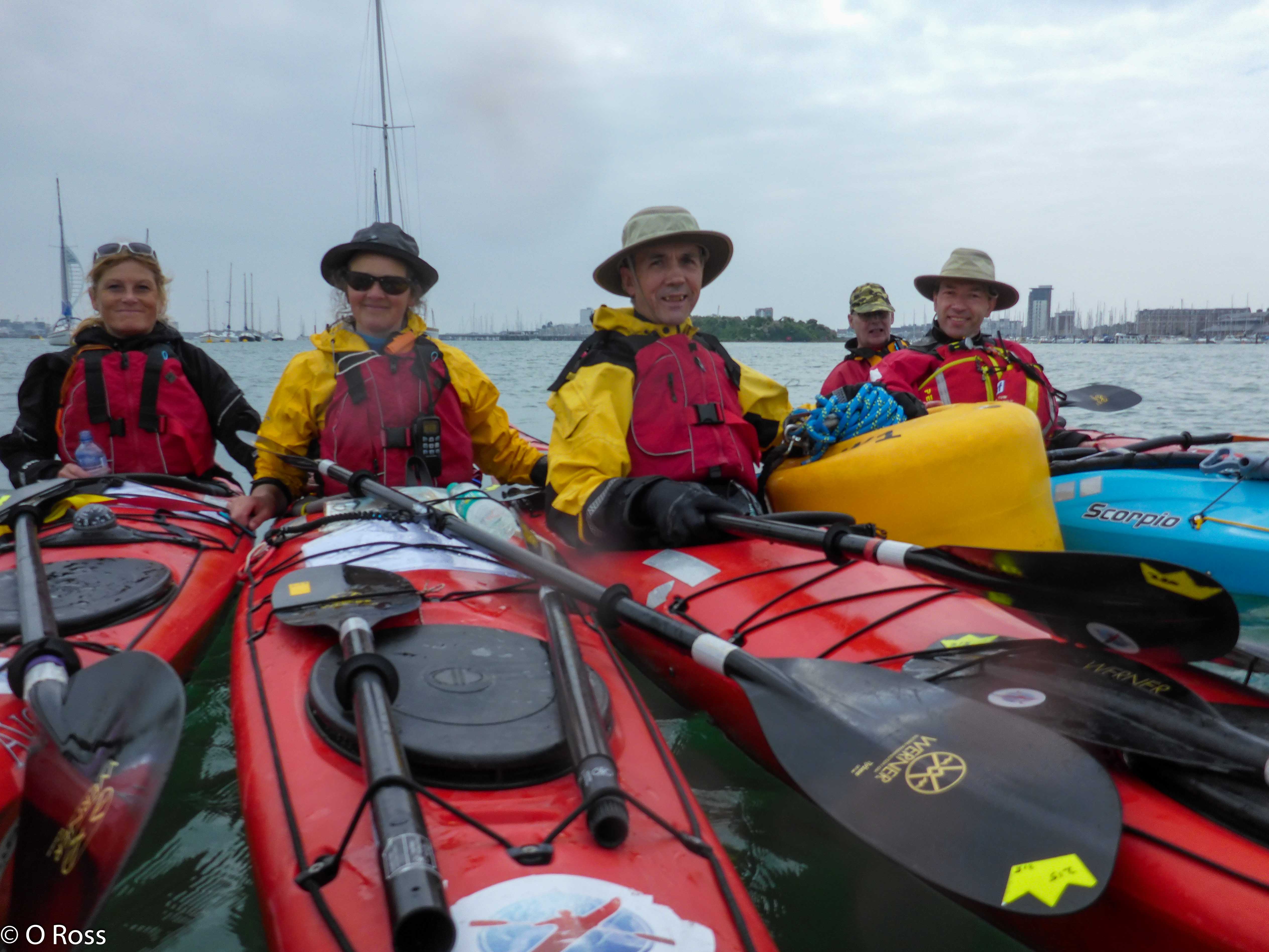
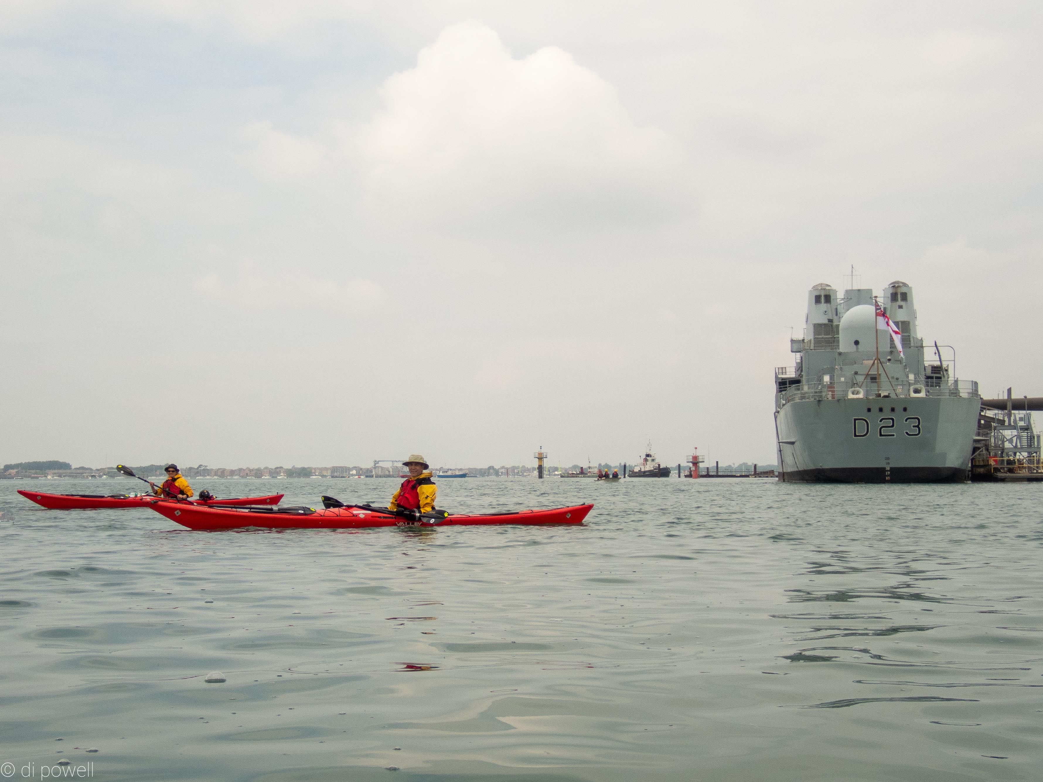
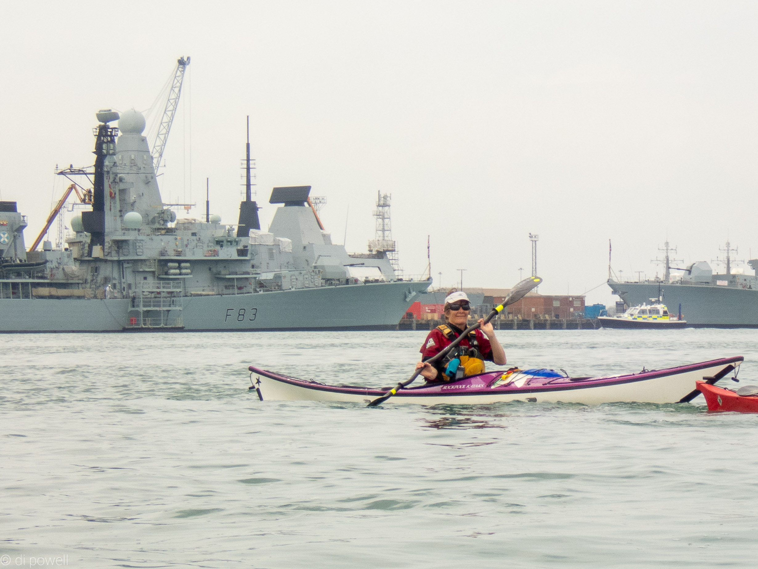
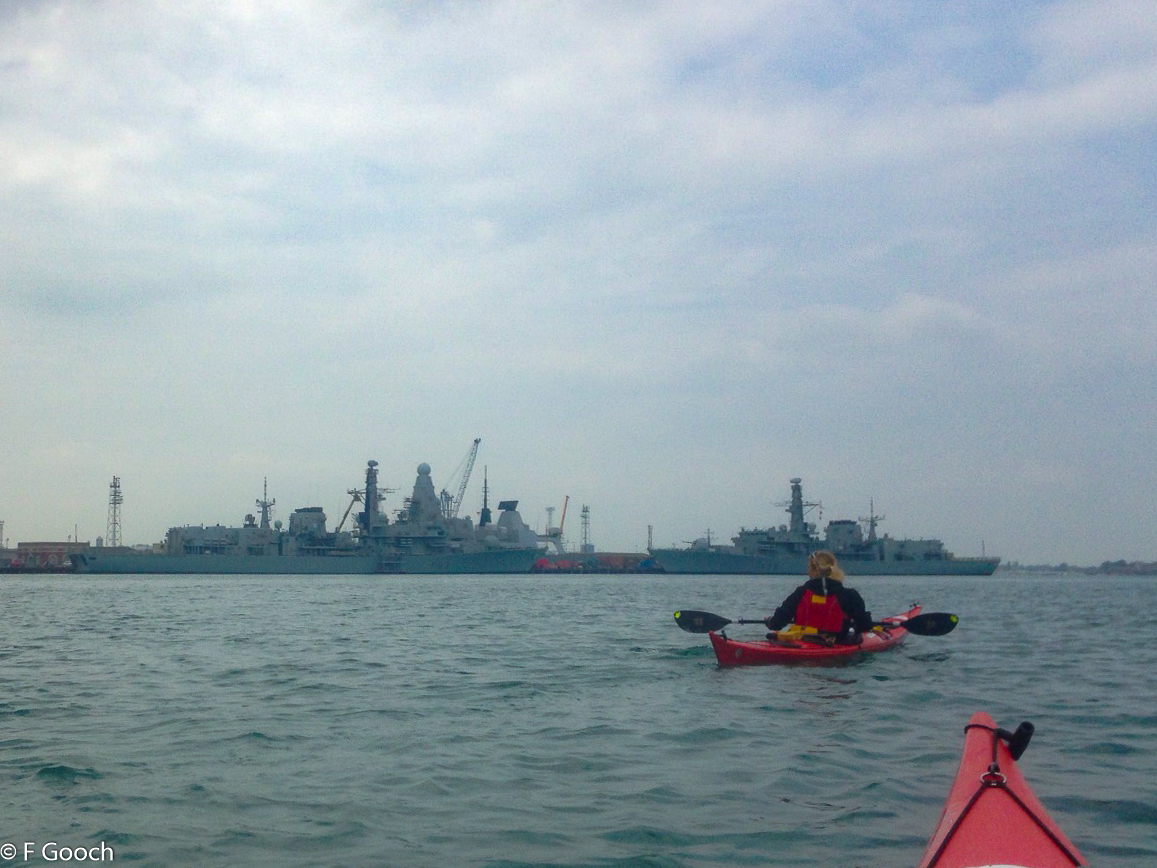
From the top of Portsmouth Harbour we headed south, along Horsea Island, then over to Whale Island, following the Eastern channel around the island. Whale Island, originally just a mudbank, has been built into the permanent Royal Navy training base of HMS Excellent and, even though land based, it is still given the name ‘HMS’ by the Royal Navy.
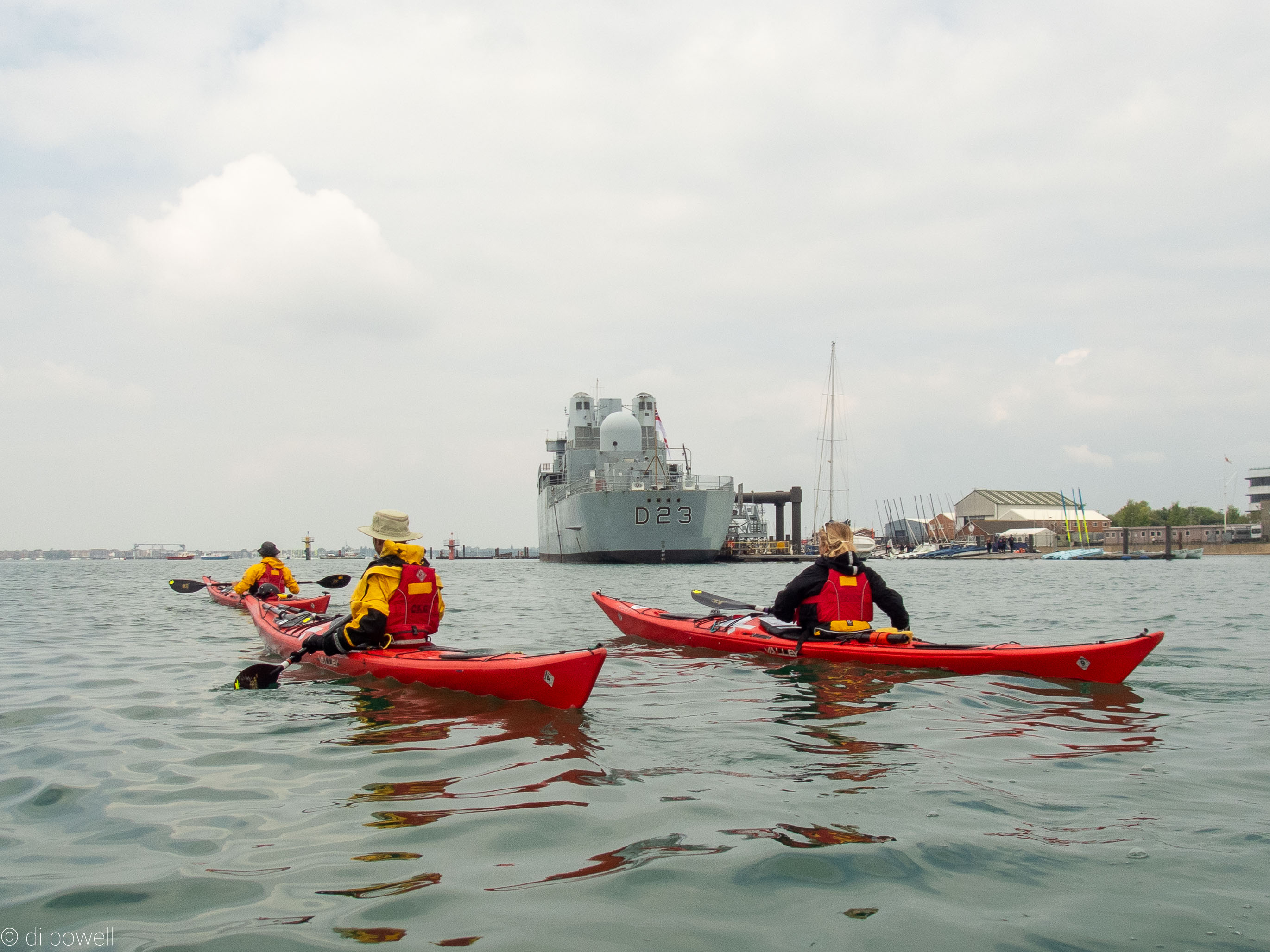
HMS Excellent is now primarily a training centre and at the south of the island we were able to paddle passed the training ship HMS Bristol (D23), which saw action in the Falkland War in 1982.
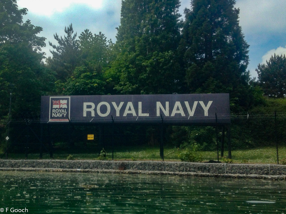
With the heritage of Portsmouth and the Royal Navy, it came as no surprise that there are specific rules that we needed to follow to kayak within Portsmouth Harbour. Primarily these involved being 100m away from submarines and 50m from warships at any time. The harbour is regularly patrolled by the Police and Queens Harbour Master Portsmouth Volunteer Harbour Patrol to check, and the Police launch came to investigate our movements, although didn’t interfere with our trip. You can see the Police launch in some of the pictures below.
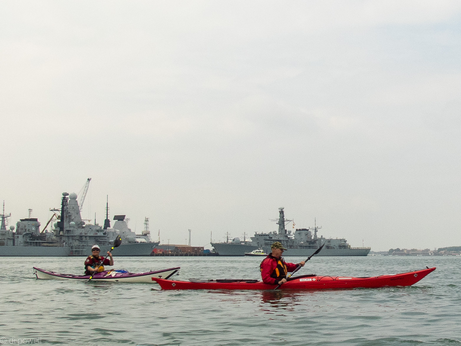  
From the bottom of Whale Island we crossed to Shell Pier, rafting up to congratulate ourselves on successfully crossing the main harbour and managing to dodge the ships.
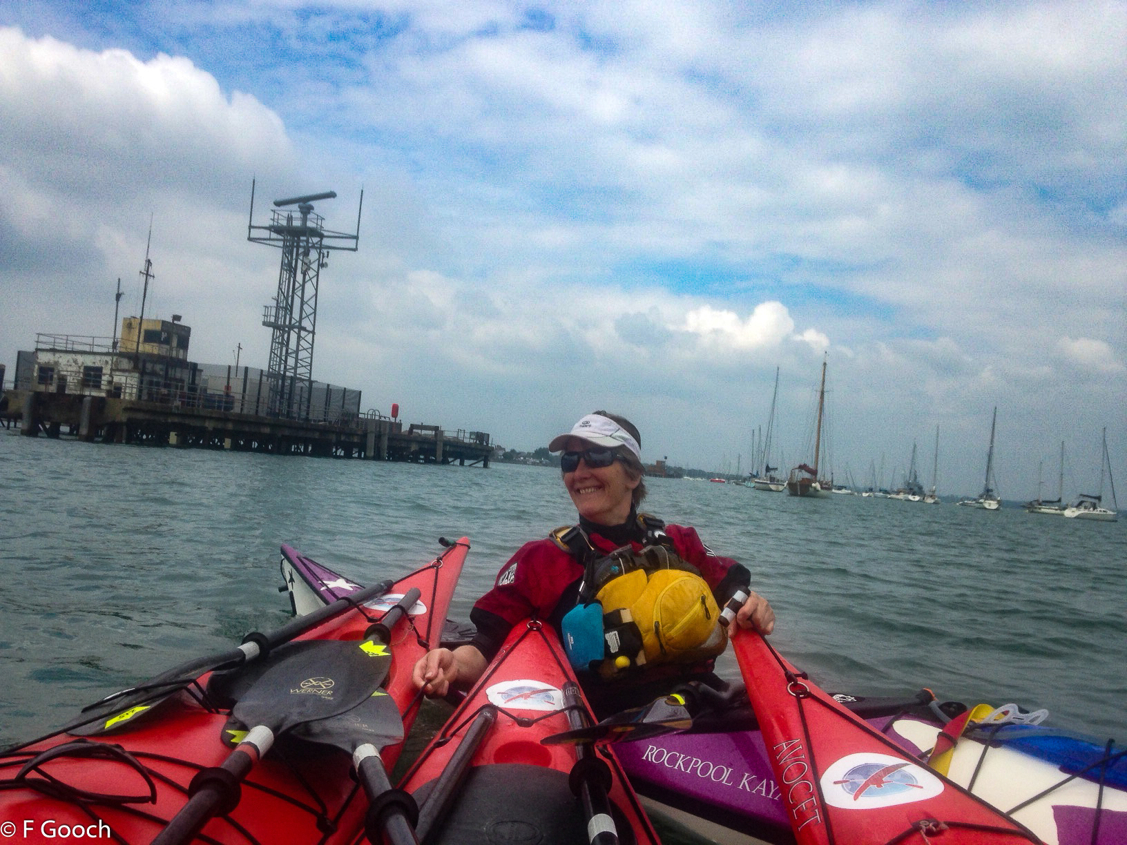 
Shell Pier currently houses a radar installation and seems innocuous enough, but originally was used for loading of ammunition onto ships. The word ‘shell’ has a very different meaning for kayakers and the Royal Navy!
From Shell Pier we followed the coast North, alongside the Royal Navy Armaments Depot (RNAD), towards Fareham, crossing to Cams Bay at Wicor Hard and managed to find a pebble lined beach and lush vegetation to sit on, for lunch.
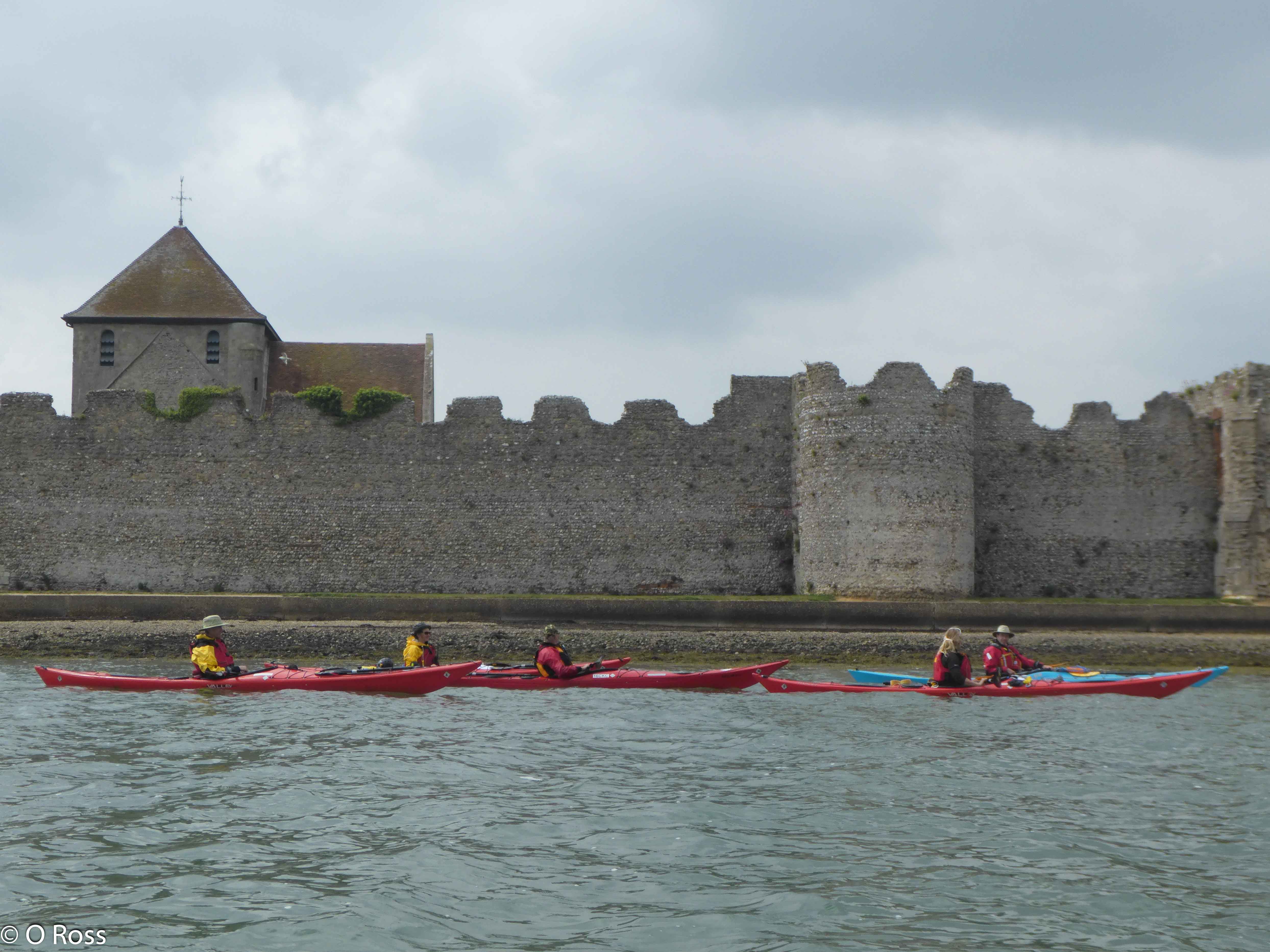
After lunch we crossed the low lying water Eastwards to Porchester Castle. We had expected that the low water might cause an issue (grounding) but completed the 3km quickly and without issue. Arriving at the medieval Porchester Castle, the solid stone walls look impregnable even today at this commanding position at the North end of the harbour.
As the water drained from the harbour as low water started to approach, our minds turned to making the navigation through Ports Creek around the top of Portsea Island. Paddling under the M275 bridge, the flow of the water was strongly against us and although we were able to paddle against it passed the underwhelming ‘Jackstar’ sculpture by Richard Farrington, the main issue quickly became mud.
With the water draining the harbour and the creek, the water level fell to about 20cm in places revealing a sticky kind of mud. To avoid being grounded, we sought the narrow but deeper channel on the East side of Horsea Island. Once around to the North of Portsea Island, the water was deeper and more free-flowing, allowing us easy access under the railway bridge (a particular hazard at high water) and into the tranquillity of Langstone Harbour.
Meanwhile at Wembley Stadium the FA Cup final kicked-off, with some of the Chelsea Kayak Club members still unrealistically positive about the chances of Watford winning:
Pushing onwards through Langstone Harbour, passed the Mulberry Caisson – a relic from the D-Day landing – and onwards to the entrance, we triumphantly reached the Solent and turned westward, back towards Portsmouth. Although the trip through the two harbours has been enjoyable and enlightening, it is the open sea that really energises the team: the grey clouds clear, the sun shines and the water sparkles. Even though the muscles are weary, we land at Eastney Beach happy that, although we didn’t complete a circumnavigation of Portsea Island, we did complete a figure ‘9’ of Portsea Island. And a ‘9’ is just an upside down ‘6’. Ask any Watford fan.
Editor’s Note: You don’t have to be a Watford resident to join Chelsea Kayak Club. Chelsea Kayak Club is open to non-Watford residents also.
If your preferred sport is football, we won’t even hold that against you if you can do an assisted rescue 🙂
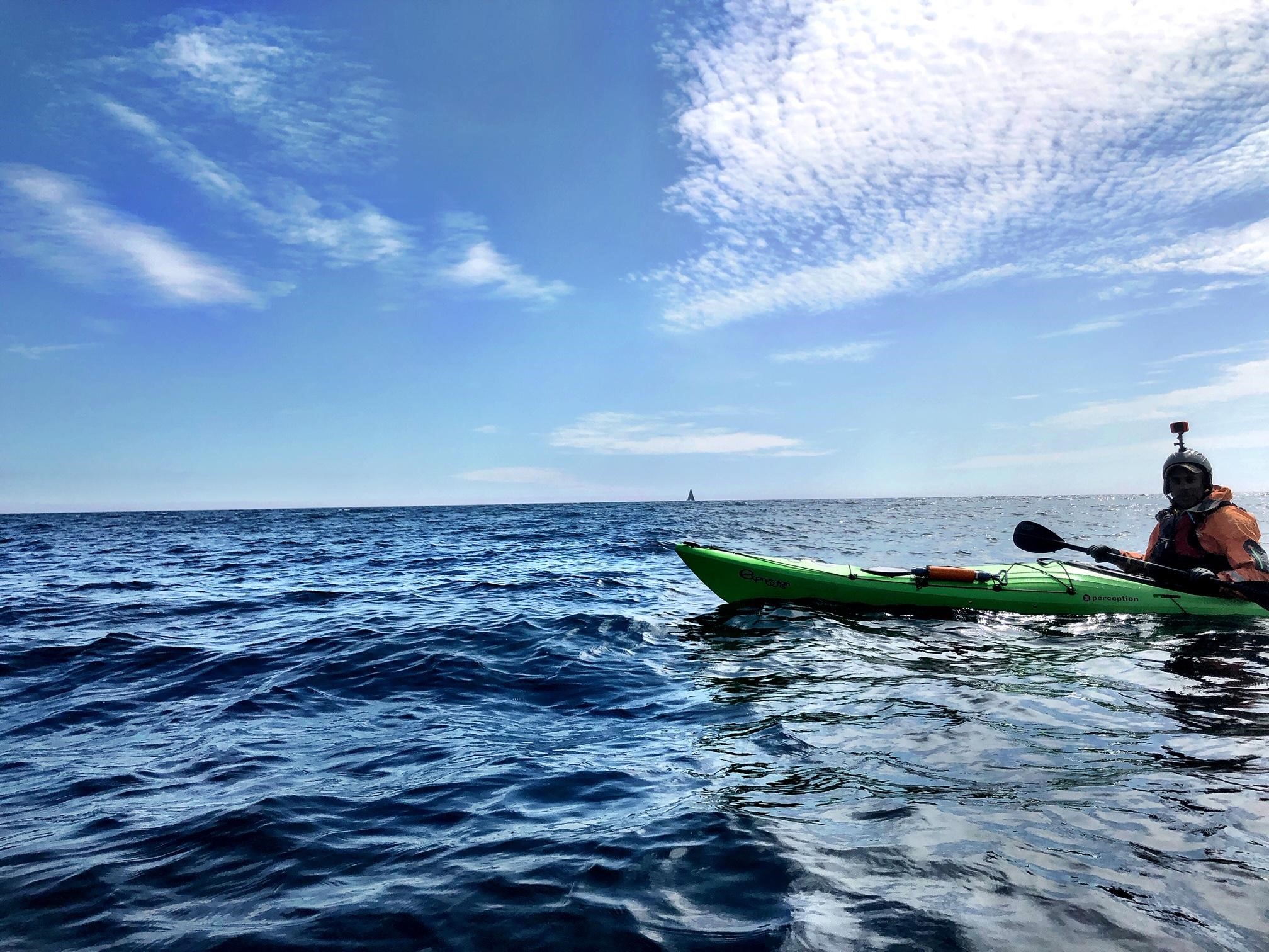
An anti-clockwise circumnavigation of the Isle of Wight over the Easter holiday weekend covering 97.5km in 2.5 days, including crossing The Solent twice, some wild camping and a few Easter eggs.
Leaving the Good Friday traffic behind, the CKC expedition slipped into the harbour at Keyhaven mid afternoon under blue skies and gentle winds (F2).
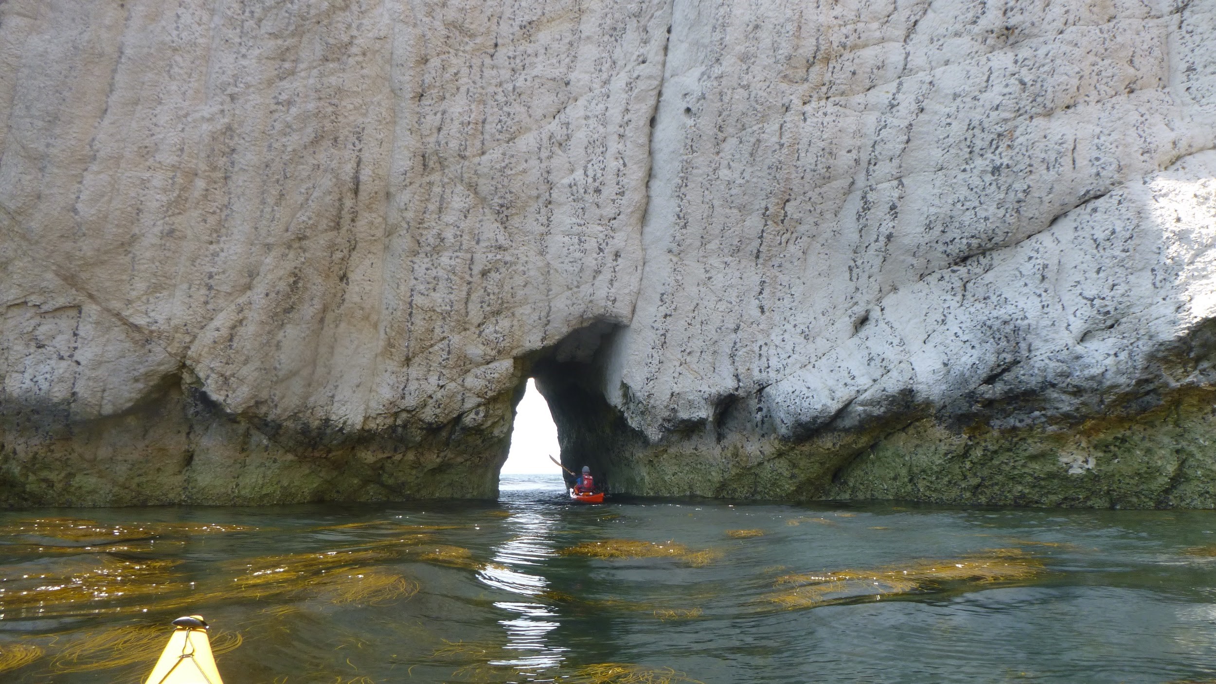
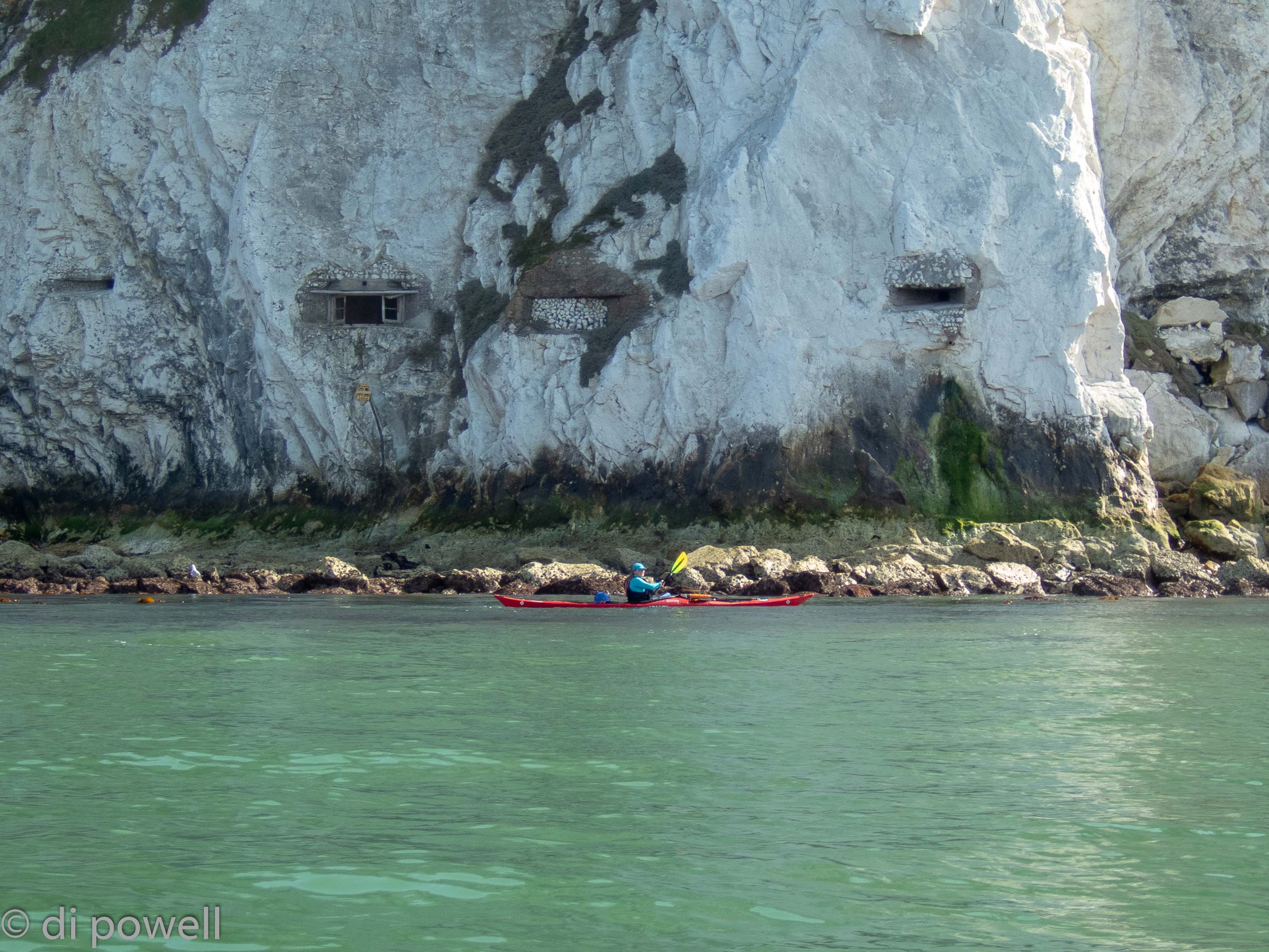
Following the winding course through the Keyhaven Lake tidal marshes to the harbour entrance, we came alongside Henry VIII’s massively long Hurst Castle. Where the harbour water and the Solent met, the well-known tidal race (called the Trap) had formed, jostling us for a few minutes as we crossed it into the smoother main flow of The Solent’s west channel. In the distance we could see the iconic The Needles and with a relatively strong tidal flow assisting us, headed south westerly to Hatherwood Point at the top of Alum Bay. In Alum Bay the wind dropped to F1 and the sea took on a glassy look:
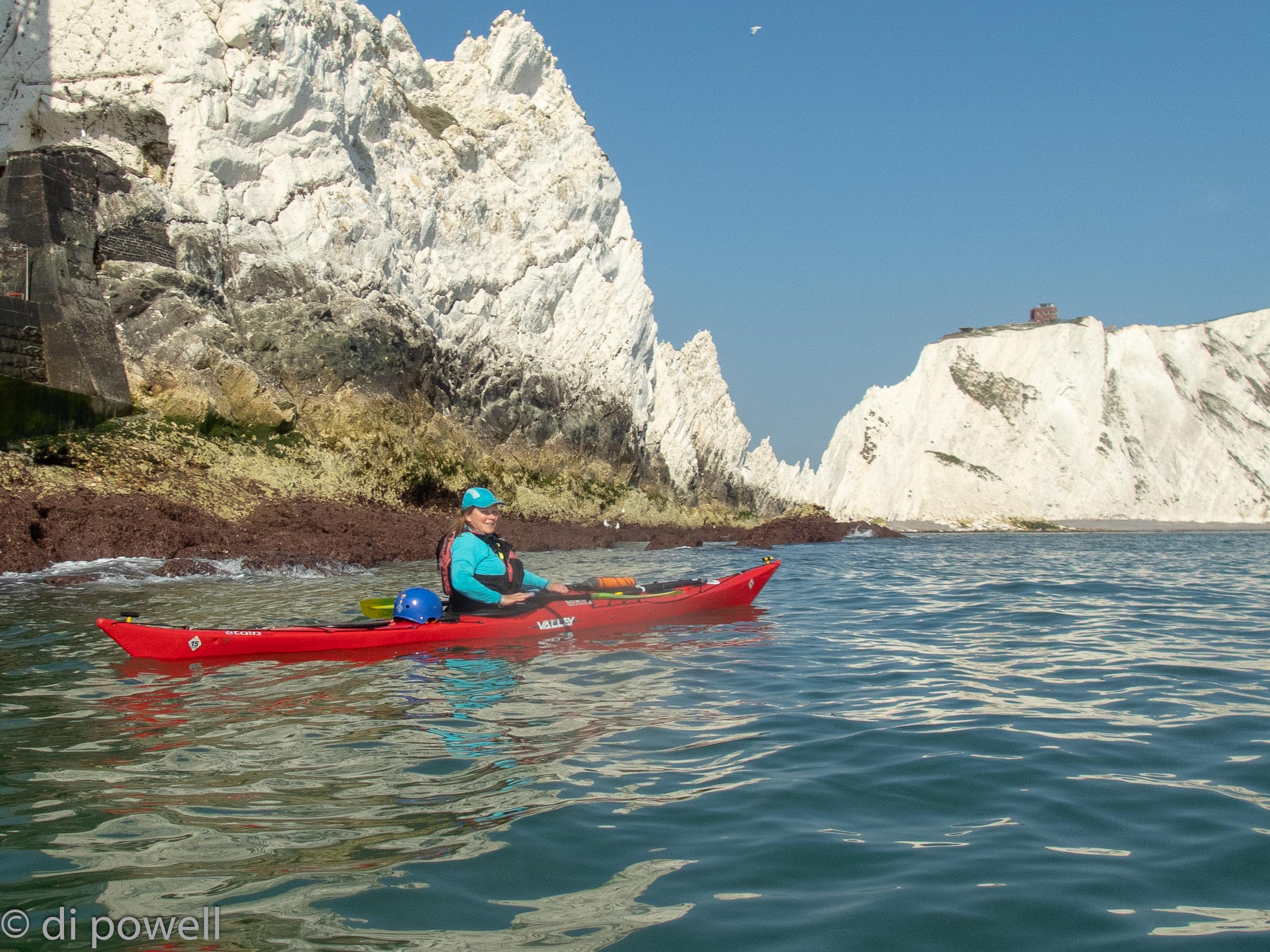
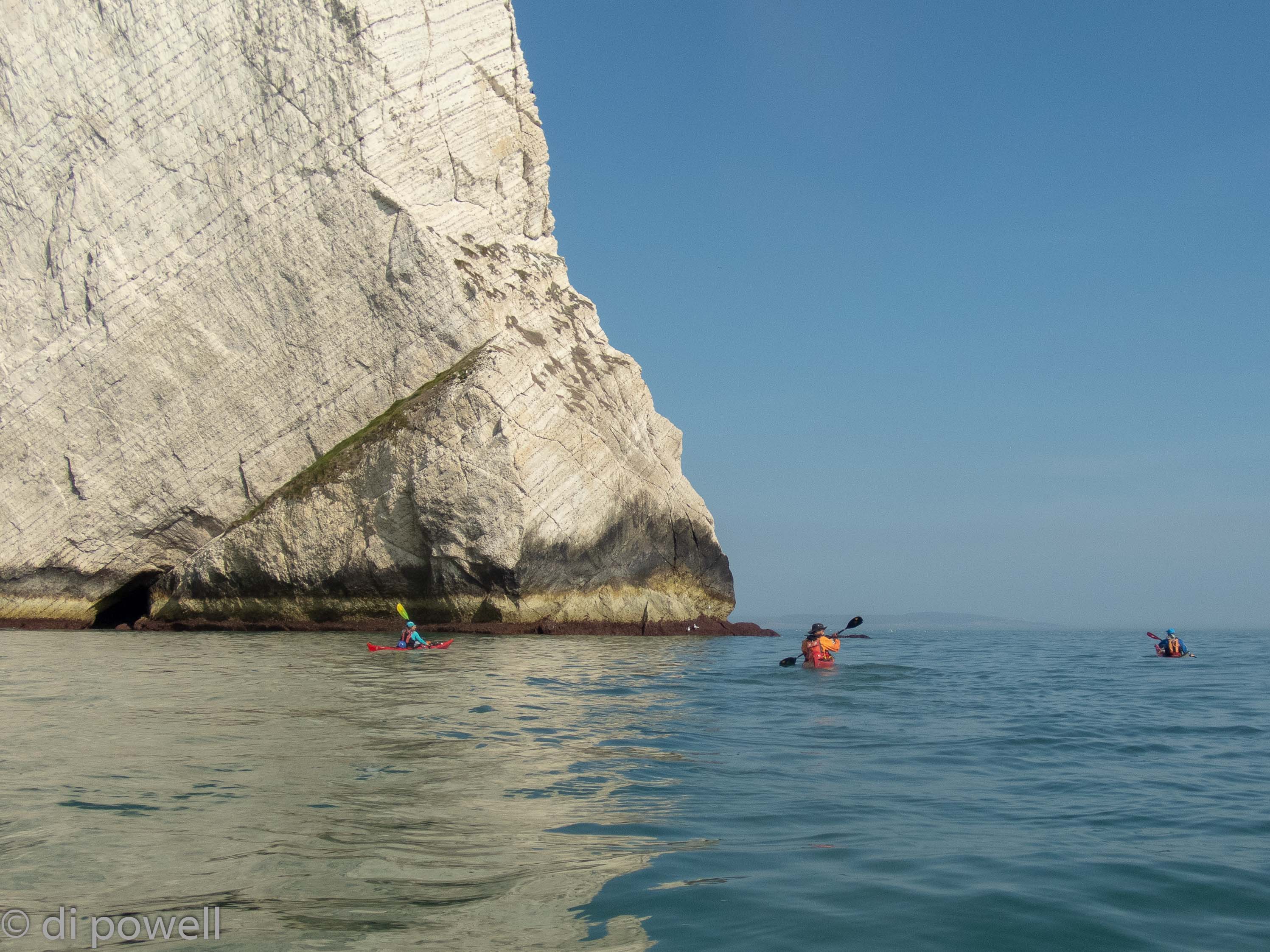
After examining the famous marmotino multi-coloured cliffs and chair lift of Alum Bay we continued south west along the White Cliffs and saw some strange holes in the cliff face:
It wasn’t long before we reached The Needles and as the winds were light, we were able to go around the lighthouse, get some fabulous pictures and take a closer look at the white rock face:
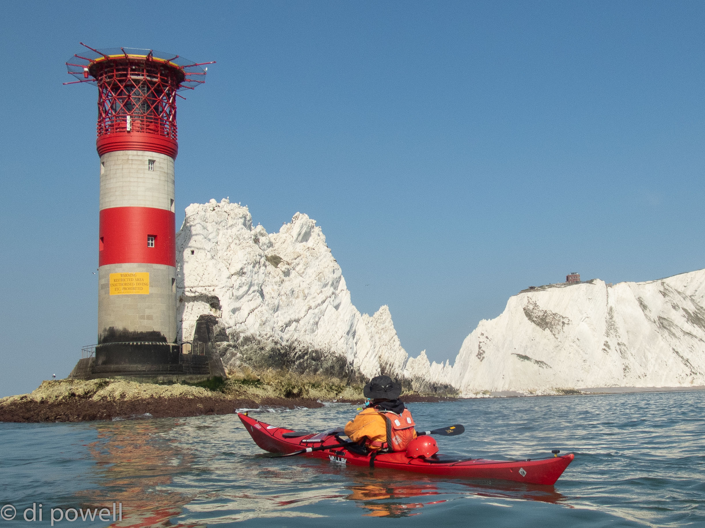
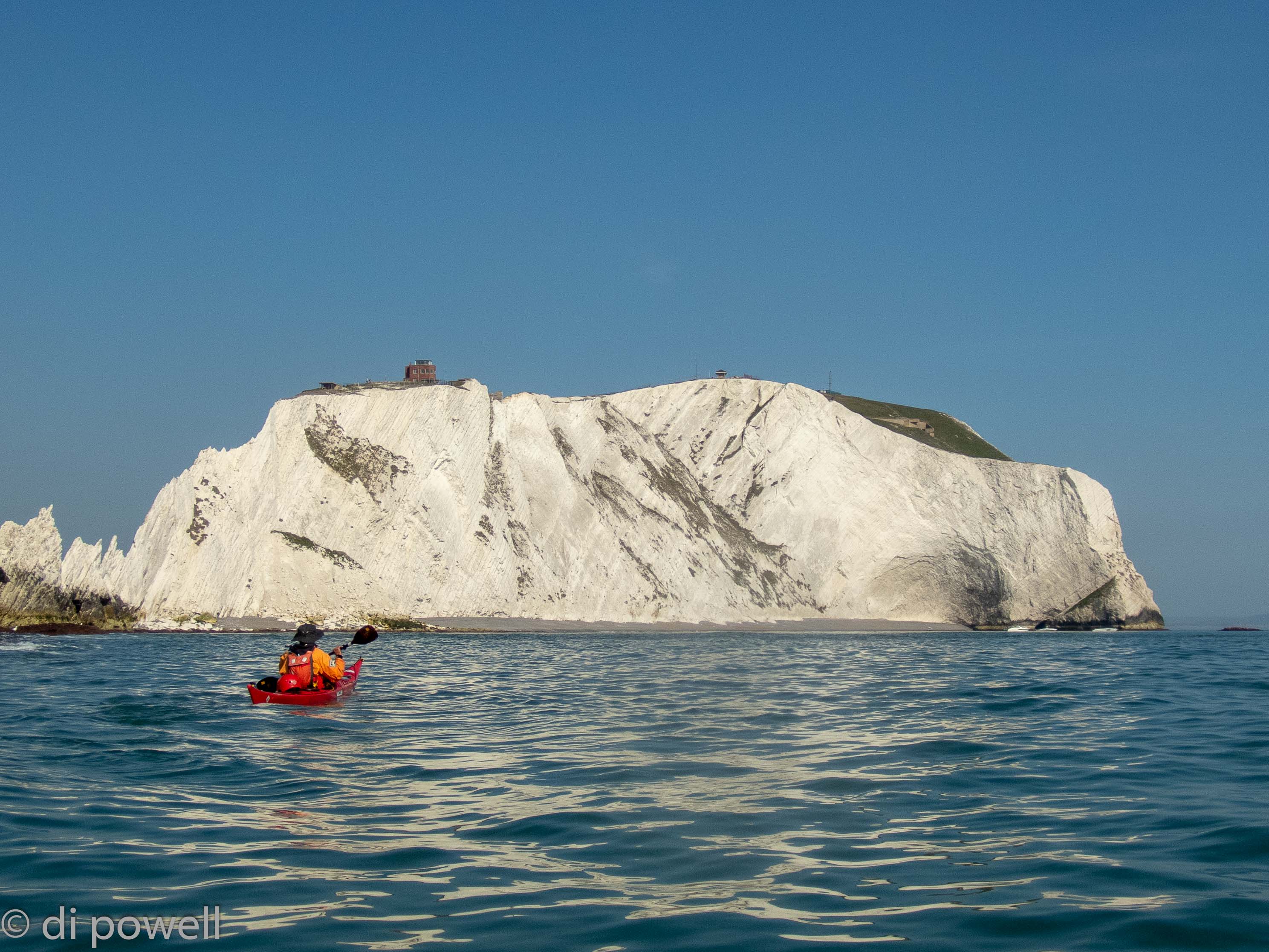
The rock face here is made from the same material as at South Purbeck, which the CKC team had visited a few weeks earlier, including Old Harry’s Rock, The Little Pinnacle and Pinnacle. It was amazing to think that all these cliffs were made up from the shells (coccoliths) of small sea organisms called coccolithophores, millions of years ago in the Jurassic period. Somewhat fittingly, these organisms look like tiny Easter eggs under the microscope! The next expedition planned by CKC is to the Jurassic Coast to investigate the composition and erosion of these cliffs further (and to do some paddling in world class scenery).
At Sun Rock we also saw the bedding plane lines folded upwards to form a monocline ridge, although it really looked like someone had just drawn parallel lines on the rock:
After we turned the corner at Sun Rock it was time to put in some serious paddling. So far we had had a tidal stream assist of about 3 knots to cover the 9km to The Needles, now we would have less than 1 knot and still needed to cover 14km before sunset to get to our campsite at Grange Farm, near Brighstone.
Although we were able to do that in plenty of time, we hadn’t counted on the walk up the 30m cliff with all our kit to get to the campsite. However, once there and set up in our tents, we had fantastic views of the coastline we had just paddled, as well as the coastline we would paddle tomorrow.
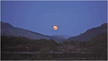
We ate fish and chips in front of our tents (from the mobile van that visits the camp site every Friday) and when we thought an excellent day’s paddling couldn’t get better, watched a huge red full moon appear on the horizon and slowly rise.
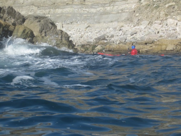
On Easter Saturday, we set off with some trepidation to round St Catherine’s Point due to the tide races that form here, and can be very large on springs. Initially with NE F3 winds we were protected by the island and made good progress, covering the 10km to the point quickly. At the point we experienced some limited tidal race conditions as well as some clapotis from the reflected waves, but everything well within the group’s abilities.
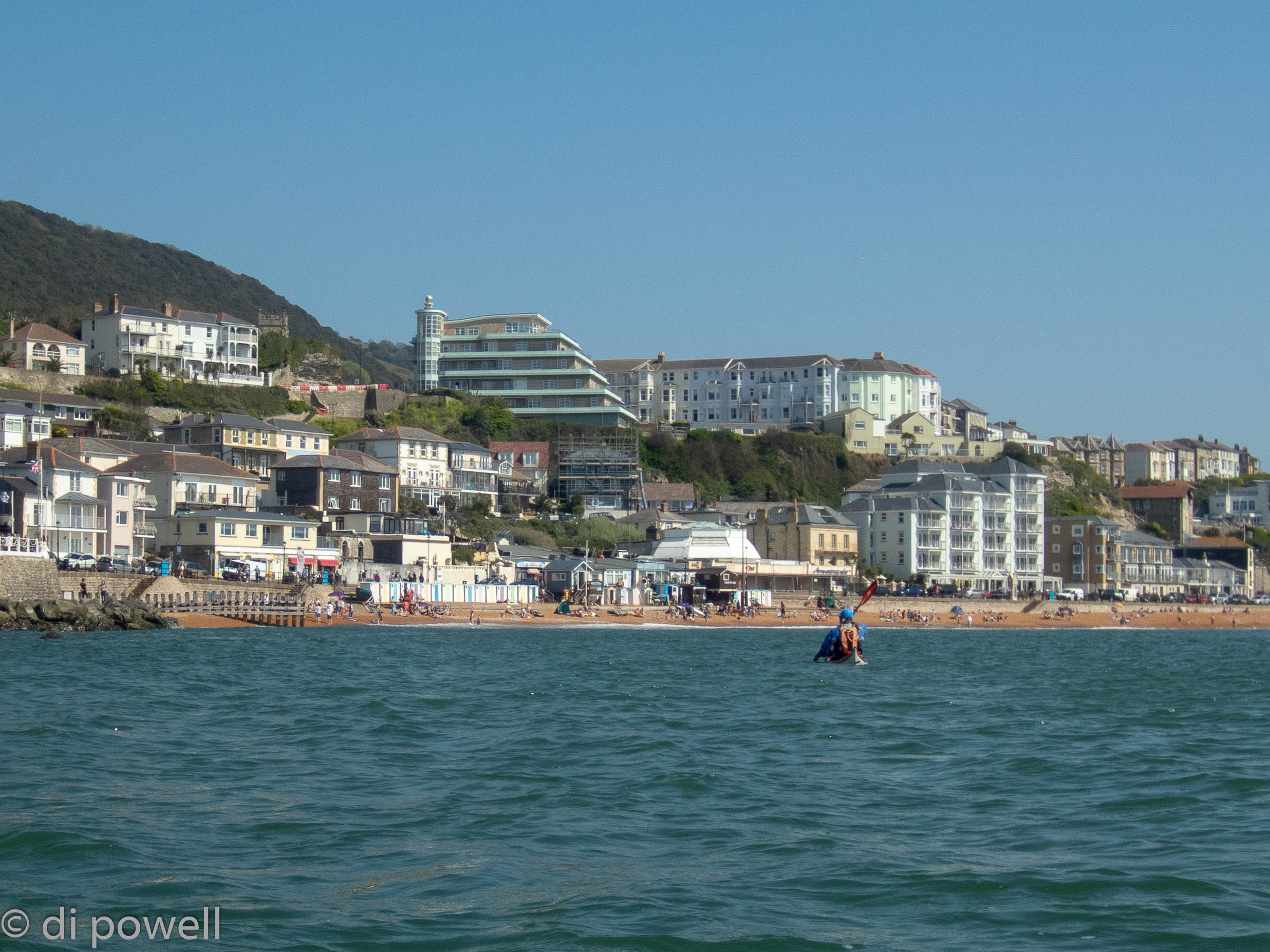
Harder work was the paddle to Ventnor against both the tide and wind. At Ventnor, we took a break spending the afternoon with the holidaymakers on the beach, while waiting for the tide to turn in our favour:
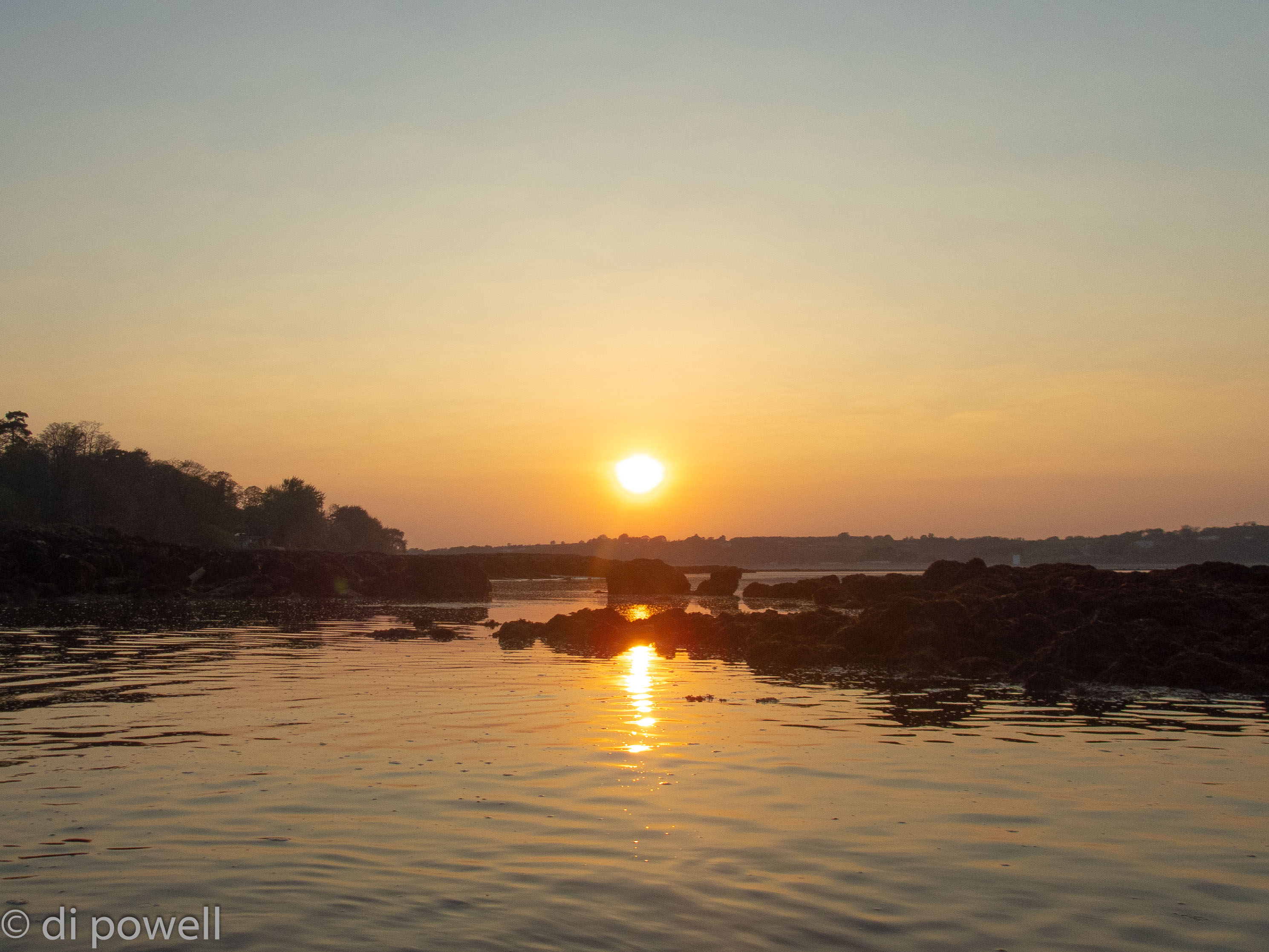
On departure from Ventnor, we found the winds had dropped to F2 and with the tidal stream now in our favour were able to round Dunnose to Shanklin, then head directly across Sandown Bay to Culver Cliff. The winds dropped further to F1 and tracking across Whitecliff Bay we came across rock ledges and breaking water close to the shoreline. Rounding the headland at Bembridge we started to search for locations to wild camp for the night. Putting in at Bembridge Beach through a gap in the ledges, we were treated to a magnificent sunset (see below) and shortly after putting up tents and cooking, to another unbelievably massive red moonrise.
Easter Sunday started, as all good Easter Sundays do, with Easter eggs. Both from our own collection and from some given to use by locals on the beach early in the morning. Leaving Bembridge in light winds (F1) and sunshine, we made good time to Ryde and with the high water, were able to cross the Ryde Sands without difficulty. Arriving at Ryde, the main hazard was to dodge the hovercraft zipping in and out of the port, sometimes moving sideways:
Heading under the pier and on towards Osbourne House in the distance, meant that we were able to stop on a small beach for lunch before rounding the corner to Cowes. At Cowes, dodging more shipping traffic to cross the harbour entrance, we started to cross to the north side of The Solent to Lymington with the strong tidal flow. Once more dodging the shipping traffic, we crossed the harbour entrance to see Hurst Castle on the horizon in the hazy sunshine. A final push got us back to Keyhaven, just in time for an evening meal in the sunshine of the beer garden at the local pub, The Gun Inn.
We had really needed those Easter eggs to help us cover 39km on the last day (along with some tidal assistance)!
Friday 23 October
The start of October half-term holidays and for most of us (Rob, Tudor, Izzy, Goers, Corinne and I) the evening was filled with roadworks and slow moving traffic down to Swanage. Fiona escaped that excitement by catching the train earlier in the afternoon. The highlights were watching the fish whilst crossing from Sandbanks to Studland, admiring the wood panelling in the lounge of the YHA and taking on bets on when Geors and Corrinne would arrive…
Saturday 24 October
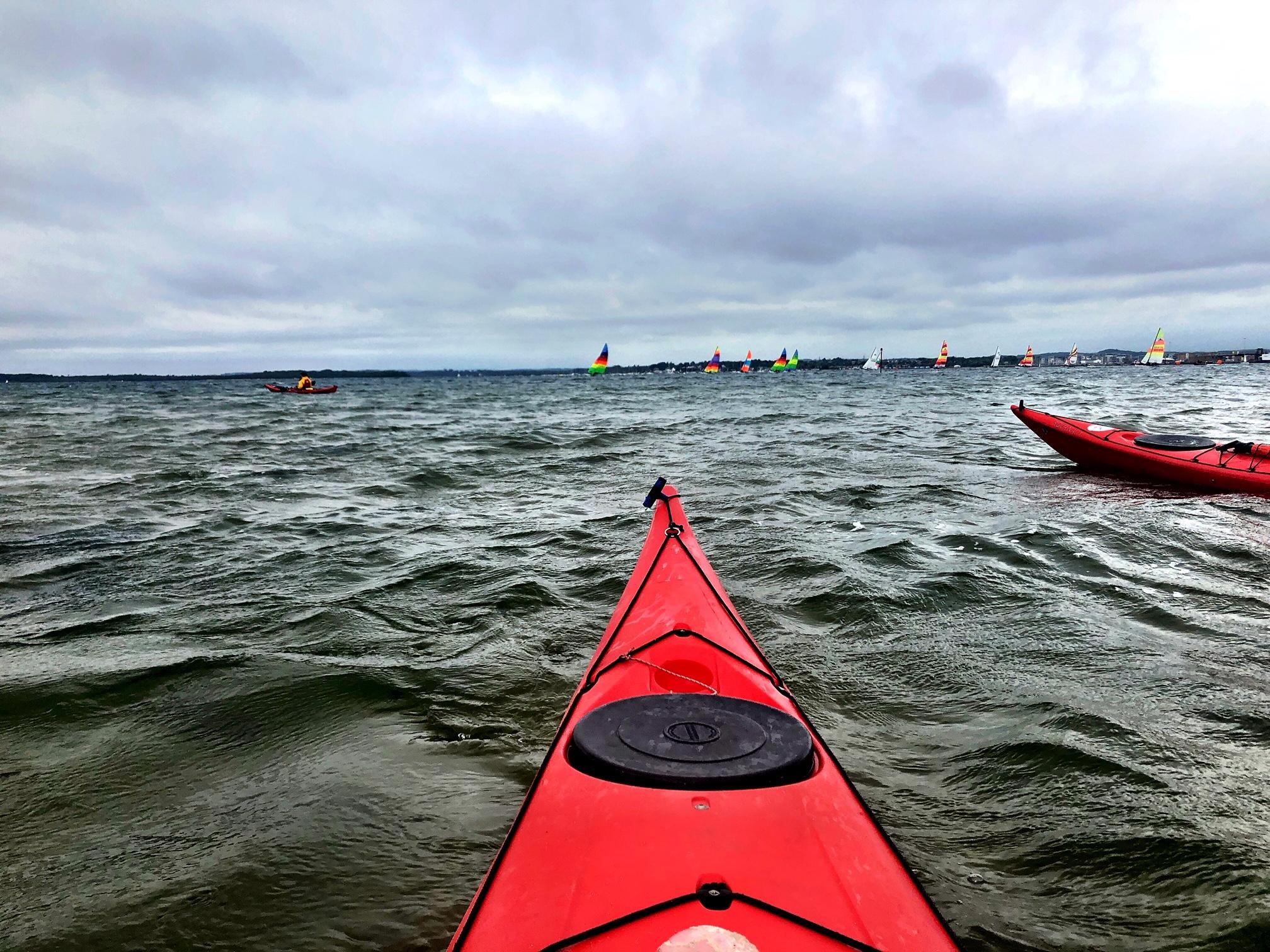
We met at 9am for a planning meeting. The forecast was not promising (rain and wind up to force 5) so the options were limited. Having discussed our varying levels of experience, fitness and what we wanted to get out of the weekend as well as what the wind and tide would be doing we agreed that the best plan would be to spend the day exploring the relatively sheltered waters of Poole harbour.
We drove in convoy towards Shell Bay and parked up in a convenient layby. It was raining but we donned waterproofs and carried out a quick recci of our chosen launch spot before unloading the boats and kit and getting changed. A note on boat unloading/loading – for Geors (and more specifically for the Mazda Bongo) – this was no mean feat. Each load/unload required a stepladder, someone to go up the ladder, at least one other person to hold the ladder, two/three tall people to assist with manoeuvring the kayaks and a few others to offer ‘helpful’ advice.
Once everyone was happy we departed for our first destination – ‘that sticking out bit of land over there’. The rest of the morning was spent crossing from point to point along the SW shore of the harbour – taking in numerous sightings of grebes, oyster catchers and an egret or two. Fiona squeezed under a wooden pier; Corinne played chicken with a ferry and we abided by the polite notices on private islands (‘KEEP OFF. NO LANDING’). It was grey and overcast with fairly strong winds but pleasant enough. I was dry and warm for once – thanks to my new dry suit – so I wasn’t complaining!
After negotiating some shallow sections of water just before Round Island, we stopped for lunch at Arne Bay. A curious seal took a shine to Rob and followed him towards the shore– prompting shouts of ‘he’s behind you’ – inevitably as soon as he turned the seal promptly vanished. Our lunch spot contained some amazing trees with exposed roots, providing convenient seats.
After lunch we spent time extracting ourselves and the boats from the black, sticky mud before successfully re-launching into the harbour. We contemplated heading for the north side of Brownsea Island but changed course given the increasing wind, the ominously dark clouds and the need to retain some energy for Sunday’s trip. Instead we headed back through the channel between two islands; crossed eddy lines; played in the waves from passing ferries and observed the oil well and more bird-life. On our return to our launch site, we were relieved that the tide had not left us with half a mile of mud to contend with.
We spent the evening sampling some traditional Dorset delights in the Red Lion pub – including local cider, ales, sausages, ham hock and apple cake!
Sunday 25 October
Daylight saving gave us an extra hour overnight. We could have spent this time sleeping but Rob had other ideas…and we left the YHA at 8.05 to drive to Kimmeridge Bay. The plan was for a 22km trip to Durdle Door and back with the additional option of rock-hopping along the way.
After parting with a hefty £10 per car* we dropped the kayaks off at the slipway then got organised (a.k.a faffed). The weather was amazing. Clear blue skies, warm sunshine and NO WIND. As a result the sea in the bay was completely flat – like a mill pond. Further out – on the rock ledge to the right of the Bay – there was some impressive looking surf but we skirted round that with ease and were on our way.
The morning’s paddle was so lovely. We were spoilt with brilliant weather, calm seas and amazing cliffs and strata lines courtesy of the Jurassic coastline. The wind (what little there was) was behind us and we were going with the current / tide. We spotted some enormous jelly fish and Rob and Corinne had fun rock-hopping. We arrived at Lulworth cove and were tempted to stop for lunch and a rest but we pushed on so that we could take advantage of the tide.
Between Lulworth cove and Durdle Door we met a group of kayakers from the New Forest. Sharing stories, it transpired that they had paid £5 to park at Ringstead and were heading for Lulworth cove before heading back. We found a rock arch to duck under and admired the huge strata lines in the cliff in the bay behind then it was onto the main attraction. We were at Durdle Door surprisingly quickly and it really is an impressive arch! A bunch of people were coasteering in the area and jumping off the far side of the arch, which looked like fun!
The return section back to Lulworth cove for lunch was slightly harder – some wind against tide and kayakers hungry for lunch but we made it in good time and lined up our kayaks alongside those from the New Forest club – it was pretty impressive seeing all 15 in a row.
The longer return trip back to Kimmeridge was hard work. We were paddling into a head wind but fortunately the tide/current had turned, which helped enormously. Izzy discovered what happens if you don’t pull your kayak far enough up the beach when you have a toilet-stop but aside from that it was uneventful!
We were all relieved to see Clavell tower appear in more detail as we got closer and closer to Kimmeridge. What was less pleasing was the surf forming on the rock ledge once more; fortunately we realised that if we skirted far enough round to the right we could avoid the breakers although it was a little lumpy for a short time.
We ended the trip with well-deserved cups of tea and slabs of cake in the Clavell café before heading back to London.
It was a brilliant weekend! Huge thanks go to Rob for leading; Goers for organising; Alex H for YHA membership and Corinne / Rob for the photos.
*Fee is £10 for a car with a boat/kayak on the roof; £5 for cars without boats… unclear what the fee is if the kayak is in the car.
Sally Widdop
30 May – 6 June 2015: Kilchoan, Ardnamurchan
Not the title of a crappy sequel to the classic John Candy movie, but how a dozen CKC members got to this remote part of Scotland.
SATURDAY, 30 MAY 2015
Kilchoan is the most westerly village on the British mainland. It is so remote that you have to travel 26 miles down a single track road to get there. England is at least 5 hours away by car. A few of us (Dan, Kenneth and me) got the train to Edinburgh and were then lucky enough to get a lift in Alex’s car the rest of the way. Dave flew to Glasgow and got a lift from there. Others drove from various parts of the UK. And Philippe came in his van.
Lorna (coming from the Norn Iron branch of CKC), Geors, Richard, Phil & Jacqui (and 6 month old Ollie) and Sue completed the group. Geoff and Alex were the official leaders on the water.
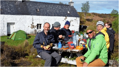
Geoff was the driving force behind the trip and with his wife Sandra gave all of the CKC group tremendous hospitality on arrival. A dozen people turning up at odd times through the afternoon and evening, but all got a good feed and a glass or three of wine at their house in Kilchoan. Sandra’s pavlova was the subject of much comment, most of it suitable for mixed company.
At the last minute, Alex took the executive decision to rent a third holiday cottage to add to the other two. This had the benefit of less people having to share rooms. With a week long trip, this was well worth doing.
SUNDAY, 31 MAY 2015
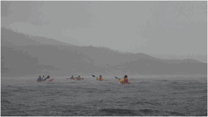
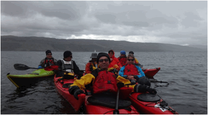
Windy, from the west. F6 out in the main channel between Kilchoan and the Isle of Mull. However, we were keen to at least wet the kayaks, and so we hugged the coast just for a mile or so west of Kilchoan. Even well inshore, progress against the wind was hard work.
Eventually we reached a small bay in the lee of a headland and had a rest. Geoff gave us the option of heading out into the channel for some surfing. Three of us declined this “opportunity” but most of the group ventured out. Even the more experienced paddlers said that turning in the wind made the boat feel a bit “wobbly” but no-one capsized. Until …
What do a dancer called Kenneth and a Frenchman called Philippe have in common? They both re-defined “rock-hopping”. Both of them had finished out in the big stuff and were coming into the little bay side by side.
My recollection is that they were alongside each other parallel to the rocks when a wave caused Kenneth’s boat to hit Philippe’s causing him to capsize. Philippe got out of the sea and onto the rocks but in the confusion a wave then took Kenneth’s boat onto the rocks. More wave action ensued until for a split second Kenneth was sitting in his boat perched on a rock completely proud of the water. Anyway, the waves kept on coming, Kenneth managed to stay upright, and eventually he was back on the water.
MONDAY, 1 JUNE 2015
Very very very windy. No kayaking. Not even Katie and Lee (see Katie-and-Lee-at-sea on Facebook) who were circumnavigating Britain went out in it today.
So we had a 6 mile walk to Ardnamurchan lighthouse for a brew and a piece of cake.
In the evening, we all repaired to the local pub for a few drinks at the Kilchoan Hotel. This was a pattern to be repeated throughout the week.
TUESDAY to THURSDAY, 2-4 JUNE 2015
A weather window appeared for a few days, so the decision was taken to do a 3 day/2 night wild camping trip to Loch Sunart, a sea loch.
On Tuesday, the wind still had a bit of bite in it, so the first 2 mile crossing from headland to headland as we headed east in a following sea was testing for some of us. But no capsizes!
My experience is that each time I go out in conditions that test me, I get just a little bit better at dealing with them. Some titbit of advice on a course from way back or from a more knowledgeable paddler pops into my head and I try to apply it.
The sea conditions are unpredictable even as you get further up the sea lochs. In the space of 10 minutes or so the sea can go from benign to very choppy. Waves close together and a bit confused, rather than long regular swells, seemed to be the norm.
Tuesday evening we arrived at the spot Geoff had earmarked as our campsite for the night. Problem: it was boggy after so much rain and the spring tide meant that we had to be a good distance above the high water mark. Strike one. Dave then paddled off to scout around the corner but that location was too boggy also. Strike two. Then we got lucky and found a bit of level dry ground just across from the SE corner of Oronsay.
The feeling of remoteness, wild scenery and yet being with a lot of good company was priceless.
Throughout the week, there were so little signs of human activity. We may have seen just one sailing craft each day. The coastline was usually devoid of people.
After a night’s camping we left our gear there and headed further east up Loch Sunart, reaching Salen.
After a second night’s camping, we struck camp and headed west. We had to be on the water by 9.30am to catch the high tide in the creek so we could go directly west. Any delay and we would have had to go the long way around Oronsay. We made it.
We eventually headed around the point opposite Tobermory. We edged up the coast and then made the crossing to the south of the small island just south of Tobermory harbour. Just outside the harbour there was a waterfall which some more hardy paddlers went through. The reward for our efforts over the last few days was fish and chips in Tobermory.
After lunch there was a choice of an open crossing to Kilchoan or getting the ferry. A few of us opted out of the crossing as the inshore forecast was eventually for F5 to arrive. As it turned out, most of the crossing was in benign conditions with just a bit of lumpiness at the end. Oh well, there’s always next time.
FRIDAY, 5 JUNE 2015
The group split between those opting for a short paddle on the north side of Ardnamurchan, or a walk tracking the kayakers route. We all met up at Sanna beach where Kenneth led an impromptu dance class. Yes, really!
In the evening it was a farewell dinner at the local pub. The manager arranged what was in effect a private dining room for all of us, but at budget prices.
SATURDAY, 6 JUNE 2015
A long slog back to London for many of us. Some took the opportunity to see more of Scotland.
The Thames just doesn’t seem as awesome after experiencing Kilchoan. Ah well, next year!
Tudor Grashoff, June 2015
(Photo Credits: Richard Gooderick and Alex Hester)
|
|